Take-out
TX
Take Out
Save this feature with the run it belongs to.
Gauge Conditions
Runnable: 100.0 – 5,000.0 CFS
Best boatable levels uncertain. Help us out! Add a comment or 'report'.
Data from American Whitewater & USGS
Photo
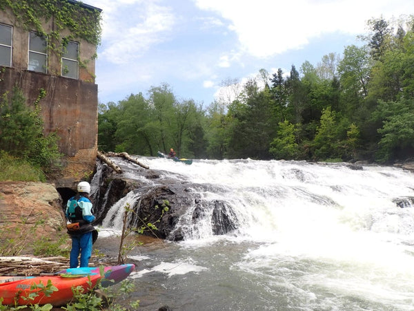
Photo courtesy of American Whitewater
Description
Take Out is an unrun section of Independence Creek with unknown characteristics, situated between FM 2400 and the Pecos River confluence. Due to the lack of documented descents, potential paddlers would face completely unexplored and potentially hazardous conditions requiring extensive scouting and advanced whitewater skills. No reliable information exists about specific technical challenges, water features, or safe navigation routes for this remote Texas waterway.
Location
Other Rapids on This Run (1)

View Full Run
FM 2400 to Pecos River (18.35 miles)
Independence Creek (no known descents)
II+
21.7 mi
Current Conditions
5-Day Forecast
Whitewater data from
American Whitewater
American Whitewater