How's Your
River
×
Explore
Explore Map
Water Bodies
Gauges
Access Sites
Tidal Stations
Whitewater
Pricing
Login
Sign Up
Hazard Warning:
Hazard information may be user-submitted and unverified. Conditions change frequently. Always scout rapids and obstacles yourself.
Whitewater
Alabama
Little - 3. Eberhart Point (Chairlift) to Canyon Mouth Campground
Bottleneck
Rapid
AL
Class IV
Bottleneck
Little - 3. Eberhart Point (Chairlift) to Canyon Mouth Campground (AL)
Monitor this Rapid
Water Body
This Run
Map
Other Rapids
Gauge
Weather
Directions
Gauge Conditions
Little River near Blue Pond AL
Downstream
Primary
Runnable: 250.0 – 10,000.0 CFS
Data from
American Whitewater
&
USGS
Photo
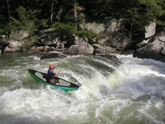
Photo courtesy of
American Whitewater
Description
Ledge rapid. Usually run by skirting the hole on the right.
Location
Radar
Counties
Cell
Verizon
AT&T
T-Mobile
Dark
Satellite
Terrain
Other Rapids on This Run (2)
Rapid
N/A
Put In
0.0 mi
Rapid
N/A
Take Out
6.0 mi
Type
Rapid
Difficulty
Class IV
Mile Marker
2.0 mi
Directions
Navigate
View Full Run
3. Eberhart Point (Chairlift) to Canyon Mouth Campground
Little
II-III+(IV)
5.7 mi
Current Conditions
5-Day Forecast
Whitewater data from
American Whitewater
Bottleneck