Gauge Conditions
Photo
Description
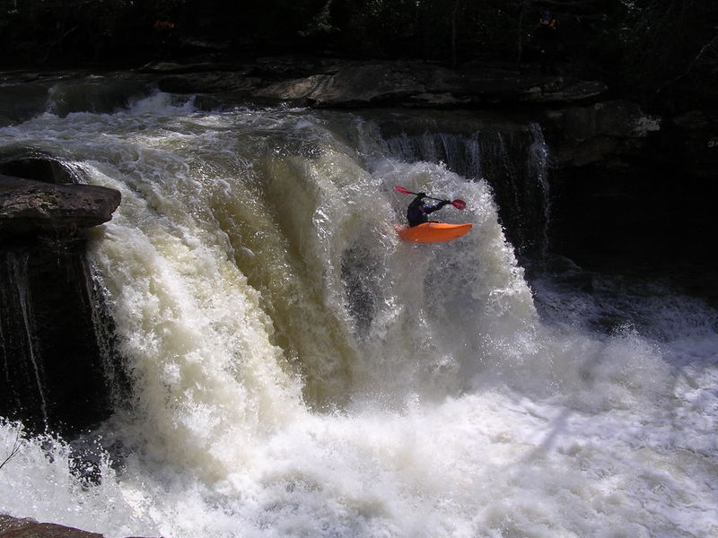
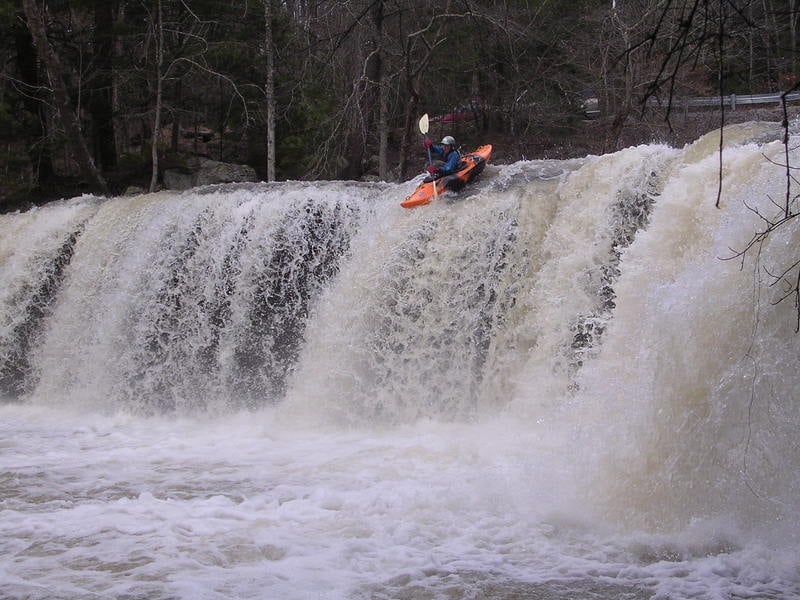
Launch this 20 ft drop off the rock finger in the center. Making your line is a must since the landing zone is only about 10 feet wide. Rock shelves exists under the falls. As long as you launch off the rock finger, you will clear the rocks. Stay away from the right side of this falls due to the rock shelf.
For those not running the falls, portage on river-left. A path leads to the base where you can walk under the falls. When you're under there, notice the crumbly underlayer of oil shale which erodes much faster than the harder rock overlay, creating the undercut. Cool!
The huge rock monolith down stream of the plunge pool was once the lip of the falls. During the flood of March 1929 (195,000cfs@Oakdale) the rock broke off and was hurdled downstream and buried in the gravel, pointing to the sky and leaning slightly upstream as if bracing against the flood.
A grist mill once stood on the river-right cliff of this falls back in 1895.
Other information on LaMance Falls.
Location
Other Rapids on This Run (4)

Current Conditions
5-Day Forecast
American Whitewater