Gauge Conditions
Runnable: 3,000.0 – 10,000.0 CFS
This is an estimate. Catch this run when the gauge is spiking or very high.
Data from American Whitewater & USGS
Photo
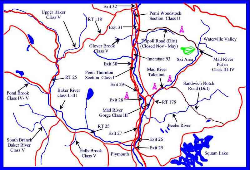
Photo courtesy of American Whitewater
Location
View Full Run
Elbow Pond (Mt. Cilley) to Pemigewasset R.
Glover Brook
V
3.5 mi
Current Conditions
5-Day Forecast
Whitewater data from
American Whitewater
American Whitewater