Hazard Warning: Hazard information may be user-submitted and unverified. Conditions change frequently. Always scout rapids and obstacles yourself.
Put-in NH

Map of the Mid Pemi region

Halls Brook - Halls Brook Road to Hwy 25 (NH)

Gauge Conditions
Runnable: 900.0 – 2,500.0 CFS
Runnable: 4.5 – 6.5 FT
Photo
Map of the Mid Pemi region
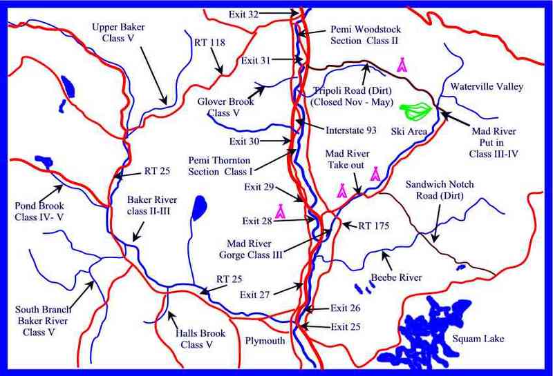
Photo courtesy of American Whitewater
Location
Type
Put-in
Mile Marker
0.0 mi
Directions
View Full Run
Halls Brook Road to Hwy 25
Halls Brook
V 2.6 mi
Current Conditions
5-Day Forecast
Whitewater data from
American Whitewater