Gauge Conditions
Runnable: ? – ? CFS
Approximate - nearest available gauge. Use as general reference only.
Data from American Whitewater & USGS
CDEC Flow Data California
Data from California Data Exchange Center (CDEC)
Photo

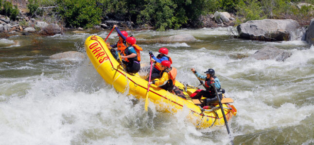
Photo courtesy of American Whitewater
Description
The Put In rapid marks the starting point for this section of the North Fork Merced, offering paddlers an initial entry into the river's challenging terrain. While specific details are limited, the rapid likely presents typical Class N/A characteristics requiring standard river navigation skills and awareness of potential obstacles near the put-in location. Paddlers should assess water levels and flow conditions before launching, maintaining standard whitewater safety protocols.
Location
Other Rapids on This Run (1)
View Full Run
Greeley Hill Road to Merced confluence
Merced, N. Fork
IV-V(V+)
19.7 mi
Current Conditions
5-Day Forecast
Whitewater data from
American Whitewater
American Whitewater