Gauge Conditions
Runnable: ? – ? CFS
Approximate - nearest available gauge. Use as general reference only.
Data from American Whitewater & USGS
Photo
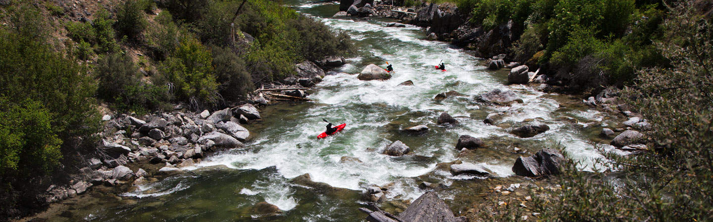
Photo courtesy of American Whitewater
Description
Put In rapid marks the entry point for the challenging upper section of the Big Lost River's East Fork, characterized by tight technical navigation through boulder-strewn terrain. Paddlers must carefully read and react to the river's dynamic flow, selecting precise lines between partially submerged rocks and potential hidden hazards that can quickly turn a run dangerous.
Location
Other Rapids on This Run (1)
View Full Run
Headwaters 12.9 mi to Star Hope Creek, 14.2 mi to Forks
Big Lost, E. Fork
II-III
24.1 mi
Current Conditions
5-Day Forecast
Whitewater data from
American Whitewater
American Whitewater