Gauge Conditions
Runnable: ? – ? CFS
Approximate - nearest available gauge. Use as general reference only.
Data from American Whitewater & USGS
Photo
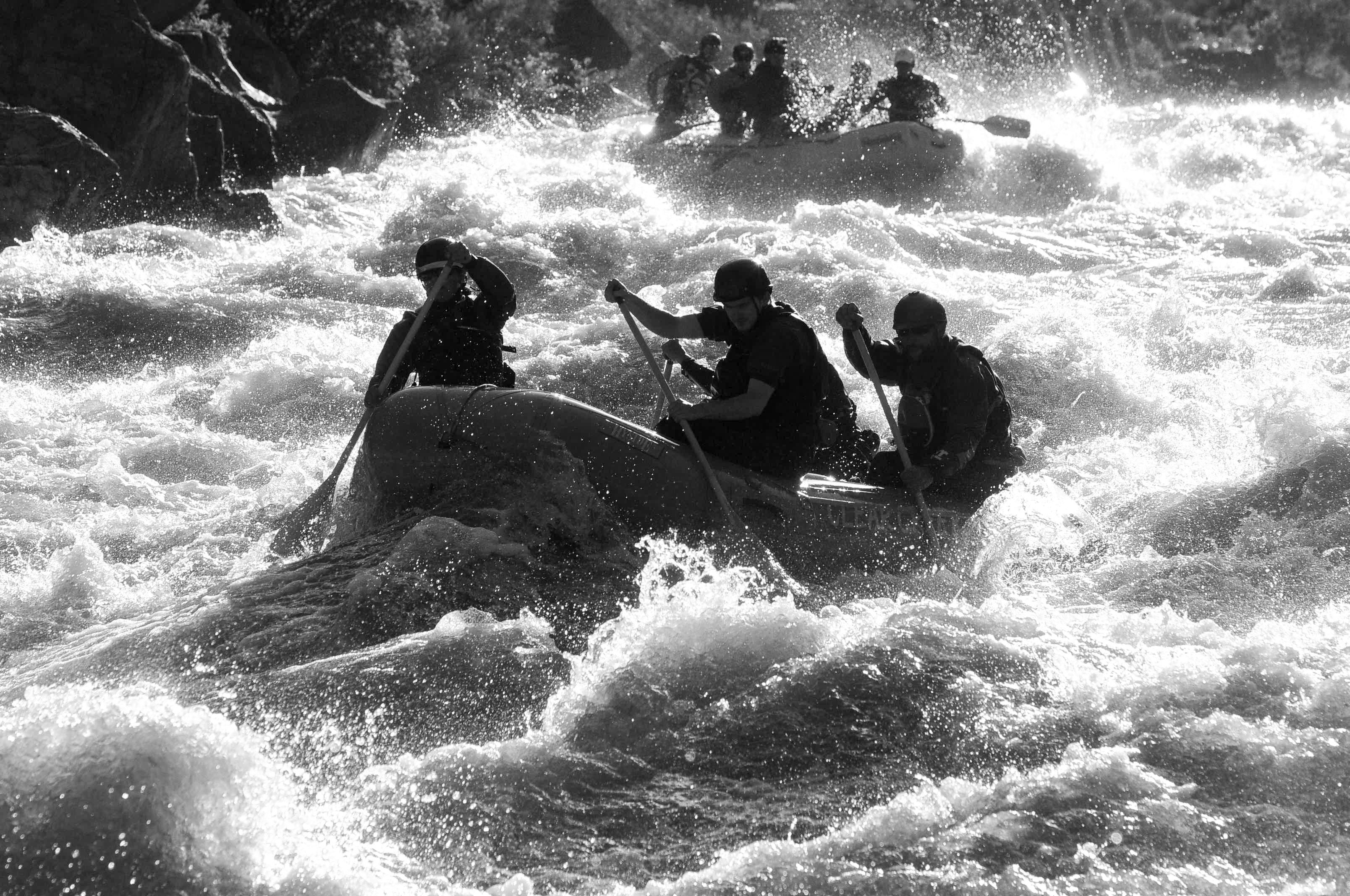
Photo courtesy of American Whitewater
Description
Take Out rapid marks the end of this Conejos River run, featuring a broad, moderately technical exit where paddlers must navigate between scattered boulder fields and potential shallow sections. While not highly challenging, careful boat positioning and reading water conditions are essential to cleanly exit the rapid without potential pin or scrape risks.
Location
Other Rapids on This Run (1)
View Full Run
03. Hwy 17 to Mogote CG
Conejos
II+
11.2 mi
Current Conditions
5-Day Forecast
Whitewater data from
American Whitewater
American Whitewater