Take-out
WV
Take Out
Potomac, North Fork of South Branch - 1. Confluence of Laurel Fork and Straight Fork to Cherry Grove (WV)
Gauge Conditions
Data from American Whitewater & USGS
Photo

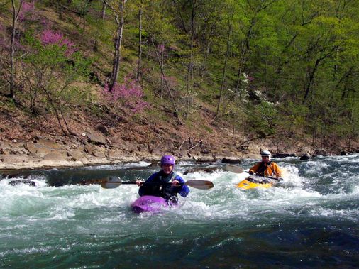
Photo courtesy of American Whitewater
Description
Take Out rapid marks the end of this challenging river section, requiring careful navigation through a tight, technical stretch with potential for undercut rocks and shifting water flow. Paddlers should be prepared for potential hydraulics near the confluence and maintain situational awareness of potential pinning hazards in the narrow channel.
Location
Other Rapids on This Run (1)
View Full Run
1. Confluence of Laurel Fork and Straight Fork to Cherry Grove
Potomac, North Fork of South Branch
II-III
6.2 mi
Current Conditions
5-Day Forecast
Whitewater data from
American Whitewater
American Whitewater