Gauge Conditions
Runnable: 175.0 – 1,000.0 CFS
Upper limit for best boatability uncertain. Please help your fellow boaters with a comment or report.
Data from American Whitewater & USGS
Photo
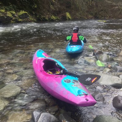
Photo courtesy of American Whitewater
Description
Take Out rapid marks the end of the Little W. Fork's most challenging section, featuring a narrow exit chute between large boulders that requires precise boat positioning. Paddlers must navigate carefully to avoid potential pin spots and maintain momentum through the constricted channel, with minimal room for error at moderate to high water levels.
Location
Other Rapids on This Run (2)
View Full Run
1. Desoto Falls to Cloudmont
Little, W. Fork
I-II(IV)
1.8 mi
Current Conditions
5-Day Forecast
Whitewater data from
American Whitewater
American Whitewater