Gauge Conditions
Data from American Whitewater & USGS
Photo
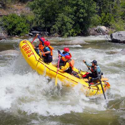
Photo courtesy of American Whitewater
Description
Take Out rapid marks the end of this challenging Deer Creek run, featuring a narrow constriction that funnels water through sharp boulder gardens and potential undercut rocks. Paddlers should carefully scout the exit and be prepared for technical maneuvering, with particular attention to the right side's potential pin and entrapment hazards.
Location
Other Rapids on This Run (1)
View Full Run
1. Highway 32 Bridge to Ponderosa Way Bridge
Deer Creek
IV-V
14.5 mi
Current Conditions
5-Day Forecast
Whitewater data from
American Whitewater
American Whitewater