Gauge Conditions
Runnable: ? – ? CFS
Approximate - nearest available gauge. Use as general reference only.
Data from American Whitewater & USGS
Photo
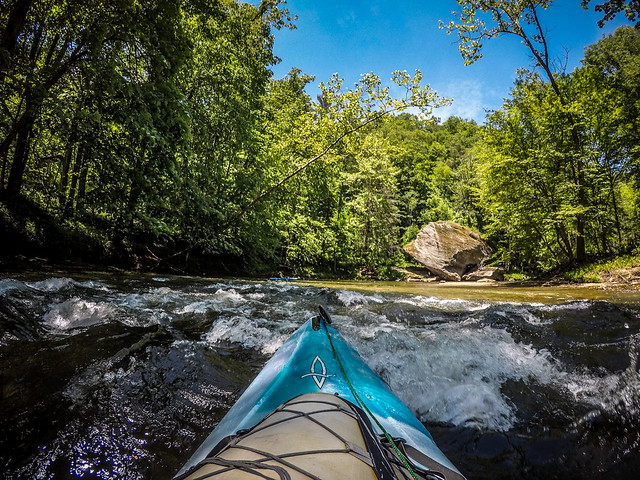
Photo courtesy of American Whitewater
Description
Take Out marks the end of this river section, typically signaling the conclusion of a challenging run with potential hazards near the takeout point. Paddlers should be alert for potential strainers, rocks, or unexpected current changes as they approach the exit, and be prepared to carefully navigate the final stretch before reaching the Black Mountain Campground access point.
Location
Other Rapids on This Run (1)

View Full Run
1. S.Toe R. Rd, from Upper Creek to Black Mtn CG
Toe, South
III-IV
2.0 mi
Current Conditions
5-Day Forecast
Whitewater data from
American Whitewater
American Whitewater