Take-out
WY
Take Out
Deer Creek - 1- Sec 4,T29N, R77W to Forest Service boundary (Upper Canyon) (WY)
Gauge Conditions
Primary
Runnable: 150.0 – 100,000.0 CFS
Data from American Whitewater & USGS
Photo

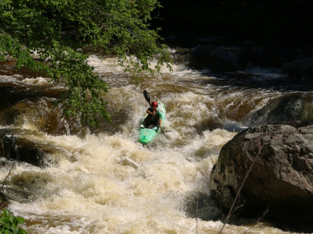
Photo courtesy of American Whitewater
Description
Take Out rapid marks the end of the Upper Canyon section on Deer Creek, featuring a complex boulder garden that demands precise navigation through tight channels and potential undercut rocks. Paddlers should carefully scout the rapid before running, paying close attention to the changing water levels and potential strainers, as the line varies significantly with flow and can quickly become hazardous.
Location
Other Rapids on This Run (1)
View Full Run
1- Sec 4,T29N, R77W to Forest Service boundary (Upper Canyon)
Deer Creek
III-V
10.4 mi
Current Conditions
5-Day Forecast
Whitewater data from
American Whitewater
American Whitewater