Take-out
CA
Take Out
Cottonwood Creek, N. Fork - 1) Sunny Hill Road to Platina Road bridge near Ono (CA)
Gauge Conditions
Runnable: ? – ? CFS
Approximate - nearest available gauge. Use as general reference only.
Data from American Whitewater & USGS
CDEC Flow Data California
Data from California Data Exchange Center (CDEC)
Photo

Photo courtesy of American Whitewater
Description
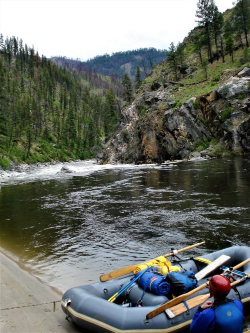
Take Out rapid marks the end of the Cottonwood Creek run, characterized by a tight channel between large boulders that can create unpredictable hydraulics during higher flows. Paddlers should be prepared for potential debris and scout the exit carefully, as the rapid leads directly to the takeout at Platina Road bridge and can pose challenges with its rocky approach and potential for shifting water levels.
Location
Other Rapids on This Run (1)
View Full Run
1) Sunny Hill Road to Platina Road bridge near Ono
Cottonwood Creek, N. Fork
IV-V
5.3 mi
Current Conditions
5-Day Forecast
Whitewater data from
American Whitewater
American Whitewater