Gauge Conditions
Runnable: 1,500.0 – 15,000.0 CFS
Flow range for best boatability uncertain. Please help your fellow boaters with a comment or report.
Data from American Whitewater & USGS
Photo
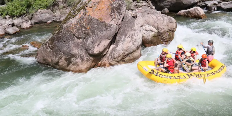
Photo courtesy of American Whitewater
Description
Take Out rapid marks the terminus point of this challenging river section, requiring precise navigation through a complex series of boulder-strewn channels that can quickly become technical at varying water levels. Paddlers must carefully assess the rapid's exit point and potential obstacles, as the surrounding terrain and river gradient can create unpredictable hydraulics and potential pinning hazards.
Location
Other Rapids on This Run (1)

View Full Run
4. Clarks Fork Yellowstone R. to Billings, MT
Yellowstone
II
21.0 mi
Current Conditions
5-Day Forecast
Whitewater data from
American Whitewater
American Whitewater