Take-out
VA
Take Out
Piney River - 5.) Lower Piney: Rose Mill Rd. to Tye River (S. Powell Island Rd.) (VA)
Gauge Conditions
Runnable: 150.0 – 500.0 CFS
Unknown runnability/difficulty over 400-500 cfs. Caution!
Data from American Whitewater & USGS
Photo
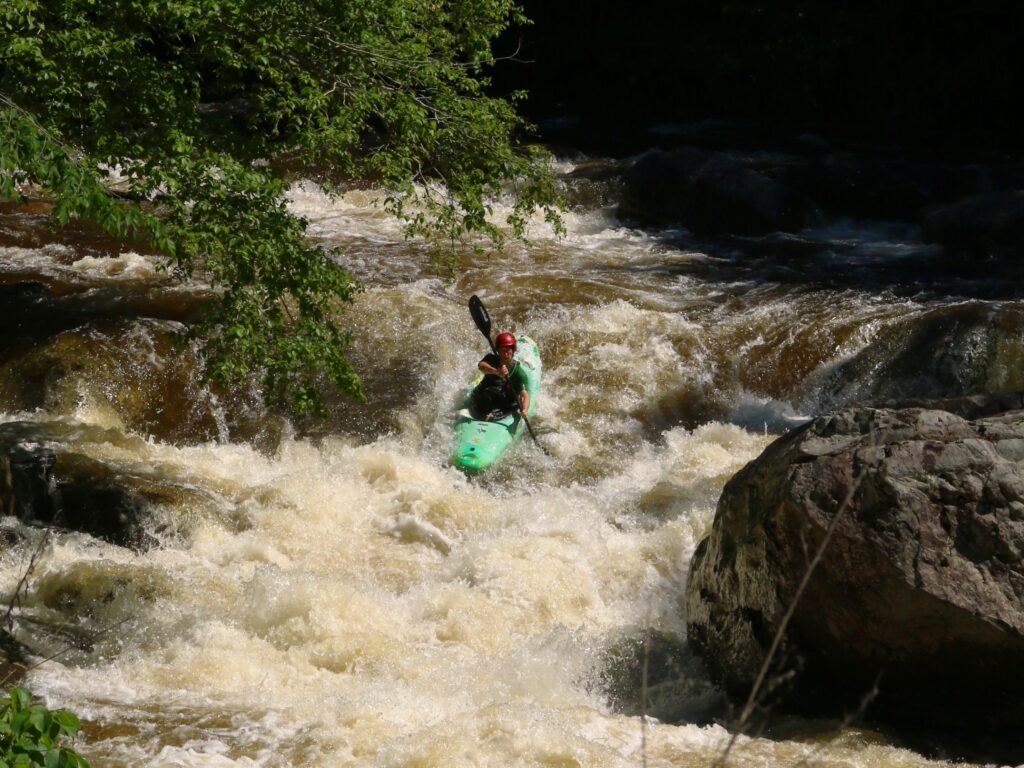
Photo courtesy of American Whitewater
Description
Take Out rapid marks the conclusion of the Lower Piney River section, characterized by a potential bottleneck and tight maneuvering near the takeout point at Rose Mill Road. Paddlers should be prepared for potential debris and variable water levels that can quickly change the rapid's characteristics, requiring attentive navigation and precise boat positioning.
Location
Other Rapids on This Run (1)
View Full Run
5.) Lower Piney: Rose Mill Rd. to Tye River (S. Powell Island Rd.)
Piney River
I-II(III)
8.0 mi
Current Conditions
5-Day Forecast
Whitewater data from
American Whitewater
American Whitewater