Gauge Conditions
Data from American Whitewater & USGS
Photo
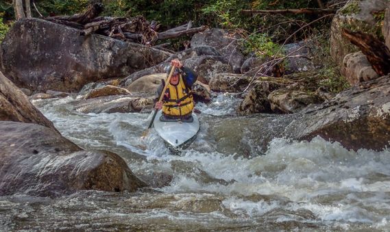
Photo courtesy of American Whitewater
Description
Take Out marks the end of the upper Cranberry section, serving as a critical transition point for paddlers entering or exiting the recreation area. While details are limited, the rapid likely presents navigation challenges typical of West Virginia mountain streams, with potential rocky terrain and current variations that demand attentive maneuvering.
Location
Other Rapids on This Run (1)

View Full Run
AA (Upper): Above Cranberry Rec. Area to Cranberry Rec. Area
Cranberry
I-III
17.1 mi
Current Conditions
5-Day Forecast
Whitewater data from
American Whitewater
American Whitewater