Take-out
WV
Take Out
Deer Creek - Confluence with North Fork of Deer Creek to confluence with Greenbrier River near Cass (WV)
Gauge Conditions
Data from American Whitewater & USGS
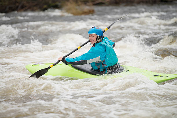
Photo

Photo courtesy of American Whitewater
Description
Take Out marks the terminal rapid before the confluence with the Greenbrier River, characterized by a complex boulder garden that requires precise maneuvering between large, irregularly placed rocks. Paddlers should be prepared for potential pin and entrapment hazards, with the most navigable line requiring careful route selection and advanced boat control to avoid undercut rocks and potential hydraulic features.
Location
Other Rapids on This Run (1)
View Full Run
Confluence with North Fork of Deer Creek to confluence with Greenbrier River near Cass
Deer Creek
I-II
7.2 mi
Current Conditions
5-Day Forecast
Whitewater data from
American Whitewater
American Whitewater