Gauge Conditions
Runnable: 300.0 – 700.0 CFS
Estimated range. Best when Nisqually is above 3000 after heavy rain.
Data from American Whitewater & USGS
Photo
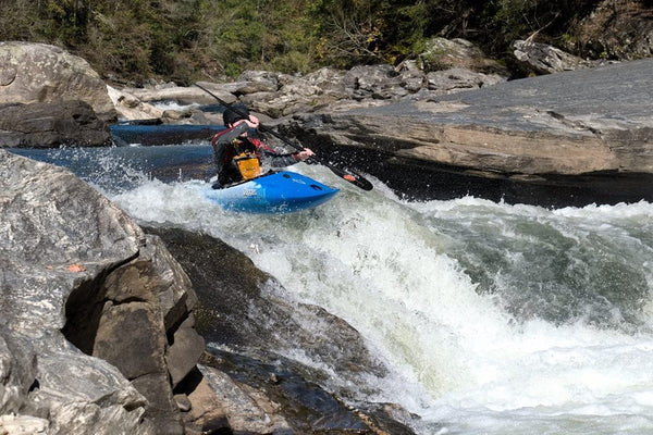
Photo courtesy of American Whitewater
Description
Take Out rapid marks the end of the Mashel River run, located just before the confluence with the Nisqually River. The rapid features a complex mix of rocks and potentially shifting debris, requiring careful navigation and precise boat placement to avoid potential hazards. Paddlers should be prepared for potential wood or strainer risks, especially during lower water levels when rock placement becomes more critical.
Location
Other Rapids on This Run (1)
View Full Run
Eatonville to Nisqually River confluence
Mashel
II-IV
7.0 mi
Current Conditions
5-Day Forecast
Whitewater data from
American Whitewater
American Whitewater