Gauge Conditions
Runnable: 150.0 – 600.0 CFS
Based on Bill Tuthill's CACreeks
Data from American Whitewater & USGS
Photo
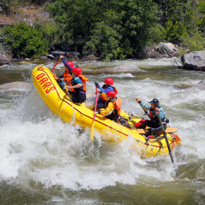
Photo courtesy of American Whitewater
Description
Take Out rapid marks the end of the Coyote Creek run, characterized by a broad, shallow boulder field that requires careful navigation and precise boat placement. Paddlers should be prepared for potential pin hazards and shifting rocky terrain, with lines that demand technical maneuvering to avoid getting stuck or damaged. Low water conditions can make this section particularly challenging, increasing the importance of reading water and selecting the most navigable route.
Location
Other Rapids on This Run (1)
View Full Run
Gilroy Hot Springs Road to Coyote Reservoir
Coyote Creek
II
8.6 mi
Current Conditions
5-Day Forecast
Whitewater data from
American Whitewater
American Whitewater