Gauge Conditions
Runnable: ? – ? CFS
Approximate - nearest available gauge. Use as general reference only.
Data from American Whitewater & USGS
Photo
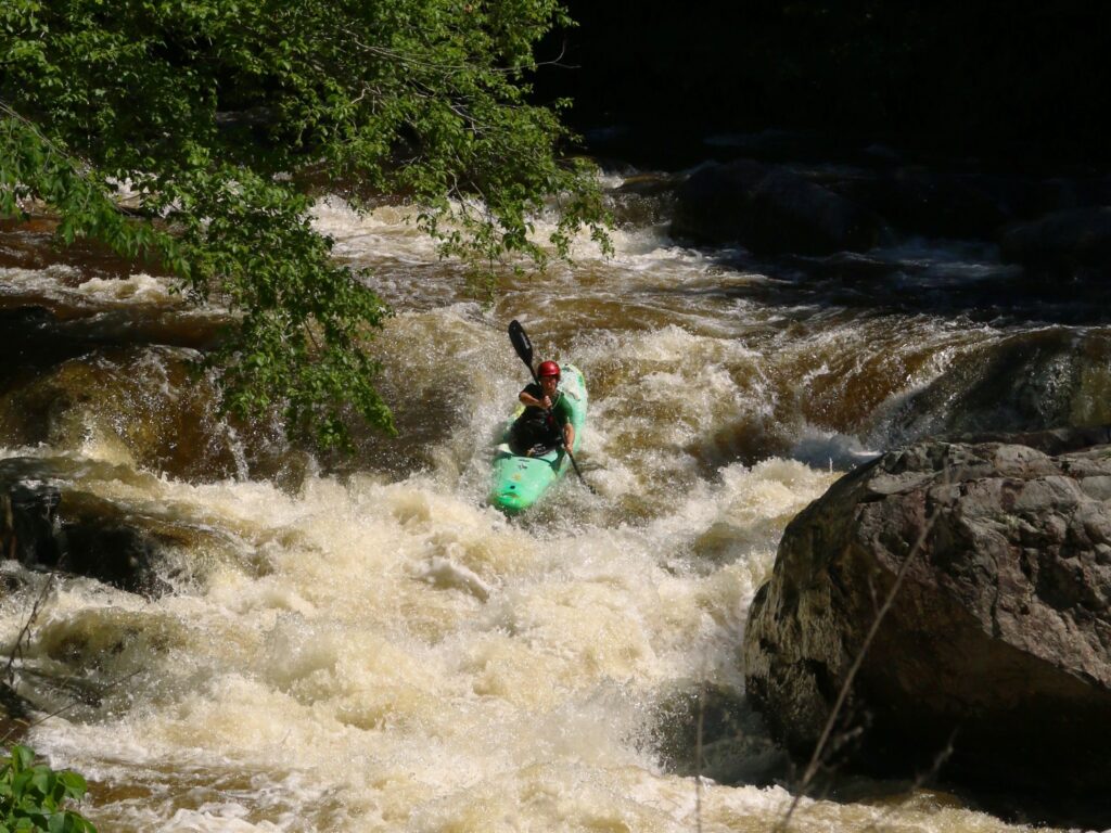
Photo courtesy of American Whitewater
Description
Take Out rapid marks the end of the Carver Creek run, featuring a tight, technical exit with multiple boulder formations that require precise maneuvering. Paddlers should be prepared for potential pin hazards near the river's right side and a narrow channel that demands careful boat positioning during high water conditions.
Location
Other Rapids on This Run (1)

View Full Run
Highway AA to County Road 114 (1 mile)
Carver Creek
IV
1.1 mi
Current Conditions
5-Day Forecast
Whitewater data from
American Whitewater
American Whitewater