Gauge Conditions
Runnable: ? – ? CFS
Approximate - nearest available gauge. Use as general reference only.
Data from American Whitewater & USGS
Photo
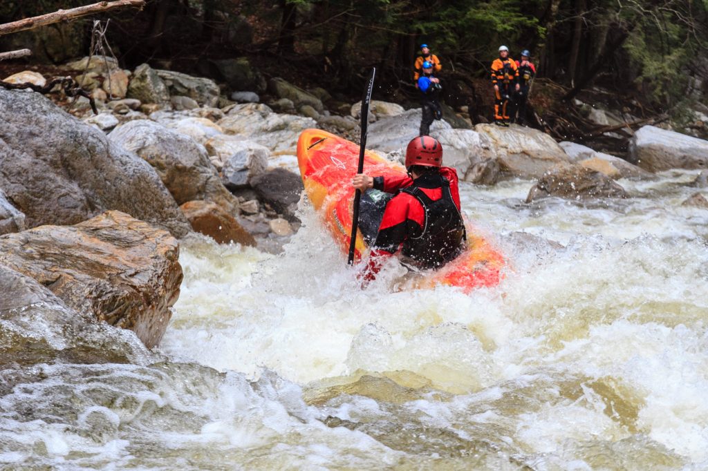
Photo courtesy of American Whitewater
Description
Take Out rapid on the Big Branch presents an unmarked exit point with potential for unexpected hazards near the takeout zone. Paddlers should exercise caution and scout the area carefully, as the transition from river to takeout can involve tight maneuvering around rocks and potential shoreline obstacles. While difficulty is unclassified, attentive navigation is critical to safely conclude the river run.
Location
Other Rapids on This Run (1)

View Full Run
Mt. Tabor to Appalachian Trail
Big Branch
V
2.6 mi
Current Conditions
5-Day Forecast
Whitewater data from
American Whitewater
American Whitewater