Gauge Conditions
Runnable: ? – ? CFS
Approximate - nearest available gauge. Use as general reference only.
Data from American Whitewater & USGS
Photo
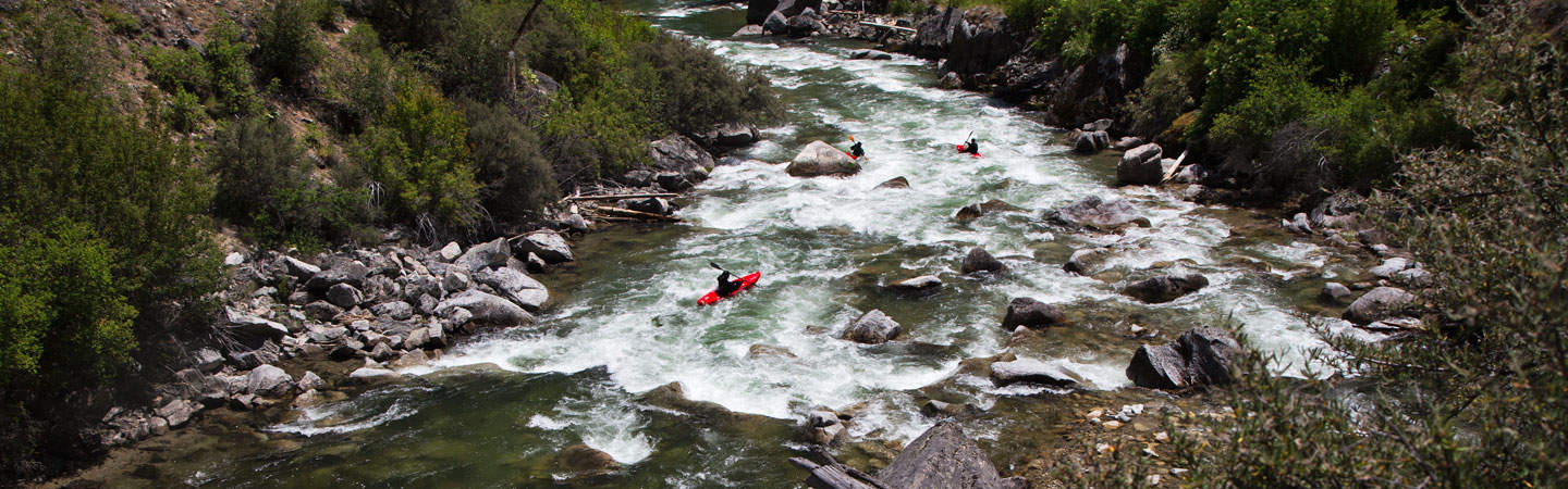
Photo courtesy of American Whitewater
Description
Take Out is a transition point at the end of a remote desert river section, marking the conclusion of the run with potential logistical challenges for boat extraction. The rapid itself appears to be more of a takeout location than a technical whitewater feature, likely requiring careful navigation of potential shallow areas, rocky shoreline, or limited access points typical of the Owyhee River's rugged terrain.
Location
Other Rapids on This Run (1)
View Full Run
Mudflat Road to Rickard Crossing, Owyhee River
Deep Creek
I-II
34.3 mi
Current Conditions
5-Day Forecast
Whitewater data from
American Whitewater
American Whitewater