Take-out
CA
Take Out
Cosumnes, Middle Fork - Outingdale to Highway 49 (last 2 mi. on Main Cosumnes) (CA)
Gauge Conditions
Runnable: ? – ? CFS
Approximate - nearest available gauge. Use as general reference only.
Data from American Whitewater & USGS
CDEC Flow Data California
Data from California Data Exchange Center (CDEC)
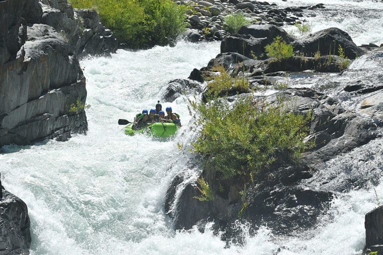
Photo

Photo courtesy of American Whitewater
Description
Take Out is the terminal rapid of the Middle Fork Cosumnes run, marking the transition from the wilderness section to the takeout at Highway 49. While specific details are limited, paddlers should be prepared for potential debris, blind drops, or shifting hydraulics as the river approaches the highway bridge, requiring careful scouting and precise navigation.
Location
Other Rapids on This Run (1)
View Full Run
Outingdale to Highway 49 (last 2 mi. on Main Cosumnes)
Cosumnes, Middle Fork
IV-V+
11.2 mi
Current Conditions
5-Day Forecast
Whitewater data from
American Whitewater
American Whitewater