Take-out
MO
Take Out
Marble Creek - USFS Marble Creek CG to CR 427 south of Highway E (3.8 miles) (MO)
Gauge Conditions
Data from American Whitewater & USGS
Photo
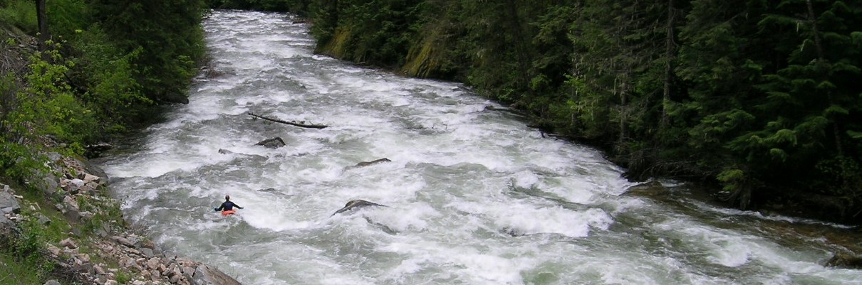
Photo courtesy of American Whitewater
Description
Take Out rapid marks the conclusion of the Marble Creek run, featuring a potentially complex exit with multiple channels and scattered rock formations that require careful navigation. Paddlers should be prepared for potential shallow areas and positioning challenges when approaching the takeout point, especially during lower water conditions.
Location
Other Rapids on This Run (1)
View Full Run
USFS Marble Creek CG to CR 427 south of Highway E (3.8 miles)
Marble Creek
II
4.0 mi
Current Conditions
5-Day Forecast
Whitewater data from
American Whitewater
American Whitewater