01. Escalante Forks to Captain Smith's Cabin
Linked via: Proximity 97% confidence Synced 6mo ago
Gauge Conditions
Runnable: ? – ? CFS
Approximate reading: This gauge is 10.9 miles away on Escalante Creek. Use as a general reference only.
Data from American Whitewater & USGS
Run Map
Run Time Estimate
Select put-in and take-out to estimate time.
Unlock Advanced Trip Planning
See wind-adjusted speed maps, forecast planning, and detailed time estimates.
Sign in to generate an AI timing estimate for this run.
Whitewater timing varies with scouting, portages, and group pace. Use as a planning baseline.
Description
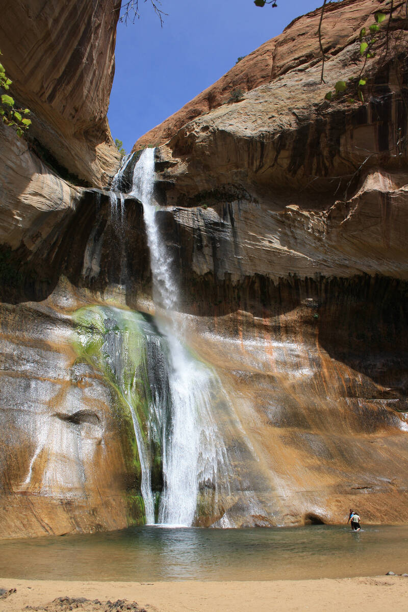
Driving up the narrow dirt road through Escalante Canyon you're presented with 400' sandstone cliffs framing a wide desert valley. At the bottom of this valley is a narrow gorge carved into dark igneous rock, hidden deep inside is Escalante Creek. This is a very beautifull place, even if your not a class V paddler this canyon is worth seeing!
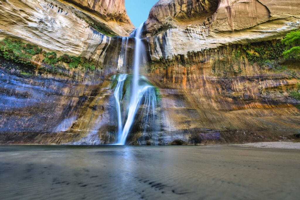
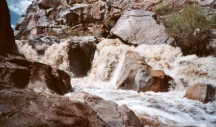
Just a fraction of the view from the lower gorge.
The season for running Escalante Creek is extremely short. Most years it will run for a week, maybe two. In dry years it won't run at all. It is fed by snowpack on the Uncompahgre Plateau, which is in a low elevation, hot and dry part of the state. The run-off goes quickly, and starts earlier in the season than anything else in Colorado. Usually in the second half April after several days of hot, sunny weather. If it becomes overcast, or if a storm rolls through, the creek will shut down quickly. Check Mountainbuzz.com during this time for beta on the flow. There will be lot of hype, controversy, and occasional facts concerning the level!
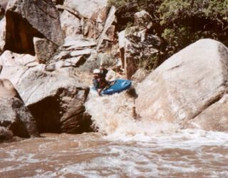
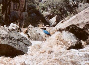
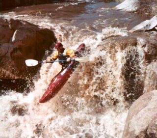
The creek is a typical desert stream in that it is very muddy. There are a lot of shallow rocks hidden in this silty water so you have to very carefully read the surface of the water to avoid pitoning or being deflected off your line. This is compounded by the fact that this creek rarely has good water to pad it out and is usually run very low.
Also, many of the major falls require you to boof hard left or right to avoid sharp rocks, pitons, overhanging walls, etc... Scout all horizon lines!
In the upper 3/4 of the run all the major drops are spread out and have clearly defined horizon lines with good eddies above them. There is a good amount of III/IV boogie water between the major drops.
The lower gorge is very intense, it's like all the previous major drops placed end to end. Know where to get out before the gorge if you don't want to run it. The only rapid you can scout from river level in the gorge is Escalante falls, all others you have to scout before dropping in.
To get there: The dirt road to Escalante Canyon is between Delta and Grand Junction on Hwy 50. It is narrow washboard road with tire-punching rocks to watch out for, but can be easily driven in a passenger car.
11 miles up the road from Hwy 50 is Captain Smith's Cabin, a well marked funky stone cabin on the right with a covered picnic table. 1/2 a mile further, just after entering public land, is the takeout on the left. Another 1/2 mile or so up the road, on a short gravel road to the left, there is a large sign warning swimmers of 'potholes'. This is the lower gorge, and the best place to camp. Beware! All glass is prohibited! Rangers WILL give you tickets if you have ANY glass bottles at your camp.
To get to the put-in continue up the road for several miles, and through alternating public and private lands - but it all looks the same. Take the gravel road to the left just before leaving public land for good, there will be an obvious ranch with irrigated fields beyond the fence.
FLOW
There is now a gauge for this creek (admins, please update Flow section):
Escalante Creek Near Delta, Co. - 09151500
More data is needed on the optimal flow range, but an initial guess is a solid medium flow is around 500 cfs. Note that there is a signficant diurnal fluctuation.
Waterfalls (6)
Hazards & Portages (5)
Caution: The following locations may require scouting or portaging. Always check current conditions.
Difficulty
Class IV-V(V+)
Length
5.0 mi
Gradient
131 ft/mi
max 200
Rapids
0
5 Hazards
Access Points
Difficulty Classes
I Easy
II Novice
III Intermediate
IV Advanced
V Expert/Extreme
VI Unrunnable
Current Conditions
5-Day Forecast
Whitewater data from
American Whitewater
American Whitewater