01. Perkinsville to Clarkdale Wild
Linked via: Proximity 71% confidence Synced 6mo ago
Gauge Conditions
Runnable: 200.0 – 10,000.0 CFS
Flow range for best boatability uncertain. Please help your fellow boaters with a comment or report.
Data from American Whitewater & USGS
Run Map
Put-in
Take-out
Rapids/Hazards
Wild
Scenic
Run Time Estimate
Select put-in and take-out to estimate time.
Unlock Advanced Trip Planning
See wind-adjusted speed maps, forecast planning, and detailed time estimates.
Sign in to generate an AI timing estimate for this run.
Whitewater timing varies with scouting, portages, and group pace. Use as a planning baseline.
Description
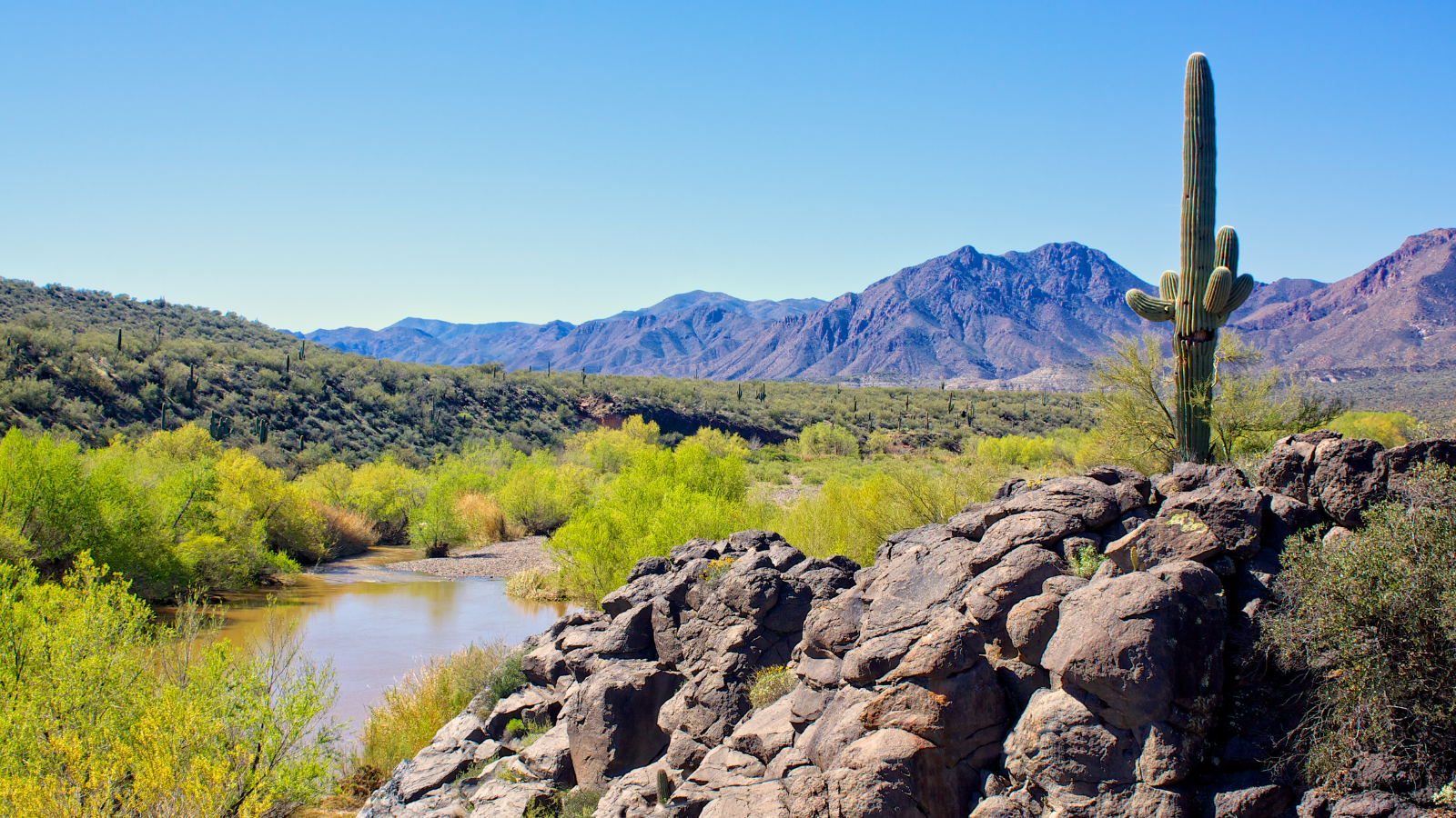
Access in Perkinsville is complicated by private lands. Watch for barbed wire; this is cattle county. Put-in at the Perkinsville Bridge. There is a dispersed camping area here. Once you pass Perkinsville and pass under the railroad bridge- behold the Verde Canyon. The carving of this canyon was catalyzed by the kiss of the Black Hills and the Mogollon Rim millions of years ago. Enjoy your decent into the stratigraphy of the Colorado Plateau. Stream flow increases in the vicinity of Mormon Pocket (see USGS topo) as the result of springs in the stream channel. This is a spectacular, wild place. Watch for bear, elk, and even coatimundi! Beware strainers in the riparian jungle. More beta needed.
You'll exit the Verde Canyon roughly at the Sycamore Creek confluence. Flows will increase once more as this perennial, spring-fed stream adds water. There are private lands for roughly .5 miles upstream of this confluence along river left. A rough 4x4 forest road comes down to the river a little way downstream from the Sycamore Canyon Wilderness trailhead. The last .25 mile of this road is exceptionally steep and rocky. However if you make it down to the river this an excellent RAP for a shorter trip.
From the Sycamore Creek RAP, the river enters a narrow, basalt gorge shortly after a USGS gauge on the river left. There are numerous rocky Class II rapids along this stretch. This a narrow stream corridor with narrow floodplains. This is a tormented place; floods rip through there, evidenced by the hammered riparian forest throughout. Watch for strainers! Shortly after SOB Canyon, the river begins to leave the confines of the basalt gorge and widens out as it begins to enter the Verde Valley. As a result, the river gets shallower. Watch for fencelines and weird, old mining infastructure and stream channel alterations.
Information from AZ Rivers, Streams, and Wetlands Study, 1989, AZ State Parks
Also see the other segments:
Clarkdale to Camp Verde
Camp Verde to Beasley Flats
Beasely Flats to Childs
Childs to Horseshoe Reservoir
Horseshoe Reservoir to Bartlett Reservoir
Bartlett Reservoir to confluence with Salt River
Rapids in this Run (1)
Hazards & Portages (1)
Caution: The following locations may require scouting or portaging. Always check current conditions.
Difficulty
Class I
Length
24.4 mi
Rapids
1
1 Hazard
Access Points
Difficulty Classes
I Easy
II Novice
III Intermediate
IV Advanced
V Expert/Extreme
VI Unrunnable
Current Conditions
5-Day Forecast
Whitewater data from
American Whitewater
American Whitewater