02. Narrows
Linked via: Nhdplus discovery 90% confidence Synced 6mo ago
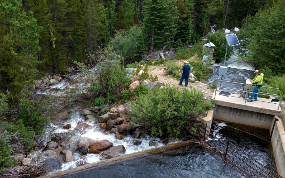
Gauge Conditions
Runnable: ? – ? CFS
Approximate reading: This gauge is 8.0 miles away on Saint Vrain Creek. Use as a general reference only.
Data from American Whitewater & USGS
Run Map
Description
Colorado road side mank at its finest, with a unique touch.
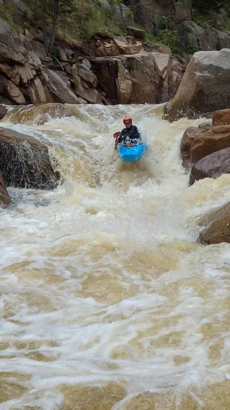
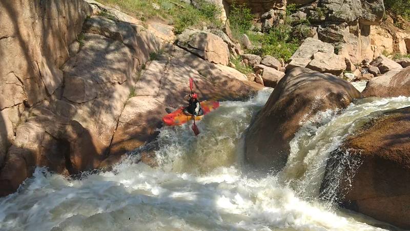
This tall roadside canyon comes complete with multiple put-in and take-out options for variable spice factor; boasting hairy cascades and gnarly ledges to keep you on your toes the whole way down.
After driving three miles towards Allenspark, from Lyons on highway 7 you'll come around a corner and see a roughly five foot spout drop, this is 1in5.
Use the large dirt pull off next to the rapid as a take out. A large cotton wood tree acts a good marker from river level, if you wish to take out above this one.
It's a good idea to scout this one. Safety is recommended.
The main line on 1in5 is off the left, a good right stroke will bring you home. This drop becomes substantially meatier above 400 cfs. The right side acts as a potential sneak at these levels. If water is running over the rock on river left, it may be a good idea to take out above.
This rapid is ideal for lapping. Get creative with put in methods.
It is important to be aware of the cave on the river right side of the pool, created by the boulder that creates the two channels. Too date no person has been stuck in that room, several boats have though. They where in there for quite awhile.
For the put in, drive about a mile and a half up the road, coming around another bend you'll see Jihad, a steep and manky drop, with an out of play log in the middle of two pinches. Use the first pull off on the right directly adjacent to the drop. Gear up and scout.
There are several put ins depending on how high you want to walk up. Hiking up the shoulder will bring you to a very steap cascading section, barreling around a sheer corner: The Narrows. If this looks like your jam, keep hiking. If not, put in below all that nastiness. Be aware, put in spots are loose at best.
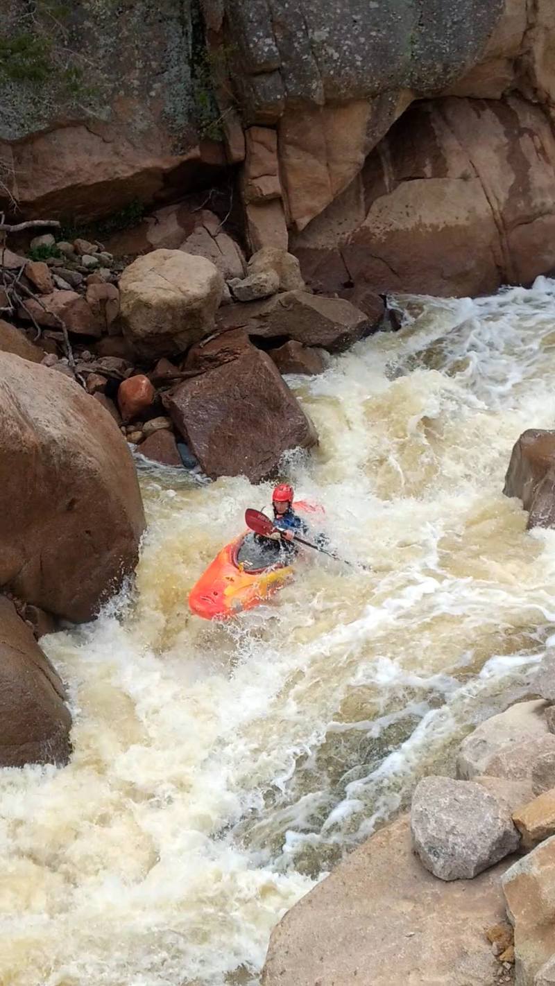
The top of the Narrows is marked by a river wide ledge drop with a dynamic lip. This is the one and only, Hot Donna. After running this you're commited to the rest of the section. Find a good spot above to get in and send'er on down. Hot Donna is run off of the left with a big right boof, it is easy to get eddied out on the left after landing.
Next is White Lightening, run down the left; this is followed quickly by two back to back boulder jumbles. Run the first on the left, then hussle back right for the second. Lastly, slip down the left side final pile, dodging a hidden piton rock. Catch the big eddy on the right and breathe a sigh of relief.
Don't let your gaurd down just yet, you still have a series of class IV+ drops, and then Jihad. The top of Jihad is run down the left tongue, despite what you might think, you won't piton. The more left you come in at the top, the less difficult the move at the lip will be. Move across the pool toward the right, mind the log.
Run the second tier from right to left, and take solice in knowing the sketchest part is behind you. The rapids from below jihad are all fun IV+ until 1in5. This section is easily routable with someone who knows the lines. Don't forget to keep your eye's peeled for the 1in5 cottonwood tree.
This run is at the most two miles from the top of Narrows, so lapping is typicaly a popular idea.
As of 2017, several groups have put in above Narrows, but below the confluence, and run through 1in5. There are several technical class IV/V drops in this section, and more than a few log portages.
Have fun, be safe, and don't forget to keep your eyes peeled for wood.
The various reaches of of Saint Vrain Creek,
Upper NSV (Class V+/VI-),
Middle NSV (Class IV/V),
Lower NSV (Class II/III),
Upper SSV (Class V+/VI-),
Left Hand Creek (Class IV).
Rapids in this Run (12)

Waterfalls (2)
Difficulty
Class V+
Length
6.6 mi
Gradient
248 ft/mi
max 375
Rapids
12
Access Points
Shuttle Info
The entire run is next to HWY 7, about three miles upstream of Lyons.
The last class V drop, 1in5 is an obvious spout visible from the road. Use the large dirt pull off as a take out. A large cotton wood tree can be seen from the river, and acts as a good marker if you wish to take out above 1in5.
For the put in, drive a mile and a half up the road, coming around another bend you'll see Jihad, a steep and manky drop with an out of play log the middle of two pinches. Use the first pull off on the right directly next to the drop.
Difficulty Classes
I Easy
II Novice
III Intermediate
IV Advanced
V Expert/Extreme
VI Unrunnable
Current Conditions
5-Day Forecast
Whitewater data from
American Whitewater
American Whitewater