02. Taylor Park Reservoir to Almont
Linked via: Proximity 97% confidence Synced 6mo ago
Gauge Conditions
Runnable: 350.0 – 2,000.0 CFS
The gauge in Almont can also be used to assess flows on the Taylor, however this gauge includes Spring Creek which is a tributary below the South Bank takeout
Data from American Whitewater & USGS
Run Map
Run Time Estimate
Select put-in and take-out to estimate time.
Unlock Advanced Trip Planning
See wind-adjusted speed maps, forecast planning, and detailed time estimates.
Sign in to generate an AI timing estimate for this run.
Whitewater timing varies with scouting, portages, and group pace. Use as a planning baseline.
Description
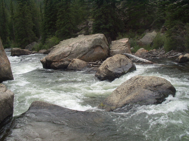
The Taylor River is stunning and beautiful with alpine scenery, a boulder-strewn course through the pines offering up whitewater at different levels.
Another great thing about the Taylor River is options:
The top reasonably boatable section, there are serious access problems above here, begins at Lottis Creek Campground.
The first rapid; Lottis Creek, appears immediately. It is a long Class IV boulder garden. Next comes several miles of rock gardens alternating with more placid sections. Todd's Slot is the best known drop on the river and is a technical Class IV / IV rapid. It is a bit complex and has killed so take a look at this rapid. Below Todd's Slot are miles of beautiful continuous Class III mountain water to the takeout by the south bank bridge right above Harmels resort. Below this bridge to Almont the river steadly decreases in gradient until it is a placid Class II stream where it meets the East River at Almont to form the Gunnison River. The top miles below Lottis Creek drop at about 80 FPM with the gradient steadly decreasing to 20 FPM at Almont. This is a trophy trout stream with constant releases all summer to maintain the fishery. Watch for wood, especially given the fast pace of the water. The Taylor River is known for being woody, its Colorado.
The Taylor is a superb Beginner (near Almont), Intermediate (below Todd's slot) and Advanced (from Lottis Creek) river and will have water when most everything else is dry.
For best gauge see: The gauge below the dam:
https://waterdata.usgs.gov/co/nwis/dv/?site\_no=09109000&PARAmeter\_cd=00060
\[The one linked is at Almont which also includes Spring Creek, which comes in below the South Bank takeout.\]
Rapids in this Run (1)
Difficulty
Class II-IV
Length
12.0 mi
Rapids
1
Access Points
Difficulty Classes
I Easy
II Novice
III Intermediate
IV Advanced
V Expert/Extreme
VI Unrunnable
Current Conditions
5-Day Forecast
Whitewater data from
American Whitewater
American Whitewater