07. Gateway to Colorado River (UT)
Linked via: Proximity 97% confidence Synced 6mo ago
Gauge Conditions
Runnable: 250.0 – 5,000.0 CFS
Minimum flows are 250 cfs for canoes/kayaks/inflatables, 800 cfs for small rafts to 14 ft., 1000 cfs for large rafts to 18 ft.
Data from American Whitewater & USGS
Run Map
Description
SEASON: April to early June depending on snowpack and release from McPhee Dam and inflow from the San Miguel River.
ISSUES: Recreational users have traditionally been the last to be considered in the management plan for McPhee Dam. American Whitewater has become a leader in policy discussions around Reservoir management, and restoring flows below McPhee for the benefit of recreation and native fish. Follow the links to the right, for more information.
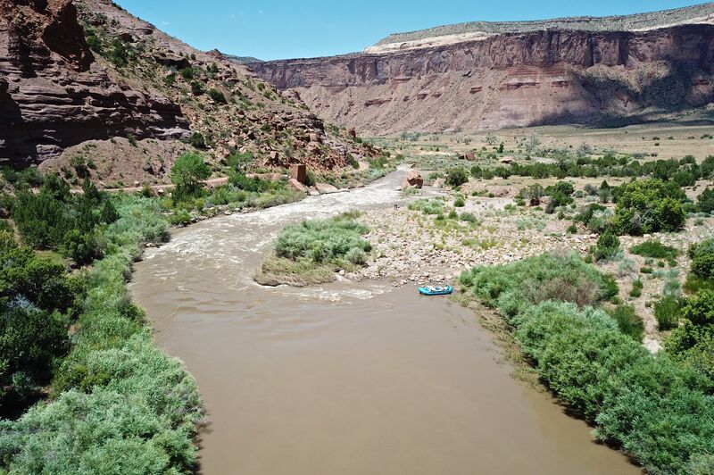
LOGISTICS: It's a long shuttle via Grand Junction but that also means this section receives somewhat reduced use. The put-in is on the upstream river right side of the Highway 141 Bridge in Gateway. The take-out is at Dewey Bridge across the Colorado just downstream of the confluence with the Dolores. In spring, snow can block the short-cut shuttle through Castle Valley. Inquire locally to see if you can find someone willing to run your shuttle.
DESCRIPTION:
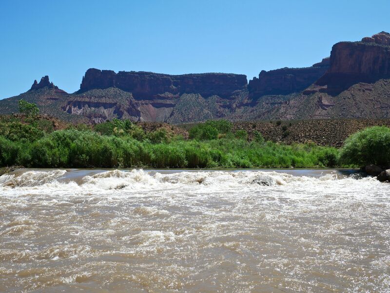
This river sees somewhat limited use compared to nearby desert runs. The shuttle can be long (when the mountain shortcut is blocked by snow), the action is mellow except for Stateline which can be too much action for some, and there's a bit of ranch and mining "history" that detracts a bit from the scenery. But if you're looking to avoid the crowds, this is a trip worth checking out and with supplemental flows from the San Miguel it can be a possibility when McPhee Dam holds back the spring melt and the upper sections on the Dolores are too low. In some years your only opportunity for paddling the Dolores is to paddle the sections below the confluence of the San Miguel and this one contains the most whitewater. The Dolores is managed by the BLM and they maintain a web page with information on the river. Although permits are not currently required in Colorado, once you cross into Utah, a permit is needed. Permit information can be found below.
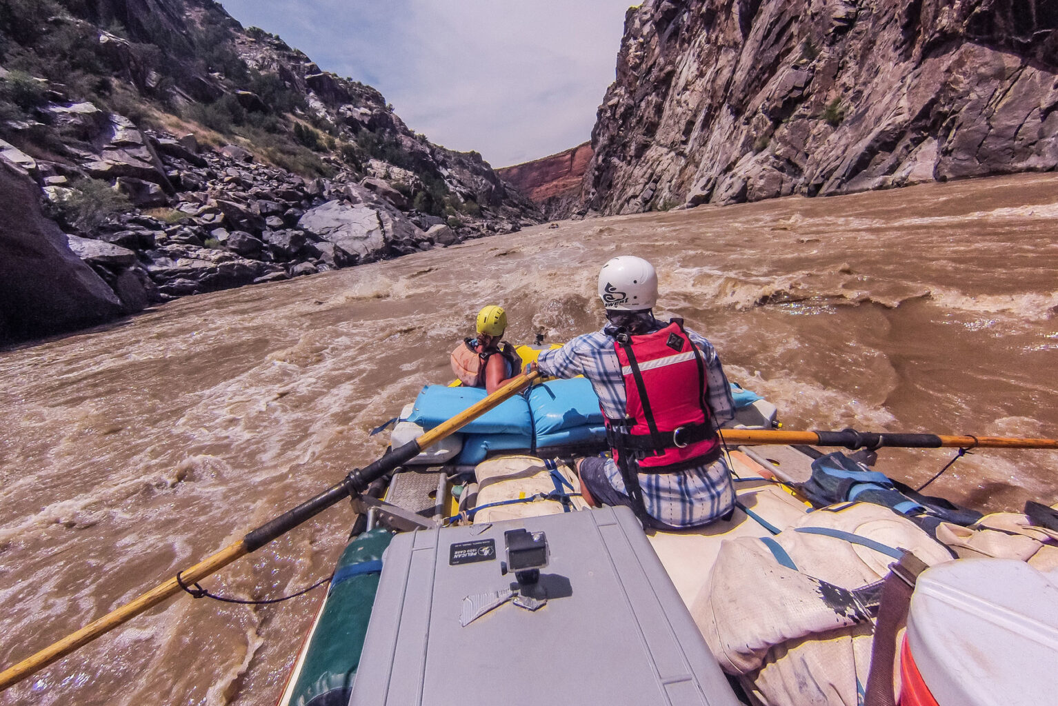
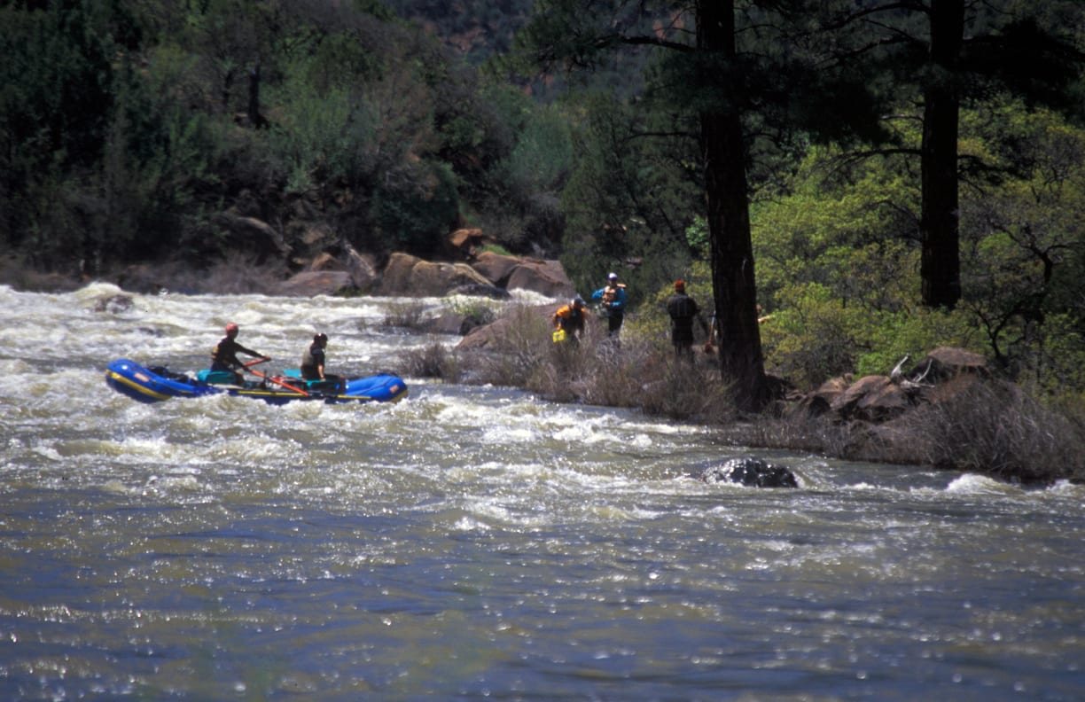
The run starts out from the Gateway Launch at mile 141 as a mellow float characteristic of the sections just upstream. A road parallels river right as you pass through open bottomlands. Within a few miles the action begins to pick up with some class II and III rapids before you reach the highlight of this section at Stateline Rapid. You'll want to get out to scout this class IV drop from river right. After this rapid the river mellows out again with only a couple more rapids before settling out to a lazy float to the Colorado.
Decent campsites can be found once you've passed through Stateline Rapid and into Utah. Here the run becomes more remote as you start to leave the roads behind. You'll find some good wilderness camping and side hikes. There are a couple sections of ranch land and you'll see evidence of the past human history of this area, but there's some good scenery.
The Dolores joins the Colorado and ends at mile 173 (as measured from Bradfield Bridge below McPhee Dam). It's another couple miles on the Coloardo to Dewey Bridge.
Boaters can start from further upstream or continue their trip downstream by taking advantage of boating opportunities on the following sections of the Dolores and Colorado:
- 1) Dolores River, Bradfield Launch to Dove Creek Pump Station, 19 miles, II-III
- 2) Dolores River, Dove Creek Pump Station to Slickrock, 28 miles, II-III+(IV)
- 3) Dolores River, Slickrock to Bedrock, 50 miles, II+(III)
- 4) Dolores River, Bedrock to Gateway, 44 miles, II+
- 5) Dolores River, Gateway to Colorado River, 30 miles, II+(IV), this page
- 6) Colorado River, Cisco to Moab, 47 miles, I-III
- 7) Colorado River, Moab to Lake Powell (Cataract Canyon), 112 miles, I-IV
For packrafters, there is a mellow a 2 or 3 day self supported loop trip that runs every spring. It catches the last 18 miles of the Dolores (class I - II-) and can be combine with sections of the Colorado/ Moab Daily for a 40 mile, mostly flat water trip. Drop a bike either at the Dewey bridge, Lower Onion Creek, or Take Out Beach boat ramps. Drive up the well maintained Onion Creek Road (27 stream crossings!) to Fisher Valley and on towards Rose Garden Hill. You’ll need a high clearance vehicle to make it the last mile. Then hike down Cottonwood Canyon/ Fisher Creek to the Dolores. Although short, the hike is off trail and takes ~5hrs, with a couple pour offs to negotiate (go up and right at the big one), and a 15ft wet chimney down climb. Anything over 225 CFS works.


Difficulty
Class II+(IV)
Length
31.0 mi
Gradient
14 ft/mi
Rapids
8
Access Points
Difficulty Classes
I Easy
II Novice
III Intermediate
IV Advanced
V Expert/Extreme
VI Unrunnable
Permit Required
Required permit can be obtained by calling the Moab BLM field office for a reservation.
Get Permit
Current Conditions
5-Day Forecast
Whitewater data from
American Whitewater
American Whitewater