1: <b>(Jones Gap) </b>Jones Gap Trail bridge to bridge at park HQ
Linked via: Nhdplus discovery 90% confidence Synced 6mo ago
Gauge Conditions
Runnable: 3.3 – 5.0 FT
Guess based on pictures of flow at 3.5' when gauge was on previously several years ago. Gauge levels may have changed while the gauge was inactive.
Data from American Whitewater & USGS
Run Map
Description
You must complete a permit to paddle the Middle Saluda within the state park. Permit requires your driver's license and car tag number. Includes intsructions on approved put-in and takeout points and applicable rules. This is a state trout stream and removal of wood is prohibited. The highest approved put-in is approximately a one mile walk above the park headquarters.
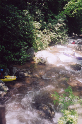
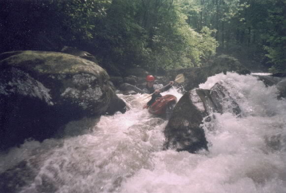
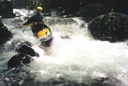
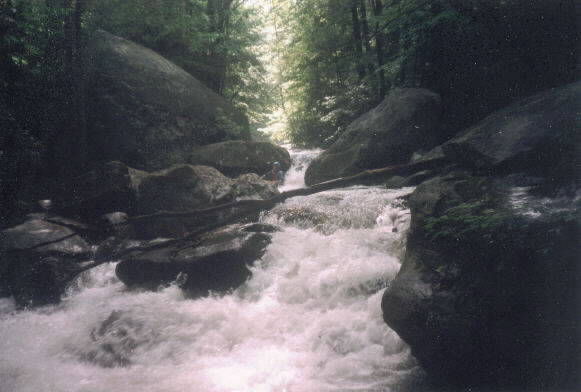
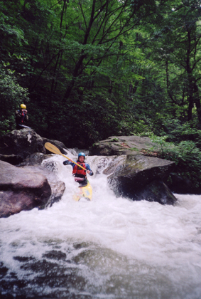
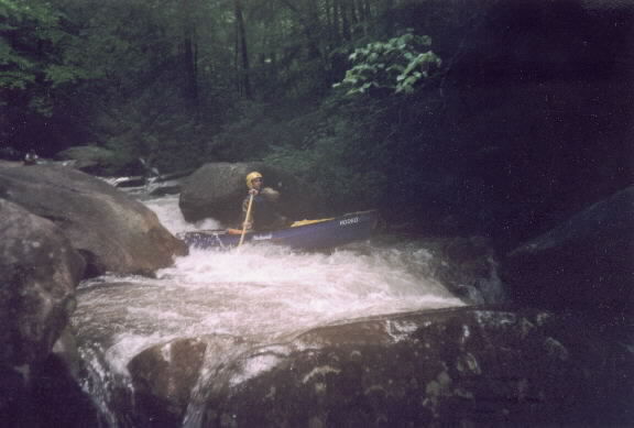
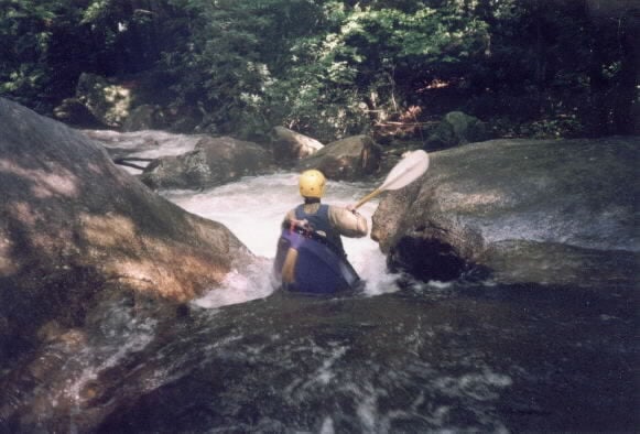
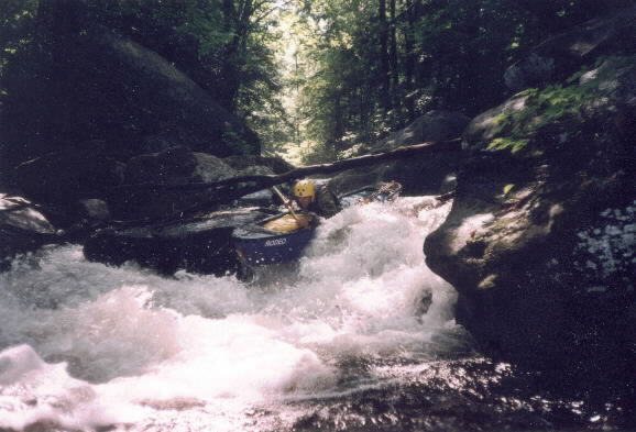
WARNING!!! There is lots of wood - some easy to see and some waiting just below the surface on this stream. This is a tight, very busy little creek that commands your attention.
Directions: Take 276 N out of Greenville, and a few miles after Hwy 11 joins in, turn Right at the F-Mart (small brown country store with a Pepsi Sign--"Best Hotdogs In Town", and they're telling the truth), and follow this road straight a nubmer of miles all the way into the park.
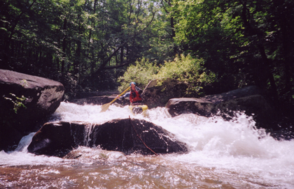
Description: This is all out tight, technical, boney, boulder infested continuous creeking. DON'T GET SIDEWAYS. It is far from hair, lacks anything huge and of Tao's enjoyment, but is still enough to get the blood pumping.
Park at the parking lot or in "camper" parking if it's during the week, and be sure to register at the park office after checking the flow. If there's enough water in the park, there should be enough upstream for a ways. Try to catch it during a serious downpour or after a number of days of rain.
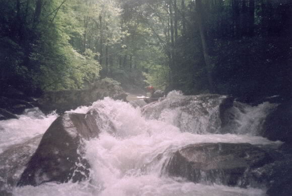
After you've started up the trail, start scouting, because eddies are going to be few and small. Be sure to check out the stream falling off the mountain on Hiker's Left about a mile up the trail. The river leaves and rejoins the trail several times. Once you're in the water, keep it pointed downstream, and catch whatever eddies you can find.
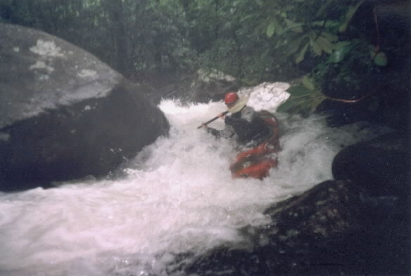
The only drops I can note are both near the end of the run. One is a huge boulder clog (Razorback), which looks runnable on the far right side down 2 or 3 steps, and then picking your way through the runnout. Stay out of the trees on the left and the clog in the left middle. The only problem it seems with the steps is that if you fall off the right side of one of them, you end up in a terminal seive. Be careful.
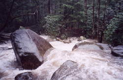
The second is actually in the park after the large wooden bridge but before the metal footbridge. It's like a huge slab had a diagonal slice about 3 feet wide cut out of it from top left to bottom right. You have a class II approch, and a small eddie in the pool on river right above the slot. The right slab is undercut, so a missed line will result in lost teeth or a nice bloody nose. You run up on the left slab, and fall off into the pool below. Beware of the f-up rocks right at the lip if the level is marginal. The total drop is only 3 or 4 feet, but can look pretty serious. Hit the water with a strong push to the left and drop through the slot and find a place to take out.
From the park office to the highest allowed put-in is approximately 1.0 miles. The river drops right at 240 fpm. Above the allowed put-in, the river gets really steep, dropping over 420 feet in the mile above the confluence. Check the topo maps and you will see that most of that gradient happens in less than a mile.
Below the park office, the next 2.1 miles drop approximately 99 fpm.
Wood on this creek is a serious concern, as the slots are narrow, and the banks are weak and prone to drop whole trees into the river. Scout when you can, and don't bang ahead, as eddies are few and far between, and you may be in the meat and maw before you know it.
Jones Gap State Park
Rapids in this Run (8)
Hazards & Portages (5)
Caution: The following locations may require scouting or portaging. Always check current conditions.
Difficulty
Class III-V
Length
1.2 mi
Gradient
240 ft/mi
Rapids
8
5 Hazards
Access Points
Shuttle Info
Park in the parking lot, complete a permit at the park office, then start hiking upstream.
Difficulty Classes
I Easy
II Novice
III Intermediate
IV Advanced
V Expert/Extreme
VI Unrunnable
Current Conditions
5-Day Forecast
Whitewater data from
American Whitewater
American Whitewater