1. Dee to Tucker Recreational
Linked via: Nhdplus discovery 90% confidence Synced 6mo ago
Gauge Conditions
Runnable: 4.2 – 5.7 FT
Data from American Whitewater & USGS
Run Map
Put-in
Take-out
Rapids/Hazards
Recreational
Run Time Estimate
Select put-in and take-out to estimate time.
Unlock Advanced Trip Planning
See wind-adjusted speed maps, forecast planning, and detailed time estimates.
Sign in to generate an AI timing estimate for this run.
Whitewater timing varies with scouting, portages, and group pace. Use as a planning baseline.
Description
The run is known as one of the best intermediate to advanced whitewater runs in the Columbia Gorge and its no wonder so many paddlers call Hood River home with this river in their back yard. The river corridor, although largely in private ownership, is nearly completely undeveloped as bedrock walls of columnar basalt rise up from the river to the forested canyon rim. While most of the run is class III, it finishes off with some more challenging class IV. Although these final rapids are relatively straightforward class IV at moderate flows and a good place to learn to boat more advanced whitewater, things crank up a notch as flows rise. Stories of epic high water runs at flood stage circulate among the Hood River boating community.
The section of the Hood known as Dee to Tucker typically starts out with a fun mile of whitewater on the East Fork Hood that ends with Confluence Rapid. An alternative is to put in at the base of Punch Bowl Falls on the West Fork Hood.
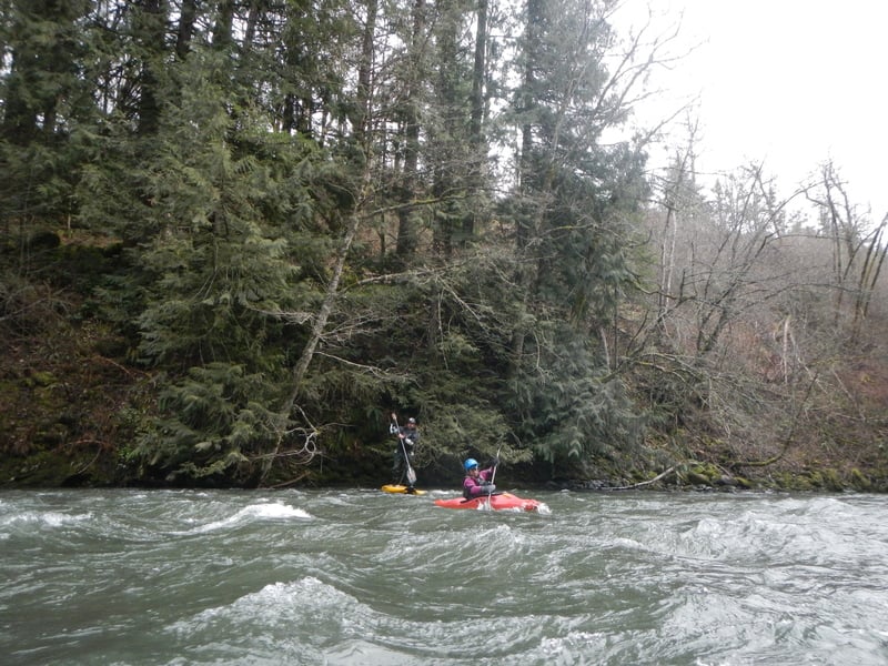
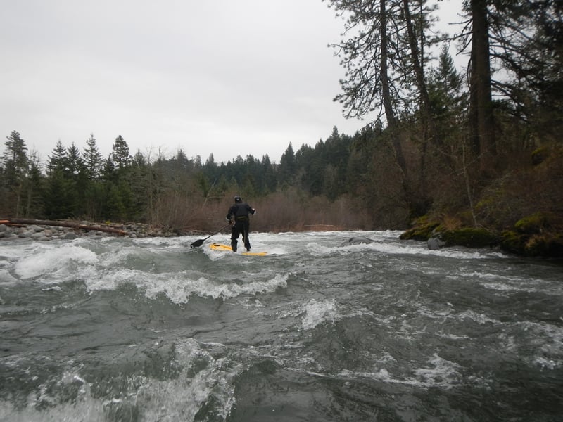
At standard flows, the 5 miles downstream from the confluence of the east and west fork is enjoyable and nearly continuous action with class II whitewater interspersed with a number of fun class III rapids. The scenery and quality of the whitewater are simply spectacular and draw paddlers from across the region. Early in this section and soon after passing the intake for the Farmer's Irrigation Canal, you will come to Aquaduct Rapid (aka Pipeline). The upper drop takes you down the left against a bedrock wall and the lower drop includes the best surf spot on the run.
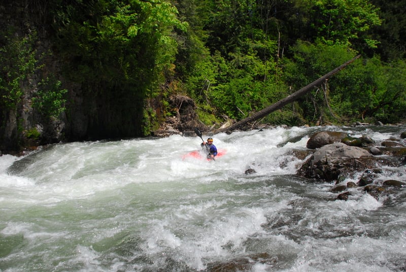
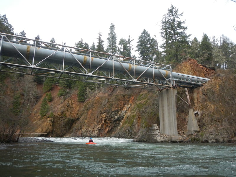
As you near the end of the run, you will come to a green truss bridge that carries a waterline across the river. This marks the start of the class IV rapids and the first one, Island Rapids, is a long one down the river right channel. Immediately below this drop the river slams into Wallbanger, a head wall rapid on river left. A few more fun class IV rapids continue as you pass Tucker County Park on river right and eventually arrive at the Tucker Bridge.
While kayakers who are just doing the upper run take out here, access is challenging for rafters who often just continue on with the next run down to the Columbia River.
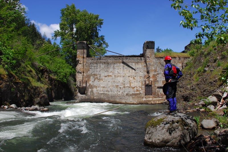
Logistics: Access for this run has always been a little bit of a challenge and it would likely be more popular with rafters if the issues could be solved. The traditional put-in access has been on the downstream river left side of the Dee Bridge, but this is private property as access within the bridge right-of-way is not practical.
Upstream of the bridge the river is in a steep gorge and an old dam creates a hazard that generally precludes access upstream (Hood River County owns the land on river right at the Dee Highway Bridge across the East Fork Hood which could serve as a put-in if not for the hazards of the dam site).
Kayakers have been using the street end at Iowa Street just downstream of the Dee Bridge on river right. Parking is limited however (please don't park in the private open space adjacent to the street end). From the street end you walk about 10 yards downstream and follow a steep trail down into the gorge. This access puts you in just upstream of the last rapid on the East Fork Hood before the confluence.
For the take-out, you can exit the river at Tucker Park but good whitewater continues all the way down to the Tucker Bridge. Another issue with the park is the road into the park is gated during the winter boating season although you can park outside the gate. You can exit the river at the USGS gage station downstream river right of the Tucker Bridge where a trail switchbacks up below the bridge. Parking is limited however. You may be able to park a shuttle vehicle at the Apple Valley Country Store if you buy a round of huckleberry shakes or BBQ after your run. Alternatively, there are a couple spots along the highway shoulder on the upstream river right side of the bridge.
Rapids in this Run (4)
Hazards & Portages (1)
Caution: The following locations may require scouting or portaging. Always check current conditions.
Difficulty
Class III-IV
Length
7.0 mi
Rapids
4
1 Hazard
Access Points
Difficulty Classes
I Easy
II Novice
III Intermediate
IV Advanced
V Expert/Extreme
VI Unrunnable
Current Conditions
5-Day Forecast
Whitewater data from
American Whitewater
American Whitewater