1) Dixon Ford to Boxley Bridge (15 Miles) Wild
Linked via: Proximity 93% confidence Synced 6mo ago
Gauge Conditions
Runnable: 4.5 – 8.0 FT
Data from American Whitewater & USGS
Run Map
Put-in
Take-out
Rapids/Hazards
Wild
Scenic
Description
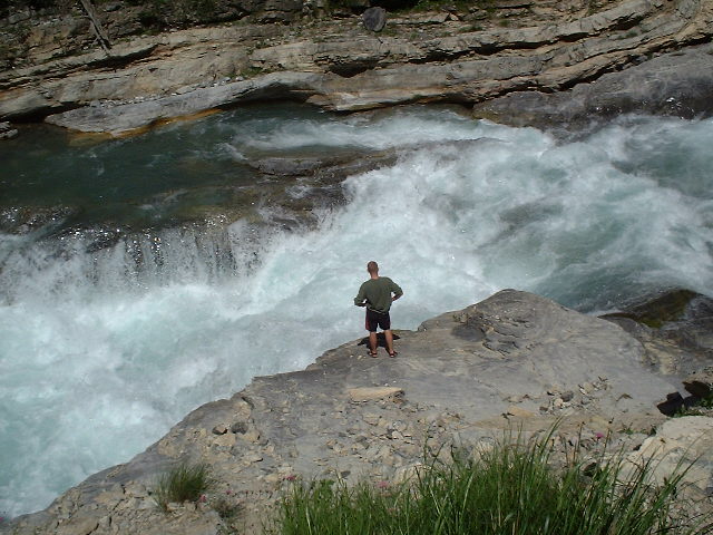
This is a long, remote, breathtaking run. The vast majority of the run, starting .5 miles past Dixon Ford, and continuing until 1 mile before the Boxley Bridge is inside the Upper Buffalo Wilderness Area. The first 10 miles of the wilderness are managed by the US Forest Service and the bottom 4 miles are managed by the National Park Service. The section of this run inside the National Forest is also managed as a part of the Wild and Scenic River system, one of 3 such rivers in Arkansas (along with Richland Creek and Hurricane Creek) with this designation. Finally, the 135 miles of the Buffalo from the National Forest border to the White River are managed as the Buffalo National River - America's first National River. The only sign of development in the gorge is high on the left bluff at Whitaker Creek (Mile 8.6). This is the former home of wilderness photographer Tim Ernst. His journal and photographs can be seen at timernst.com, and he also has a Facebook Page, Tim Ernst Photography of Arkansas and other wild places.
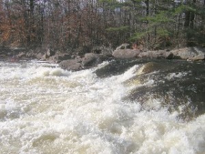
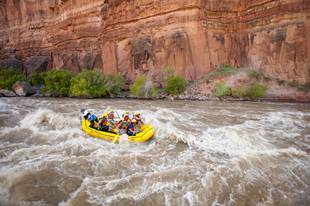
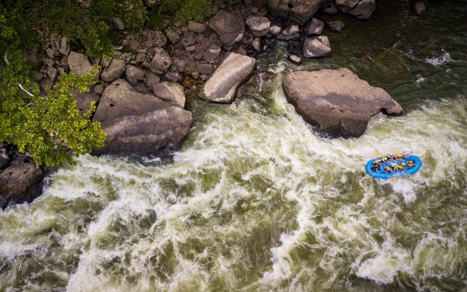
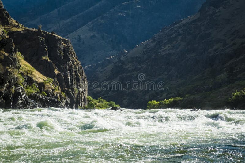
The first couple miles of the run consist of mainly shallow Class II bedrock shoals and small ledges, offering countless surf waves as the walls of the gorge begin to grow. Be careful of the numerous areas where this bedrock is undercut along the banks.The action picks up when boulders begin to appear in the stream creating several class III to III+ rapids for the next couple miles.The difficulty subsides after the 'Room of Doom' rapid, but regains intensity below Whitaker Creek. Large boulders again populate the streambed and create several rapids with slots, holes and some undercuts. Although this river is pool drop in nature, the pools are generally small with good current in the gorge.
There is a large midstream boulder at mile 13.2, that after which the Gorge rather abruptly opens up into the Boxley Valley. After about a half a mile of calm wide water, you'll hit the Willow Jungle. There is some pathfinding to do thru this section, so stay on your toes. When you start seeing powerlines, farm houses, and the old concrete structures, stay left to get into the best channel for the take out. Take out at the Boxley Bridge river left (either above or below the bridge, based on your craft and willingness to carry and/or climb up the bank).
This is a very long run for most paddlers. While not as technically demanding as other Class III+ runs in Arkansas like the Cossatot or Richland, it's the remoteness and length that can beat boaters down. Bring plenty of snacks and fluids, keep a consistent pace, and don't burn yourself out too early. Good paddlers can get themselves into trouble by the time they reach the Keyhole if they're getting cold, tired and hungry and start making mistakes.
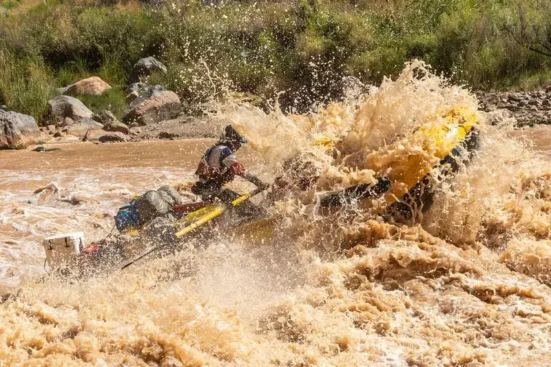
How to Judge if the Run is In: The run almost never stays in for more than 24 hours, so you have to get it fast after a big rain. Generally 3-4 inches of rain in a 48 hour period over the higher parts of the Boston mountains around Fallsville will get the run going from dry conditions. If the rivers are already primed and the ground is wet, 1 or 2 inches will be enough. While the Hailstone can & has been run down to around 400cfs, things start getting very boney below 700cfs and you stand a good chance at damaging your boat. Also note the gauge is at the bottom of the run, so by the time you drop a vehicle at Boxley, do the hour shuttle to Dixon ford and put on the river, You will have already lost some flow - and then lost more flow in the 4-5 hours it takes to complete the run. Generally if you're on the water by 700cfs indicated at Boxley, you should be OK, but starting with 900cfs is going to give you much more padding, and more flow (up to around 1500cfs) is better yet. Above 1500cfs things start getting big and pushy, but runs this high are rare as the river is typically dropping at rate of 200cfs/hour or more. Highest known runs of the Hailstone were at 7000cfs and 12000cfs, with the entire gorge one giant torrent.
Notes on Gauges and Levels: A major flood in November of 2024 completely destroyed the Boxley USGS Gauge, and it had to be rebuilt, after which the old height measurements no longer reflect the same experience. The current CFS reccomendations are based on knowledge and experience gained during the Winter and Spring of 2025. If you insist on using the old height measurements, as a rough estimate add 1.5 feet to today's Boxley gauge reading to get a pre-2024 corresponding Boxley Gauge reading (Today's 5.5' would be last year's 7' for example). We also recognize for years many boaters simply used the airspace at the Ponca Low Water Bridge as a good estimate for the Hailstone. After the November '24 flood, this is no longer a viable tactic, as the river environment has completely changed around Ponca, and water now routinely fills the pool below the low water bridge, leaving no airspace at all for lots of river levels that are now considered quite low. Therefore the NPS has switched to using CFS based reccomendations for the Buffalo (which generally remain more consistent over time) and Hailstone runners should too.
Put-in: Located at the Dixon Ford Crossing of the Buffalo River, on NFR 1463 (Newton County 9100) off of Hwy 21 near Fallsville.
From Fallsville (intersection of Hwy 21 and Hwy 16 East) travel North on Hwy 21 for 1.4 miles and turn Left (West) onto NFR 1463 (Newton County 9100). This will be the second dirt road to the left as you travel North from Fallsville. There will be a blue '9100' sign on top of the stop sign facing the highway.
From Boxley Bridge, travel south on Hwy 21 for (taking a right at the intersection of 21 and 16) for 17.2 miles. There will be a blue '9100' sign on top of the stop sign facing the highway. Turn right onto the dirt road.
Once on road 9100, follow it 3.1 miles to the river. The road is well maintained for the first 2.1 miles to the 'Wilderness Access' sign. Do not follow the arrow to the Wilderness Access (Right). Continue to the left and the road will begin a steep descent to the river. High ground clearance or 4-WD may be needed here, especially after heavy rains. The switchbacks on the steep section of road have several large ridges built to slow erosion. Go very slow over these ridges or even high clearance vehicles will bottom out. Once to the flat level ground there are several large mudholes.. they look scary, but are generally solid underneath. Stay generally on the left or south side of the mudholes to miss most of the deep water. You can also park anywhere there is enough clearance to let others by, and hike in from here if hauling small boats. Do not block the road up to the Dixon Ford access, it is heavily used by other boaters when the water is up, and used by SxS riders and jeepers at all times. If you have an option to bring a driver to avoid leaving a vehicle down here, do it - to save space for others.
Take-out: Boxley ridge where Hwy 21 crosses the Buffalo River at 'Cave Mountain Road'. You can park along the side of Cave Mountain road, just leave plenty of room for traffic to pass.
Rapids in this Run (15)
 Rapid
II
Rapid
II
False Double Drop
 Rapid
II+
Rapid
II+
Double Drop
 Rapid
Rapid
Adkins Creek
 Rapid
II+
Rapid
II+
Entrance to Mix Master
 Rapid
III
Rapid
III
Mix Master
 Rapid
Rapid
Terrapin Branch
 Rapid
Rapid
Boen Gulf Branch
 Rapid
Rapid
Whittaker Creek
 Rapid
III+
Rapid
III+
Bloody Keyhole
 Rapid
III
Rapid
III
Unnamed Rapid #1
 Rapid
III
Rapid
III
Unnamed Rapid #2
 Rapid
III
Rapid
III
Deliverance Falls
 Rapid
III
Rapid
III
The Cemetary
 Rapid
II+
Rapid
II+
End of the Gorge Boulder
 Rapid
Rapid
Boxley USGS Gauge
Hazards & Portages (2)
Caution: The following locations may require scouting or portaging. Always check current conditions.
Difficulty
Class II-III+
Length
15.0 mi
Gradient
33 ft/mi
max 50
Rapids
15
2 Hazards
Access Points
Difficulty Classes
I Easy
II Novice
III Intermediate
IV Advanced
V Expert/Extreme
VI Unrunnable
Current Conditions
5-Day Forecast
Whitewater data from
American Whitewater
American Whitewater