1. Dries: Turtletown Creek to Apalachia Powerhouse
Linked via: Proximity 94% confidence Synced 6mo ago
Gauge Conditions
Runnable: ? – ? CFS
Approximate reading: This gauge is 10.0 miles away on Hiwassee. Use as a general reference only.
Data from American Whitewater & USGS
Run Map
Run Time Estimate
Select put-in and take-out to estimate time.
Unlock Advanced Trip Planning
See wind-adjusted speed maps, forecast planning, and detailed time estimates.
Sign in to generate an AI timing estimate for this run.
Whitewater timing varies with scouting, portages, and group pace. Use as a planning baseline.
Description
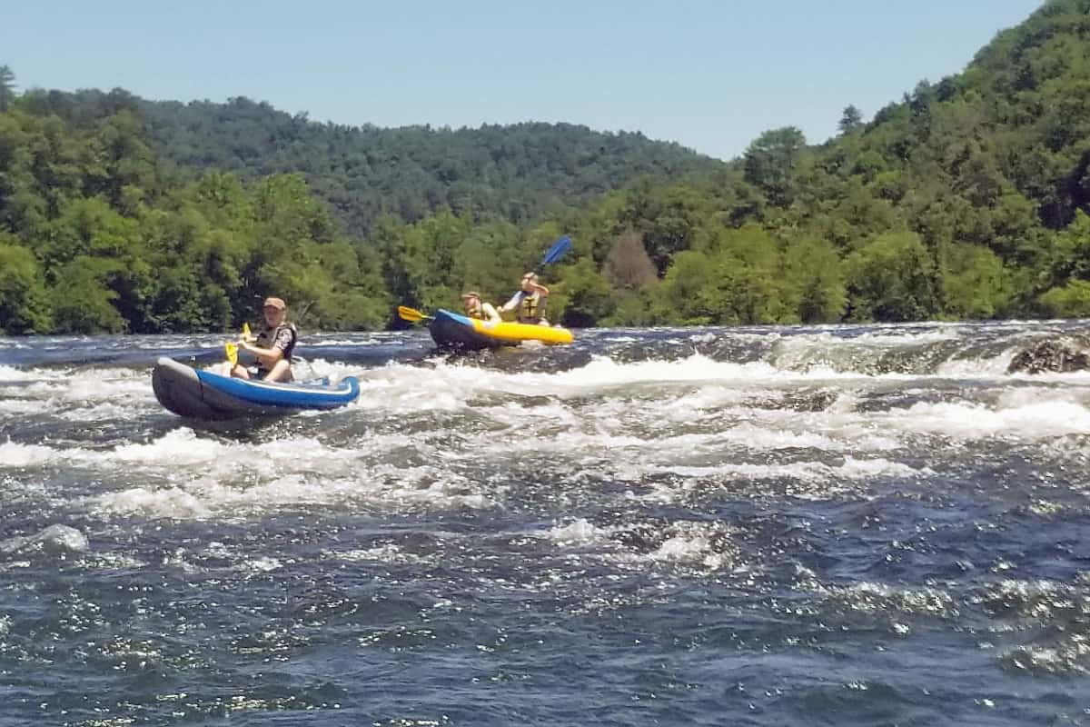
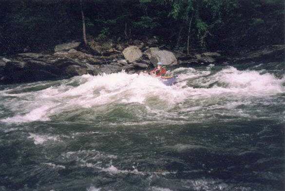
The Hiwassee Dries is a big beautiful run that is almost always dewatered by TVA's Apalachia hydropower project. Think a big-water version of Section III of the Chattooga, just over the hill from the Ocoee. An old railroad line shares the river corridor, but the scenery is most often wild. The water is crystal clear, and there are plenty of waves and deep eddy lines to play with.
The run is only available when Apalachia Dam is spilling due to high rainfall or more likely due to maintenance shut downs at the power plant, which happen once a year or so. There is no great way to tell if the dam is spilling except to keep an eye out for a notice on the TVA website. At high water (>3,000) you can expect big waves and holes and lots of fun boils. At moderate flows (1,000-3,000) expect clean deep lines and moderate sized features. Its been run and is fun at least as low as 800.
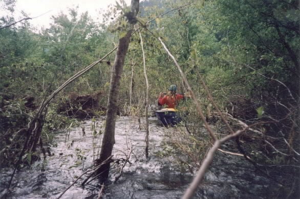
The 70+ year old hydropower diversion has allowed trees to grow in the riverbed. Above Turtletown Creek the riverbed is essentially a forest, with dangerous and miserable strainers throughout the channel. Below Turtletown Creek trees and shrubs are seldom an issue for paddlers, but caution is advised of course. Because of this: DO NOT put in at Hwy 68.
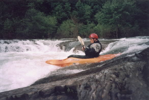
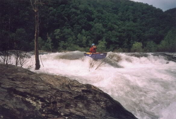
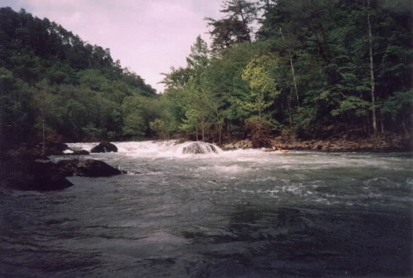
The biggest rapid by a long shot on the Dries is Hollywood Bowl, about a mile below Turtletown Creek. Scout from river left and chose a route through the 3-4 ledges with multiple lines through each depending on flow. Shortly after Hollywood Bowl is Wu, a big wave train leading to two offset features that are rocks, pourovers, or holes depending on the flow. Thread the needle, sneak right, or go for a boof at Wu. After Wu are a dozen or so easier but nice class III rapids that offer up some fun technical moves and surfing opportunities. The stretch marked on the topo maps as the narrows has some suprisingly boily funny water. The recovery pools are quite large between almost all of the drops.
You can put in at the confluence of Turtletown Creek if you have a relatively high clearance 4WD vehicle. If not, hike the steep trail down from where the shuttle road first nears the river on a sharp bend. Hike a bit upstream from here to reach Hollywood Bowl. Don't put in above Turtletown Creek (at HWY 68): it is swift flatwater and completely clogged with trees and strainers. From Turtletown Creek to the Apalachia Powerhouse is 5.7 miles at an average of 40 fpm. Using the Turtletown put-in makes for an 8.5 mile shuttle, all on dirt roads. Be aware the roads can get rather muddy after a lot of rain. Take out downstream of the Apalachia Powerhouse on river left but be sure to park and stay very out of the way, and park outside of the yellow gate. This site has been closed in the past to parking and clear vehicular access to the powerhouse for TVA is mandatory at all times.
The Dries is home to several endangered and globally rare species that are likely underwater when you are paddling. Avoid disturbing vegetation on the bedrock islands and outcrops both above and below the water.
American Whitewater is very interested in restoring flows to the Hiwassee Dries. We appreciate paddlers documenting their runs with high quality photos and video, and noting flow volumes if known.
Rapids in this Run (1)
Waterfalls (1)
Playspots (4)
Hazards & Portages (3)
Caution: The following locations may require scouting or portaging. Always check current conditions.
Difficulty
Class III-IV
Length
5.7 mi
Gradient
32 ft/mi
max 70
Rapids
1
3 Hazards
Access Points
Shuttle Info
From the Appalachian Powerhouse drive east, first on Smith Creek Rd, then on McFarland Rd. At about 6 miles the road runs along the Hiwassee. In a half mile the road turns right up Wolf Creek. At about 7.5 miles look for a left turn onto Turtletown Adit Rd. This road leads back to the river in about a mile and a half.
Turtletown Adit Rd does not show up on this map, so the mapping software has placed the put in marker on McFarland road at a point nearest in a direct line to the actual put in. Because of this, the put in marker on the map below is about 1/3 mile short of the junction with Turtletown Adit Rd.
Difficulty Classes
I Easy
II Novice
III Intermediate
IV Advanced
V Expert/Extreme
VI Unrunnable
Current Conditions
5-Day Forecast
Whitewater data from
American Whitewater
American Whitewater