1. Grey Mt. Campground to Chilkoot Campground
Linked via: Nhdplus discovery 90% confidence Synced 6mo ago
Gauge Conditions
Runnable: ? – ? CFS
Approximate reading: This gauge is 7.7 miles away on Willow Creek. Use as a general reference only.
Data from American Whitewater & USGS
Run Map
Description
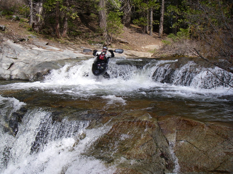
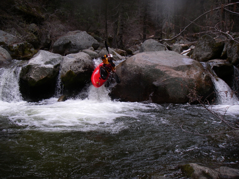
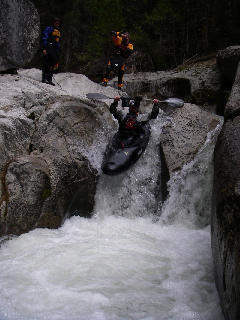
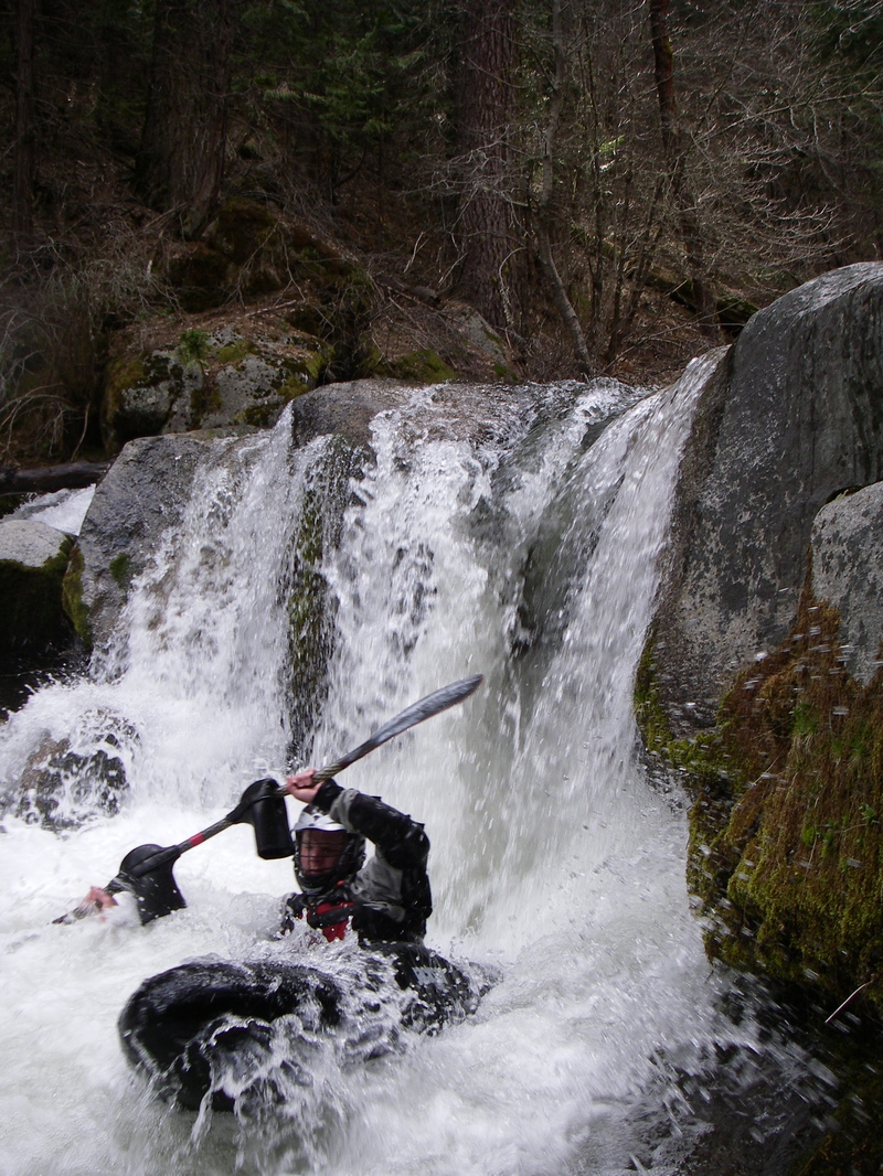
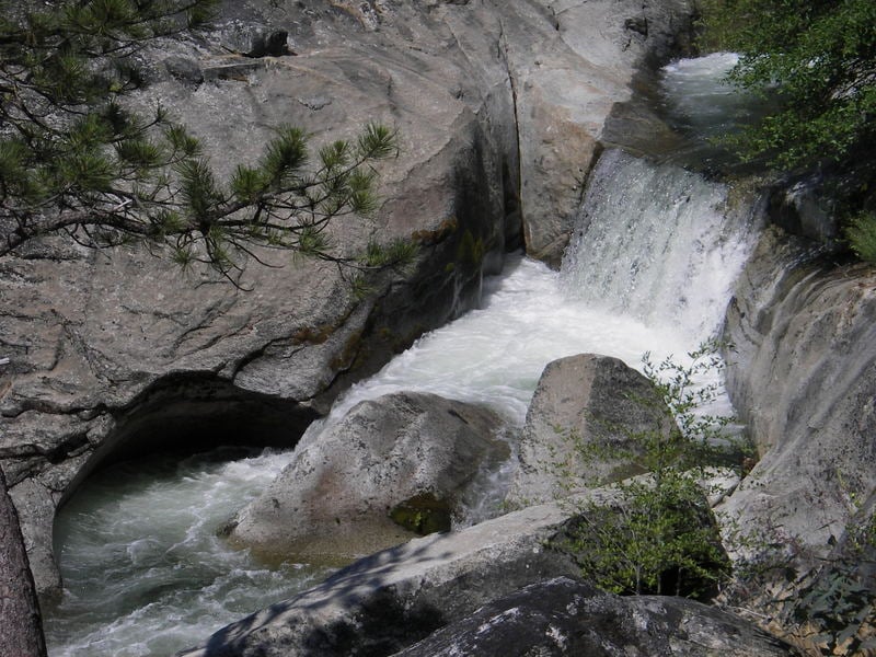
This is an interesting creek with some big, and steep bedrock sections.
Take-out: Take highway 41 to the Oakhurst area and to the Bass Lake road. Go to Bass Lake and take Beasore Rd to Chilkoot campground. There are other spots where the creek is semi-close to the road, but you will need to study a map to figure them out. Chilkoot ought to be good enough. Hike down from your car to scout the creek wherever you decide to exit, so you recognize the right place. topozone map, google map.
Put-in: Drive about a mile past Chilkoot and turn left onto a gravel road going 3 miles to Grey Mt Campground. Put in at the bridge crossing the creek. topozone map, google map.
The flow will seem pitiful at the start, but within a few hundred yards or so, you will hit bedrock dropping away and then the flow will seem just fine.
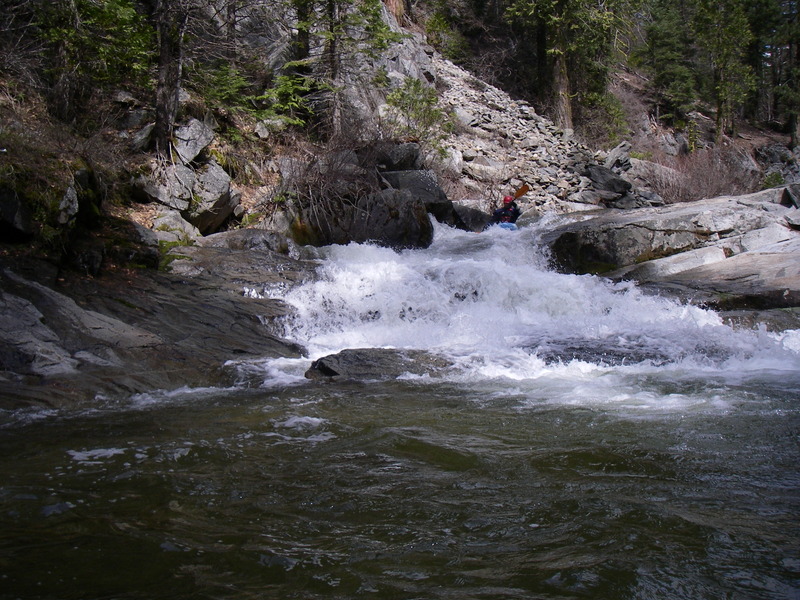
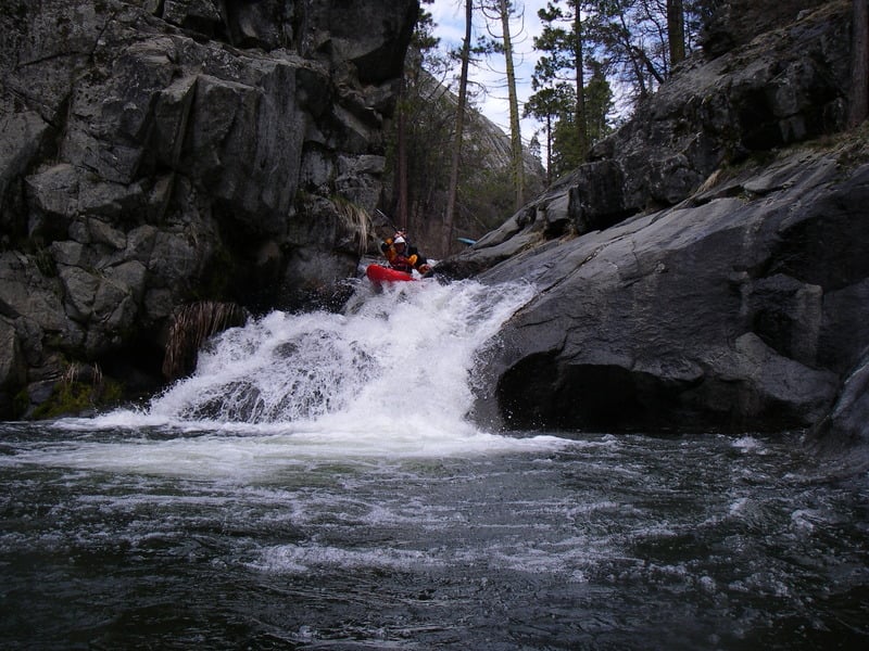
This creek has long sections of beautiful, steep bedrock slides and falls which are mostly runnable. All of the major drops have been run, but many people will portage some of them. Portages around big drops tend to be across steep dirty slopes on small trails.
Alternating with the nice bedrock sections are fairly long sections of steep, technical slalom boating. Much of these technical sections are still boat scoutable, but there will be many places throughout the run where one person will need to scout from rocks or shore and decide for the other boaters as to route or whether to portage.
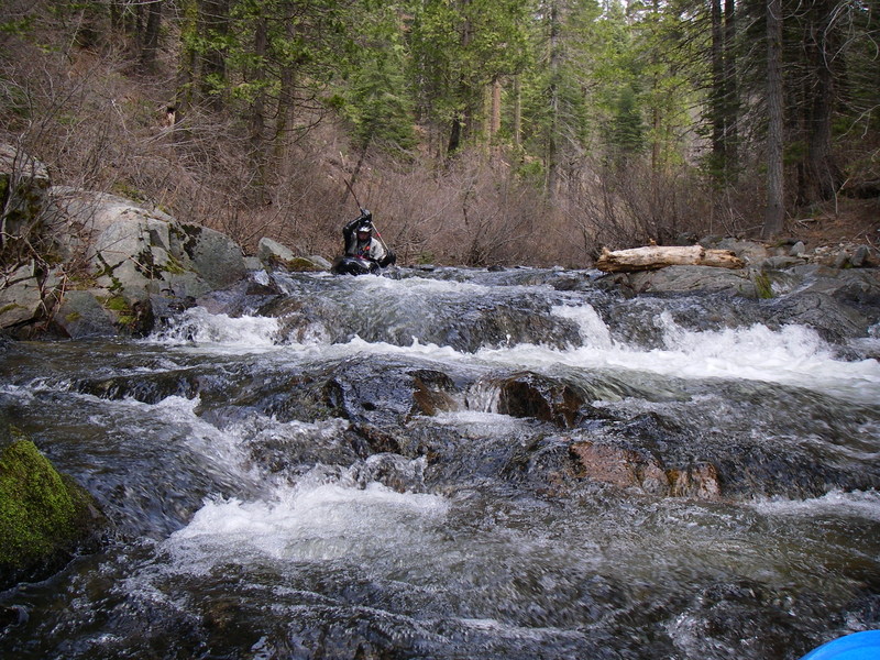
In the middle of the run there are also long sections of junk; as in irrigated rock piles. Most of the junk sections are sort of boatable and boat scoutable, but with great risk of pinning and broaching. There are a few portages around siphons, or similar, and lots of portages around logs. Logs and log jams are an issue throughout the run. Portaging tends to be fairly easy overall though, so that compensates somewhat for the number of portages.
Nathan Hunkapiller writes:
N. Willow (from Grey Mt to Chilkoot) was an interesting run but by no means a favorite of mine. I enjoyed the first mile with it's nice granite bedrock drops. The middle miles were exhaustingly crappy with many log portages and junk that is runnable but not altogether worth it when considering the fun factor vs. piton/broach factor. I was pleased that it opened up again in the end with a few more nice bedrock drops. Great take out drop!
May 2, 2005
The Lower Willow Creek section is considered to be a higher quality section with much less junk and more clean drops.
When in the vicinity, also check out Upper Big Creek and Lower Big Creek near Wawona in Yosemite.
Here is my Story on how not to run this creek, or any other.

Click To Play
http://www.myvideo.de/watch/3319299 NF Willow video:from May 2006
Other Information Sources:
Land Stewardship Council - PG&E lands proposals
Rapids in this Run (7)
Hazards & Portages (1)
Caution: The following locations may require scouting or portaging. Always check current conditions.
Difficulty
Class V
Length
3.1 mi
Gradient
300 ft/mi
Rapids
7
1 Portage
Access Points
Difficulty Classes
I Easy
II Novice
III Intermediate
IV Advanced
V Expert/Extreme
VI Unrunnable
Current Conditions
5-Day Forecast
Whitewater data from
American Whitewater
American Whitewater