1. Hee Haw Creek to Queets Trailhead
Linked via: Proximity 99% confidence Synced 6mo ago
Gauge Conditions
Runnable: ? – ? CFS
Approximate reading: This gauge is 32.8 miles away on Queets. Use as a general reference only.
Data from American Whitewater & USGS
Run Map
Description
The Queets River is one of the wildest and most remote rivers in Olympic National Park, offering a challenging and rewarding backcountry paddling experience suitable for packrafters and those seeking solitude and wilderness immersion. Originating from the Queets Glacier on Mount Olympus, the river flows through a pristine valley of towering Sitka spruce, dense moss-covered understory, and few signs of human presence. Unlike some of the other westside rivers, the Queets receives far fewer visitors due to its difficult access, river crossing to access the trail, and rugged conditions, making it a gem for experienced backcountry paddlers.
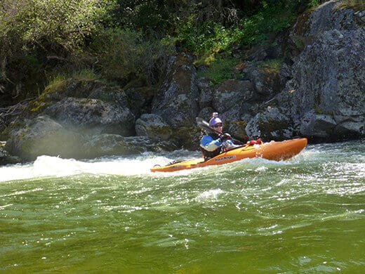
Most boaters begin their trip at the Queets River Trailhead, located at the end of a gravel forest road. The trail itself is unmaintained in places and requires fording the river at the start. The crossing can be dangerous during high flows and should not be underestimated. Once on the trail, paddlers typically hike 6–16 miles upstream to popular launch points such as Pelton Creek or Kilkelly Camp. From there, the float back to the trailhead offers about 10 to 15 miles of paddling through a broad, braided glacial valley with stunning views and abundant wildlife, including elk herds, bears, and bald eagles.
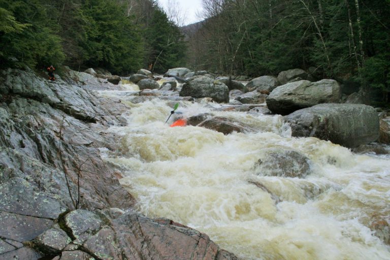
The river is glacial-fed and extremely cold, with flow levels varying significantly due to snowmelt and rainfall. The river character is mostly swift Class I to II+ water, but its braided channels, numerous logjams, and remote nature demand expert-level judgment and backcountry awareness. Many sections involve active route-finding to avoid dead-end channels and wood hazards, especially during lower flows when the river spreads wide across gravel bars.
Because of its remoteness and potential hazards, packrafting the Queets is recommended only for experienced wilderness travelers and paddlers with solid swiftwater rescue skills and cold-water gear. Drysuits are essential year-round due to the glacial temperatures. The river corridor is managed by Olympic National Park, and overnight backcountry permits are required for camping along the trail. Bear canisters are mandatory, and Leave No Trace practices are strictly enforced.
While the Queets lacks the popularity and infrastructure of some of the other westside rivers, it makes up for it in raw wilderness character. Few places in the Pacific Northwest offer such uninterrupted wild river miles, where you may go an entire trip without seeing another person. This is a true backcountry river—beautiful, unpredictable, and humbling. Be sure to check conditions, recent trip reports, and park alerts before committing to a journey on the Queets.
Access: To access the river at Highway 101 mile 137.5 take FR 21 east (this is also marked as West Boundary Road). Follow FR 21 to mile 8.2 and turn left onto FR 2180 and follow the signs where this road forks to the left at FR 2180-100 (aka Q2100). This road heads down to the Queets River corridor. Head upstream to the end of the road at the trailhead right at the Sams River confluence (road mile 13.7). The campground is located 0.2 mile downstream. Park your car at the trailhead, get your gear set, and start hiking up the river. During low summer flows you can ford the river to access the trail on river right. Alternatively you can use your boat to ferry across and then begin your hike.
Difficulty
Class I-II
Length
23.0 mi
Rapids
6
Access Points
Difficulty Classes
I Easy
II Novice
III Intermediate
IV Advanced
V Expert/Extreme
VI Unrunnable
Current Conditions
5-Day Forecast
Whitewater data from
American Whitewater
American Whitewater