1 Lake Whatcom to Yew St. Bridge
Linked via: Proximity 91% confidence Synced 6mo ago
Gauge Conditions
Runnable: ? – ? CFS
Approximate reading: This gauge is 1.9 miles away on Whatcom Creek . Use as a general reference only.
Data from American Whitewater & USGS
Run Map
Run Time Estimate
Select put-in and take-out to estimate time.
Unlock Advanced Trip Planning
See wind-adjusted speed maps, forecast planning, and detailed time estimates.
Sign in to generate an AI timing estimate for this run.
Whitewater timing varies with scouting, portages, and group pace. Use as a planning baseline.
Description
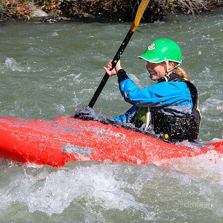
Back in the day Whatcom creek use to be a great little creek run, inside a beautiful park, within city limits. Depending on where one put in and took out, the run could be a mellow float for a newbie to hone skills on, or a class V creek to get a lunch time/after work fix on. All without having to leave town. All would soon change.
On June 10, 1999, an Olympic Pipe Line Company gas line that crossed the creek blew up killing three people and incinerating half of Whatcom Falls Park. In an effort to rehabilitate the creek, burned out hazard trees were dropped into the creek and chained into place to provide for fish habitat. In addition, the second half of the creek (where the big drops are) has been closed off to public access for an uknown period of time.
It is the hope of local paddlers that when the area is reopened, kayakers will be recognized as a legitimate form of recreation in the park. It is our hope that fish advocates and recreational users can educate each other and find common ground on Whatcom Creek. With slight alterations to the man-made structures in the creek, the run could be made safe and navigable again.
On to the Creek!
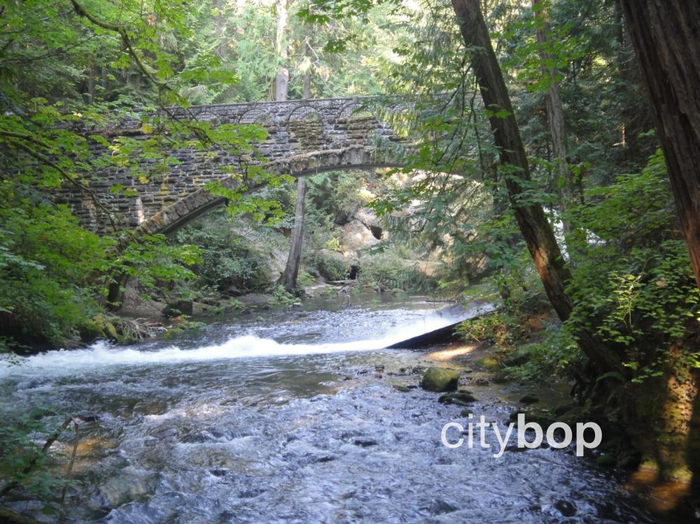
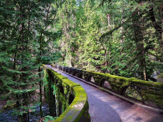
The best way to decide where you want to put in and take out is to walk the foot paths along the north side of the creek. Most of the upper run can be seen this way. There is a stick gauge on the Pipeline Bridge just upstream of the Whirlpool Falls(Houdini).
1.2ft to 1.8ft- Desperate Minimum. 1.8ft to 2.0ft- Low Runnable. 2.0ft to 2.8ft- Medium Runnable 2.8ft to 4.0ft- High Runnable. Above 4ft on the gauge some sections of the creek are still runnable, but others become much more dangerous. There is no upper limit for this creek, I have run from the Main Falls to Houdini at ~6ft on the pipeline gauge during November 2021 floods.
From the uppermost put in at Bloedel Donovan Park, paddle under the bridge past the booms until you reach the dam, portage on the left side and be respectful of houses nearby. A brief section of flatwater takes you to the Rusty Bridge, the highest put in within Whatcom Falls Park. There is a small surf wave here on river right depending on the flows. Downstream of this put in the creek flows through the site of the old railroad bridge, which has been removed and the city did a great job of clearing the passage. The old bridge used to collect wood and present a hazard to boaters. Below the old bridge site is the slalom course that fizzles out into the slackwater at the Beaver Pond. This section is class I-II
The dam below the Beaver Pond has been run but it is not advised and a quick glace will tell you why. Portage the dam and probably the falls too unless you're feeling it. The Upper Falls lies just downstream of the dam and has three lines depending on flows and your skills. The left line is always a twisty mess, with plenty of pin potential, the middle line only goes at higher flows and requires a precise boof off of a shallow lip to clear the main boil above the bottom. River right seems to be the easiest, but shallow boulders in the landing keep the consequences high. Hug the concrete wall and bounce down the shallow flake, but keep your bow up.
Below the Upper Falls is where the best 'bang for your buck' put-in sits and offers a nice splashy pool to play in below the Upper Falls. The class II rapid below the pool can be bumpy or quick depending on flows. Around the next corner comes Prison Love, a small 3 foot ledge that as of early 2025 has a large tree that fell in just above it, complicating the line. At lower flows this is an excellent place to learn, practice and perfect your boof but at higher flows this drop turns into a feature that closely resembles a lowhead dam and there is a cave behind the curtain on the river right side. The entire ledge can be run depending on flows, as things get higher river left tends to be more friendly. There is a small surf wave below the pool at Prison Love that is best at medium to low flows.
Make sure you take out before Whatcom Falls, this is a beautiful 25 foot drop that unfortunately plunges directly onto huge rocks. Portage river right and put in below the falls, there is a good seal launch from a mossy rock below the chaos but beware of a sneaky rock in the landing at lower flows. Below the Stone Bridge the creek rips around a few quick bends, there is almost always wood here so scout from the trails if you are unsure. There is a fun lateral wave/hole coming off the right wall in this section just upstream of the Fishing Corner. If there are people fishing here be respectful and continue moving downstream. Just downstream of the corner there is a big glassy wave that forms at higher water and a few more smaller waves and two fun splat rocks. This section finishes off at the Squirrel Hole, here the creek funnels down to just 10 feet wide and into a deep green pool, there is a fun boof over the right ledge at higher flows. This section is class II-III.
Scout the section below Squirrel Hole as wood tends to be everchanging on the Pipeline Bridge, even day to day with no real change in flow. Below the green bridge is a fun rapid that can have a great surf wave at most flows. There is another surf wave just downstream with easier access, but the creek flushes quickly into Double Boof. Double Boof is a fun rapid but it is important to clear the first riverwide ledge, usually easiest on river right but also possible on river left. There is a slot that runs across the width of the creek here and it would not be a fun place to end up out of your boat. The boil is only a few feet downstream so it should be easy to clear but it does get stickier at lower flows. A fun wave train below the ledge slams you around the corner into the Pipeline Bridge, which almost always has wood blocking one or more of the channels. The far right channel seems to be clear most often, but watch out for rebar on the right wall. There is a stick gauge on the downstream side of the bridge pillar on river right. A quick set of small waves takes you right to the lip of Houdini, take out and portage river right at the lip unless you plan to run it. The section from Squirrel Hole to here is class III-IV.
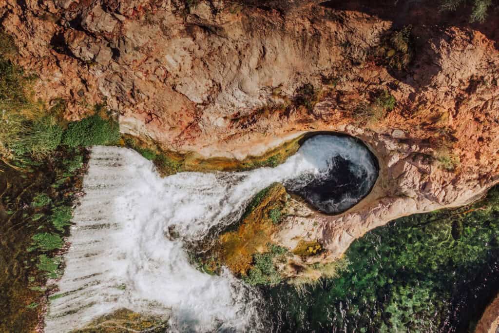
Houdini is a roughly 10 foot waterfall into a mean pool below, a swim at low summer flows will reveal why. Caves, undercut walls, siphoning potholes, it's a nasty spot to end up out of your boat at any running flows. This drop has been more and more frequently run by locals over the years and does seem to have a solid success rate. Set up in the pool above and drive for the opening below the wall on the left avoiding the pocket next to the wall. If you choose to portage Houdini you can either toss your boat on your shoulder and go for another lap or continue on downstream, but the whitewater and access get increasingly more difficult.
Below Houdini is Hole in the Wall. This rapid starts off with punching a hole just below the pool at Houdini, there is a log dividing the hole in two sides, right is usually easier. From here the river divides into a slalom of channels between boulders, the general line is to make your way river right until you are up along the left wall and then opt for the middle slot (majority of the flow) into the pool below the exit drop. The left side of the boulder slalom has some very sieved out boulders and often collects wood. The final drop is a 4 foot pourover with a sticky pin spot on river left and an undercut ledge on river right, shoot down the middle and try not to give yourself a headache from smiling too hard.
Downstream of Hole in the Wall is the last easy(ish) access section of the creek, The Alley. The Alley starts off with a twisting meander around a couple of logjams and headwalls. As soon as the creek slams up against the left wall the real fun begins. This is a fun class III racetrack of fun waves and easy to boof holes. Unfortunately it is over before you know it and the must catch eddy river right appears all too quick. There can be annoying shallow boulders entering this eddy at lower flows so keep your eyes ahead of you as you approach. The walk back up to the upstream sections is long but worth doing at least once.
From the pool below The Alley, the river bends hard left and into the entrance to Man Eater. The drop you can see from the pool looks inviting, and only rates class IV at most flows but does have an undercut ledge at the bottom left where a lot of the flow slams into, then horrendously sieved out boulders river right below the pool. Don't be tempted to run this sequence unless you're up for an adventure portaging Man Eater just downstream. The main drop of Man Eater has two parts, the first where the creek splits and the right side goes into a nasty pothole filled crack, and the left side there the creek tumbles over a manky sloping ledge that sets you up poorly for the second half. The second drop has a terrible and awful cave on the river left side at the top, adding to the consequences of missing the first move. The entire creek(minus the water that goes through the cave) pours over an 8 foot sloping ledge into a narrow forthy pool below. The boulders on the downstream and river left side of the landing are extremely sieved out and frequently have wood in them. At low summer flows the entire creek flows underneath the second half of man eater and the boulders below.
The section below Man Eater is rarely paddled but does have some redeeming features. This area was the part of the creek that was torched during the pipeline explosion and is still under rehabilitation efforts. This section starts where the clearcut path is that spans over the creek drainage. There are a few class II rapids below the clearcut and then a riverwide chained in logjam that can be passed on the right if you are brave but is usually a portage on the left.The creek then snakes around a bend and into S-Turn, a fun ledgy drop that is over all too quick. There is one quick logjam on river left that can be passed on the right and then you approach the horizon line at Pixie Falls.
Pixie Falls can be a fun park and huck spot or another feature to add to a full creek run. It can also be a takeout spot if you don't want to deal with the woody mess down to Woburn. Thewood situations have changed a lot over the years, currently as of late 2025 there is a logjam at the lip of the falls that covers the right half of the drop. The current line is just left of the logjam avoiding the left pocket. There seems to be a large logjam just downstream of the falls that is backing up more and more water, this drop has been about 15 feet tall in the past but the pool has risen to where it is maybe 10 feet tall now. The logjam presents a significant hazard to swimmers who are swept downstream. The falls can be lapped with some effort via the ghetto trail up river right, roping boats up might be easier than carrying.
Below Pixie the logjam is portaged river left and is a nasty thing. A few class II rapids later and you are seeing traffic moving down Woburn Street as you begin to bash your way through the overhanging branches down to the next feature. The next and last feature on the creek is the Woburn Hole, a steep man made feature that can create a mean hole at most flows but is punchable if you set up with a good left to right angle and have some speed. Takeout below Valencia Street along the railing for the trail.
I find the sweet spot for most of the run to be around 2.8ft where almost everything is runnable, though some sections are best at certain flows. Man Eater is best run around 1.2-1.5ft which is unfortunately really low for most of the rest of the creek.
Rapids in this Run (2)

Waterfalls (3)
Hazards & Portages (3)
Caution: The following locations may require scouting or portaging. Always check current conditions.
Difficulty
Class III-IV+(V+)
Length
1.4 mi
Gradient
100 ft/mi
Rapids
2
3 Hazards
Access Points
Difficulty Classes
I Easy
II Novice
III Intermediate
IV Advanced
V Expert/Extreme
VI Unrunnable
Current Conditions
5-Day Forecast
Whitewater data from
American Whitewater
American Whitewater