1. Lampsons Falls to Downerville
Linked via: Nhdplus discovery 90% confidence Synced 6mo ago
Gauge Conditions
Runnable: 600.0 – 3,000.0 CFS
The USGS gauge on the Oswegatchie in Harrisville provides an "approximation". The benchmarks below have many variables, so make sure you assess each drop yours
Data from American Whitewater & USGS
Run Map
Description
Directions:
Put In: Heading north out of Degrasse on Clare Rd. for 4-5 miles to the yellow/brown sign on the left for the trail to Lampson's Falls. It's probably about a half-mile easy walk to the water from there.
Take Out: On Route 24 just north of the town of Russell boaters will see a NY state sign for Downerville, a no-longer existent town at the confluence of the N. branch of the Grasse with the Main branch. Coming from Russell, turn right (SE) onto dirt/gravel Donnerville road, after old cemetary on left, take next right. Follow along beaver pond then downhill to confluence. About a mile and a half from main road to take-out.
Description:
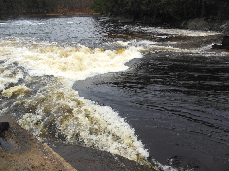
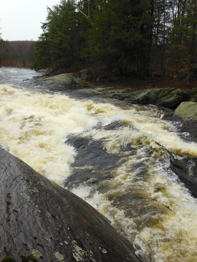
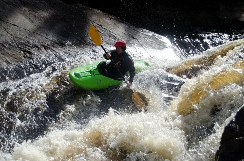
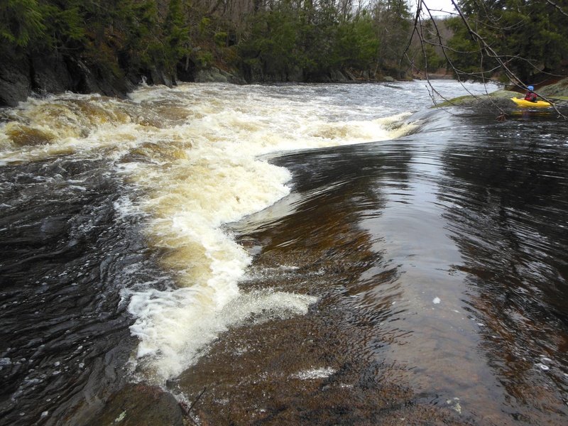
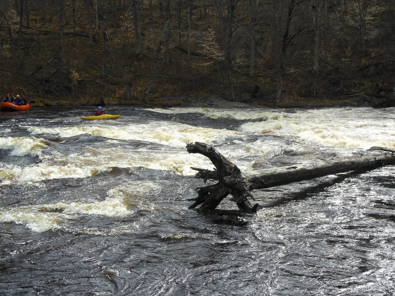
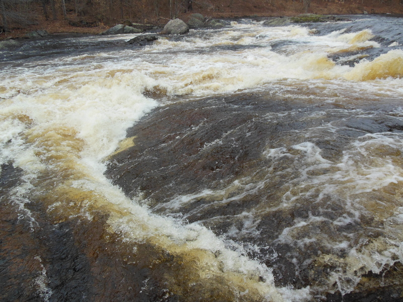
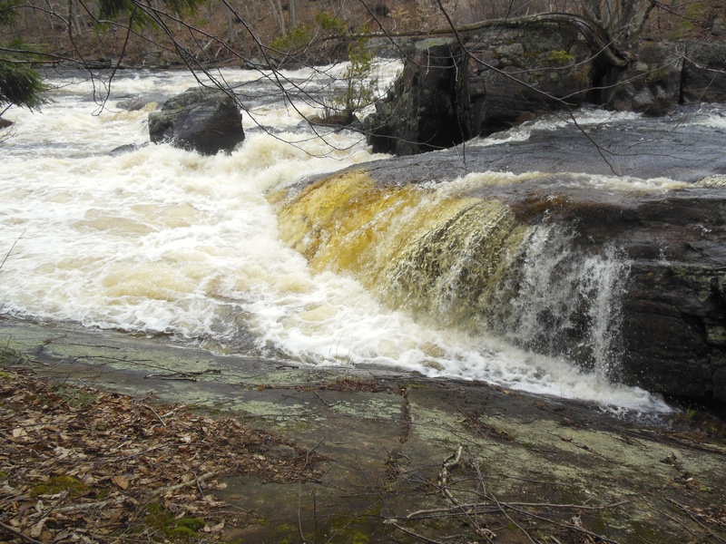
The trail comes out right at Lampson's Falls, which is Fowlersville-sized but has a bunch of flakes sticking up that don't look friendly at all; judge for yourself, I had no issues continuing down the trail to the bottom. From the pool below you have some flatwater to warm up on before dropping into a nice pool-drop rhythm. Most of the drops are worth scouting just to see the assortment of possible lines that most offer up. At low water this seemed like a nice creeking progression from Taylorville on the Beaver, with a few drops which were definite steps up. Nothing is mandatory and everything was pretty easy to scout/portage. The last mile stretch the river starts to widen and become more small rapids. When you come to the Confluence of the North Branch on river right, there will be a small path through the woods which will take you back to the parking lot. This section can be connected and run all the way down to Russell.
Canton - Cranberry Lake Area Reaches
Boland Creek Elm Creek
Grass (1. Lampsons Falls to Downerville) Grass (2. Downerville to Russell)
Grass (3. Morley to Massena)Grass (4.Woods Bridge Road to Route 47)
Grass, Middle BranchGrass, North Branch
Grass, Upper South BranchGrass, Lower South Branch (Twin Falls)
Oswegatchie, E. Branch (2.)Oswegatchie, E. Branch (3.)
Oswegatchie, W. BranchPlumb Brook
Potsdam - Malone Area Reaches
Chateaugay Deer (Dickinson Center)
Deer (Dickinson Center to Lawrenceville) Grass (1. Lampsons Falls to Downerville)
Grass (Sec. 3) Grass (Sec. 4)
JordanLittle Trout
Marble Meacham Lake Outlet
Raquette Sec. 3) Hannawa FallsRaquette 2) Piercefield to Parmenter Site
Raquette Sec. 4) Stone Valley Salmon
Salmon (Chasm Falls) St. Regis
St. Regis, E. Branch St. Regis, Middle Branch (Sec. 1)
St. Regis, Middle Branch (Sec. 2) St. Regis, Middle Branch (Sec. 3)
St. Regis, Middle Branch (Sec. 4.) St. Regis, W. Branch (Sec. 1)
St. Regis, W. Branch (Sec. 2) St. Regis, W. Branch (Sec. 3)
Trout Brook
Google Map of New York Whitewater
New York Whitewater Paddlers Facebook Group
Difficulty
Class IV+
Length
4.1 mi
Gradient
30 ft/mi
max 60
Rapids
9
Access Points
Shuttle Info
**Put In:** Heading north out of Degrasse on Clare Rd. for 4-5 miles to the yellow/brown sign on the left for the trail to Lampson's Falls. It's probably about a half-mile easy walk to the water from there.
**Take Out:** On Route 24 just north of the town of Russell boaters will see a NY state sign for Downerville, a no-longer existent town at the confluence of the N. branch of the Grasse with the Main branch. Coming from Russell, turn right (SE) onto dirt/gravel Donnerville road, this is just before a Transportation facility center, Continue on Donnerville road until you see an old cemetary on left, take the next right. Follow along the beaver pond, staying right at the fork then downhill to confluence. It is about a mile and a half from main road to take-out.
The road is shown on the map is in the wrong spot and is actually above the confluence of the north and main branches not below.
Difficulty Classes
I Easy
II Novice
III Intermediate
IV Advanced
V Expert/Extreme
VI Unrunnable
Current Conditions
5-Day Forecast
Whitewater data from
American Whitewater
American Whitewater