1. Rock Hill to Oakland Valley
Linked via: Proximity 95% confidence Synced 6mo ago
Gauge Conditions
Runnable: 640.0 – 5,000.0 CFS
The max limit is a rough guess. If you have good beta on runnable levels, please add a comment.
Data from American Whitewater & USGS
Run Map
Description
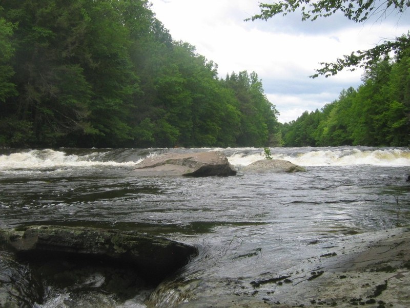
This 11.3 mile section of the Neversink is mostly class 1 to 2, but has about 1.5 miles of exciting class 3 to 4 rapids about halfway through. There is a mostly unobtrusive quarry operation along the right for the first 1.5 miles, but the gorge is very remote and isolated from there until the first houses appear on river right about 1/2 mile before the takeout in Oakland Valley
Lat/longitude coords are very close, from TopoZone and Google Maps. Thanks to Adam, from the Northeast Paddlers' Message Board for most of this information:
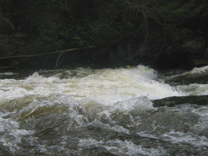
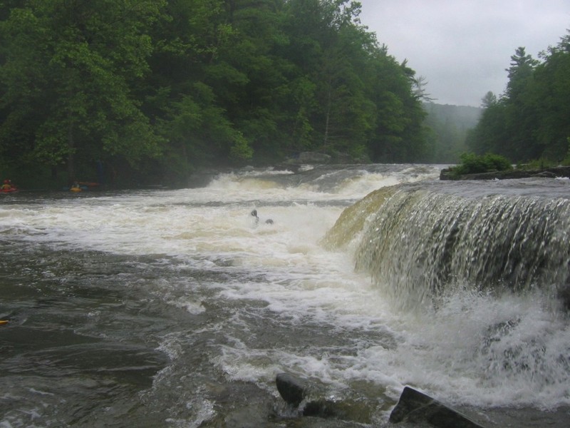
There are two major drops on the Neversink. Denton Falls is a slide run straight down the middle with no holes at the bottom. High Falls is small vertical drop of 5 feet, easily run far river right, or by taking the boof left of the rocky island. After High Falls is about 4 miles of flat to class 2 rapids. In between Denton and High Falls is the Gorge section, which is class 3-4 depending on levels. Over 7.5, I would say it is a 4. Lots of holes, waves and sticky spots. At bottom of the gorge, there are some waves to surf at 6 - 7 feet, above that they become pretty sticky. The river is not a great play river, with only a handful of waves on the 6-8 miles. However, it is beautiful and absolutely desolate. Have seen bald eagles every time I've been down. (Note- at 750 don't recall much play, but at 1200 there was a fair amount. Nothing amazing, but enough waves, pour overs and squirt spots to keep the easier section interesting. Still, bring your longest boat).
The put-in is just outside the gates to Holiday Mtn. Ski area off of Bridgeville Rd (public fishing access). The usual take-out is at the Oakland Valley bridge on county route 49. Alternate take outs further downstream include a small pullout about 1.5 miles south on route 49 or at the D&H Canal museum, just off of route 209 in Huguenot NY.
Here's a Google map showing the river, along with the main rapids, put in and takeout locations, and the shuttle route: http://tinyurl.com/neversink-gorge
Since this is a remote gorge (at least by east coast standards) and the hardest sections are the most remote carrying the New York new jersey trail conference neversink gorge trail map (which is at https://www.nynjtc.org/sites/default/files/NYNJTC\_NeversinkGorgeMap-2017.pdf ) would be a good idea.
Google Map of New York Whitewater
New York Whitewater Paddlers Facebook Group
Rapids in this Run (3)
Difficulty
Class II-IV
Length
11.4 mi
Rapids
3
Access Points
Difficulty Classes
I Easy
II Novice
III Intermediate
IV Advanced
V Expert/Extreme
VI Unrunnable
Current Conditions
5-Day Forecast
Whitewater data from
American Whitewater
American Whitewater