How's Your
River
×
Explore
Explore Map
Water Bodies
Gauges
Access Sites
Tidal Stations
Whitewater
Pricing
Login
Sign Up
Whitewater
Maine
Sandy - 1) Smalls Falls
Whitewater Run
ME
Class V
1) Smalls Falls
Sandy
Linked via:
Nhdplus discovery
90% confidence
Synced 3mo ago
Pin Location
Monitor
Water Body
Map
Gauge
Weather
Put-in
Gauge Conditions
Sandy River near Madrid, Maine
Downstream
Primary
Runnable: 140.0 – 600.0 CFS
Data from
American Whitewater
&
USGS
Run Map
Radar
Counties
Cell
Verizon
AT&T
T-Mobile
Dark
Satellite
Terrain
Description
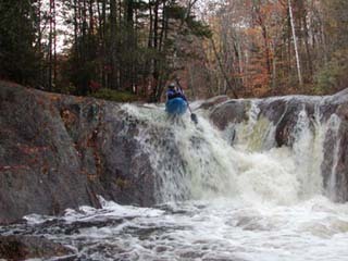
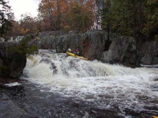
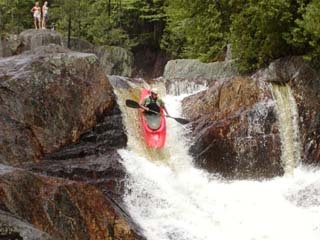
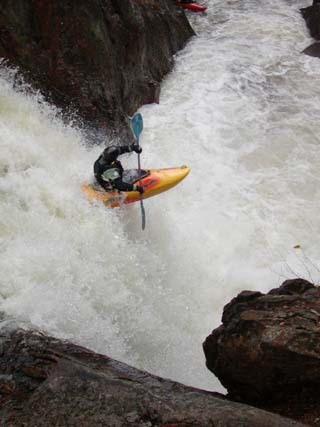
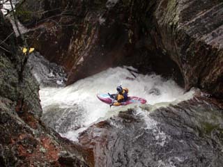
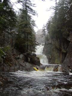
Smalls Falls is Maine's best park and huck. The headwaters of the Sandy River fall 65 feet in a tenth of a mile. The 6 waterfalls vary in size from 5 to 20 feet.
Waterfalls (6)
Waterfall
Top Drop
0.0 mi
Waterfall
Slideways (2nd drop)
0.0 mi
Waterfall
Down & Out (3rd drop)
0.0 mi
Waterfall
Biggie Smalls (4th drop)
0.0 mi
Waterfall
5th drop
0.1 mi
Waterfall
Last Drop
0.1 mi
Difficulty
Class V
Length
0.1 mi
Gradient
650 ft/mi
Rapids
0
Access Points
Put-in
44.8590, -70.5176
Take-out
44.8586, -70.5165
Difficulty Classes
I Easy
II Novice
III Intermediate
IV Advanced
V Expert/Extreme
VI Unrunnable
Current Conditions
5-Day Forecast
Whitewater data from
American Whitewater
1) Smalls Falls