1. White Haven to Rockport
Linked via: Proximity 98% confidence Synced 6mo ago
Gauge Conditions
Runnable: ? – ? CFS
Approximate reading: This gauge is 9.2 miles away on Lehigh. Use as a general reference only.
Data from American Whitewater & USGS
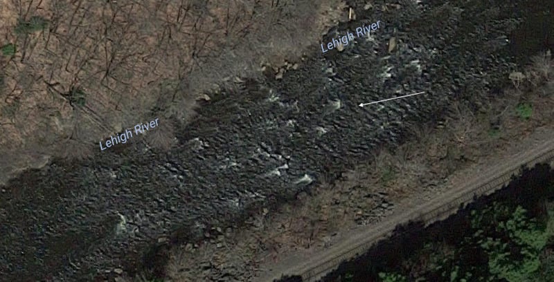
Run Map
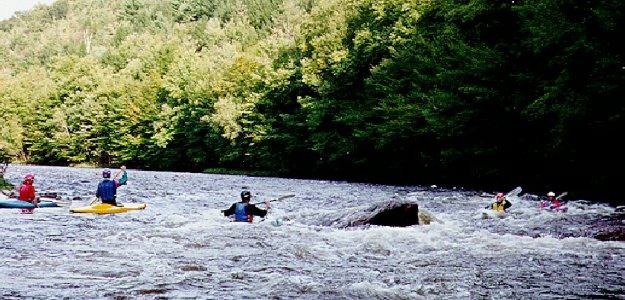
Description
Access Change! Having just built new access circles and toilets, accessed by the road starting at the far end of the White Haven shopping center parking lot, the Pennsylvania DCNR has had to change the access to the White Haven put-in again. The Pennsylvania DOT is replacing the I-80 bridges across the Lehigh river, so that the White Haven DCNR access has been moved to the Downstream side of I-80. From the I-80 White Haven interchange, turn right on PA 940 going away from the Town of White Haven and immediately look for the DCNR White Haven Lehigh Gorge sign on the left. Turn left and follow this road down to the river for the Put-in. Cars can be parked in a parking lot a little way up the hill.
River Description
-----------------
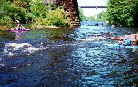
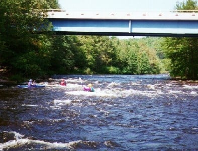
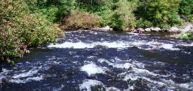
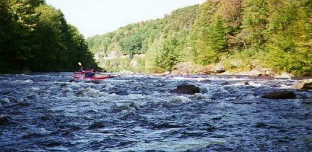
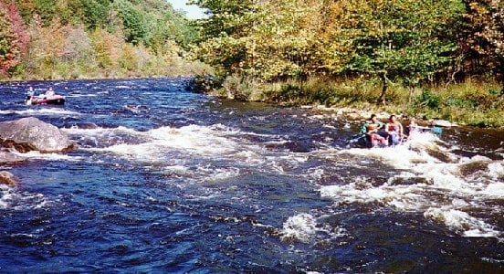
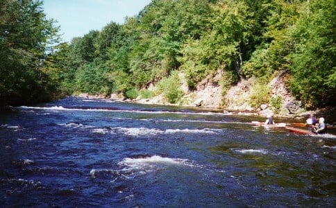
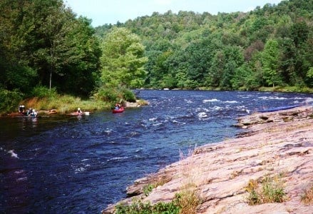
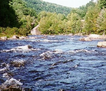
The Lehigh River has 2 whitewater sections classed as an II- III depending on levels (easier than Mongaup and the Lower Yough, but much harder than the Delaware), with guided raft trips, raft rentals, or great trips for private boaters. The river can get crowded during weekends (particularly release weekends) with raft trips and clubs.
Section I (the Upper) is a 9 mile run from White Haven (at Rt 80) to Rockport.
Section II (the Lower) is a 13 mile section from Rockport to Glen Onoko (or you can use the Jim Thorpe take out which adds about 2 miles of mostly flatwater and Class II).
Section III is a summer Class II 'family float' trip running from Jim Thorpe to Bowmanstown. Not as pristine and scenic as the first two sections, but nice on those hot summer days.
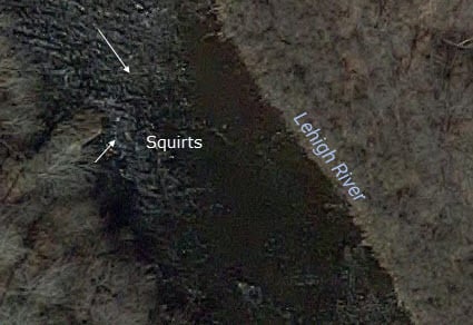
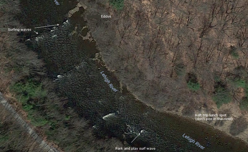
The Upper has more play spots (including enders at Wilhoyts and Beaver Hole, squirts at Lunch Rock and Eddy Turn Rock, and great surfing waves at Ledges) than the Lower, but is not as pretty as the gorge area of the Lower. The biggest rapids in the Lower (Little Swimmers, Oxbow, Tower) are longer and bouncier than anything on the Upper. But then the Lower has more flatwater stretches, and can have a pretty stiff headwind near Bear Creek.
A bike trail follows the river along an old railroad bed from Glen Onoko to White Haven as part of the state park, with bike rentals available locally. The river is administered by the PA Dept of Conservation and Natural Resources. There is a steep trail starting at the parking area at Glen Onoko that goes up to the top of a multi level water fall. The park administers access to the river as well as the bike trail. The eastern shore of the upper section borders Hickory Run state park, with some hiking trails down to the river. The whole White Haven to Thorpe area has a long history of coal mining and tourism. Water levels are dependent on the releases from the Francis Walters dam, operated by the Army Corps of Engineers; planned weekend releases are usually announced by Friday. There is usually enough water for regular releases in the spring, thru the end of May. The Army Corps also tries to release the second and fourth weekend in June, the third weekend in September and the first and third weekends in October by cutting back the flow during the week and increasing it for the release. These releases are sometimes cancelled due to prolonged dry spells.
The upper section of the Lehigh is stocked with trout down to about Hickory Run at Eddy Turn Rock. From the Francis Walter Dam down to White Haven is also a popular fishing stretch. A non-profit association stocks the river from Jim Thorpe down to Allentown. Mud Run near the Northeast Turnpike Extension overpass is fly fishing only. This area is one of the best for fishing in Carbon County. No boating is allowed on the Lehigh's upper section from White Haven to Rockport during the first weekend of Pennsylvania's trout season (early April).
Location
--------
The Lehigh is located in northeast PA, about 2 hours from NYC and 1 1/2 from Philadelphia. White Haven (the put-in to the upper section) is about 45 miles west of the NJ border on Interstate 80.
Where to Stay
-------------
There is a large state park campground (Hickory Run) near the upper section, and a smaller private campground (Lehigh Gorge Campground) on Route 940 about a mile from the put-in of the upper section. You can also stay at the rafting outfitter campgrounds, although they tend to be noisy at night. The Pocono Mountains Vacation Bureau also has some lodging ideas.
Water Levels
------------
- 520 cfs on the Francis Walters Dam gauge is the minimum flow to get down the river without dragging your boat in some sections. Even at this level the lower can be a long, scratchy day.
- 1000 cfs is more of a fun run, with most of the nastier rocks covered (Wilhoyt's, Battleship Rock).
- 4000 has a lot of nice surfing waves and some sticky holes (Chiller and Thriller in Little Swimmers, Amy's Hole below Eye of the Needle) and water is flowing thru the trees making swims much longer and getting out more hazerdous and the Lehigh legit class III.
- 10,000 has great wave trains, and any hole will let you out eventually (well maybe not Perculator at Z).
- Don't think the Army Corps will ever let it get above 13,000 though - can't have everything.
The Francis Walters dam access road was modified to allow the dam to store water for recreational purposes, not just for flood control. The Army Corps of Engineers now fills the dam in the spring to allow whitewater releases approximately every other weekend during the summer, and to ensure a minimum flow for trout fishing. Future changes may include a multi-level discharge to allow colder water to be released during the summer to protect the trout fishery.
Related web sites: ab257's Lehigh Page Lehigh River Water Trail
An AWA trip report contains screen shots of satellite photos of each rapid with brief comments, located here.
The weekend releases are posted Wednesday and finalized Fridays at: Army Corps and reservoir levels can be found at: Francis Walter Dam
Safety
------
Even the most playful rivers can be unforgiving, so be prepared (the AWA incident report was for an unguided family group not familiar with the river using plastic department store 'toy' rafts) . The park rangers will inspect your boat to be sure that you have adequate flotation (i.e., air bags in canoes- too many wrapped Grummans in the past, or that your rafts are adequate with multiple chambers), protective flotation devices (i.e. life jackets - to be worn at all times while on the river), and won't let you on the river without them. Helmets for kayakers and strapped-in open boaters are also advised, as are throw bags, biners, and 1st aid kits, duct tape (you get the idea). Boat access (put-in and take-out) within the park boundaries is allowed only at White Haven, Rockport, and Glen Onoko. The rangers patrol the bike path (weekends, during the spring season) on river right in case you get in trouble or have to hike out. Backboards are located at intervals down the river along that roadway. Don't boat alone unless you and your next of kin are prepared to accept the vagaries of Mother Nature and your own misdeeds. Rescue people first, equipment second. Float with your feet on the surface. Watch out for rattlesnakes. Don't walk on the railroad tracks. (I sound like somebody's mother.) State park rules apply: no alcoholic beverages on the river, life jackets on at all times on the river, no swimming, no fires, no parking at the bottom, etc., etc., etc. Have fun out there...
Rapids in this Run (7)
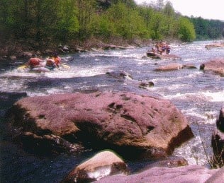
Difficulty
Class II-III
Length
9.1 mi
Gradient
30 ft/mi
Rapids
7
Access Points
Shuttle Info
The putin is on State Park property. Off Rte. 940, drive to the end of the access road, and hike your boat down to the river.
Difficulty Classes
I Easy
II Novice
III Intermediate
IV Advanced
V Expert/Extreme
VI Unrunnable
Current Conditions
5-Day Forecast
Whitewater data from
American Whitewater
American Whitewater