1319 to Hwy 44 (5.37 miles)
Linked via: Nhdplus discovery 90% confidence Synced 3mo ago
Gauge Conditions
Runnable: ? – ? CFS
Approximate reading: This gauge is 6.1 miles away on Plum Creek. Use as a general reference only.
Data from American Whitewater & USGS
Run Map
Description
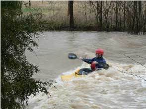
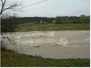
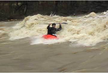
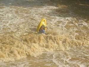
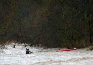
Plum Creek is the best play run for Louisville area boaters. 5 miles with over 50 playspots. Point your bow up stream and catch a wave, if you miss one another will quickly follow. Flowing along the Bullitt and Spencer county line the creek runs only a few days a year. Look for thunderstorms bringing 1.5"+ of rain to the area. Before the rain stops head to the river as the water will not last long.
As far as hazards, it's a narrow stream that is pretty much a flush from top to bottom, with very few eddies, strainers are a possibility. There are 3 bridges on the run and each of these should be approached with caution since the pilings can trap logs pretty easily. Class II-III skills are adequate if you are comfortable reading water on the fly.
Rapids in this Run (2)
Playspots (6)


Hazards & Portages (3)
Caution: The following locations may require scouting or portaging. Always check current conditions.
Difficulty
Class II(III)
Length
5.4 mi
Gradient
22 ft/mi
max 30
Rapids
2
3 Hazards
Access Points
Shuttle Info
The property owner at the put in asks that paddlers take the gravel drive down the shore line and park at the last barn on the right. Pull into the fenced area outside the barn and park along the fence. DRIVE SLOW ON THE PROPERTY. The property owner has many dogs, and kids. Plus wet ground causes ruts. **Obey her rules or don't park on her property.** On a side note: The stone house is on the National Register of Historic Places.
**To putin:** Take Taylorsville Road out of Louisville toward Taylorsville Lake. A couple miles past the Gene Snyder Freeway (265) you'll pick up Hwy 155.
Approximately 6 miles on 155, you'll see a road on the right just before you pass over the creek, Wilsonville Road Take this right approximately 50 yards to the "T", take a left at the "T" (1633) and cross the bridge. Take a right on to 1319. 1319 will make a right at the putin. (Kings Church Road) Cross the creek at the putin is on the left.
**To takeout:** re-cross the bridge and turn right (onto 1060). The road parallels the creek heading down stream which allows for car scouting along the way. Make a left on Hwy 44. The takeout is at Waterford Park just across the creek.
Difficulty Classes
I Easy
II Novice
III Intermediate
IV Advanced
V Expert/Extreme
VI Unrunnable
Current Conditions
5-Day Forecast
Whitewater data from
American Whitewater
American Whitewater