2 - Boundary Creek (Dagger Falls) to Salmon River (Cache Bar) Wild
Linked via: Unknown Synced 6mo ago
Gauge Conditions
Runnable: 700.0 – 10,000.0 CFS
May be low for a raft.
Data from American Whitewater & USGS
Run Map
Put-in
Take-out
Rapids/Hazards
Wild
Scenic
Description
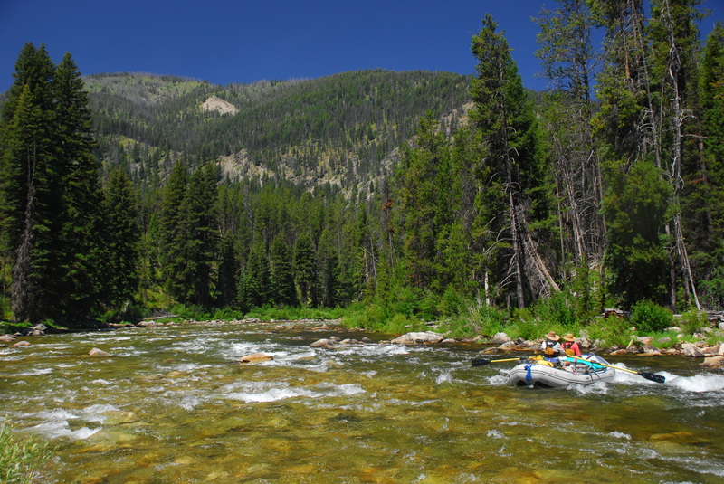
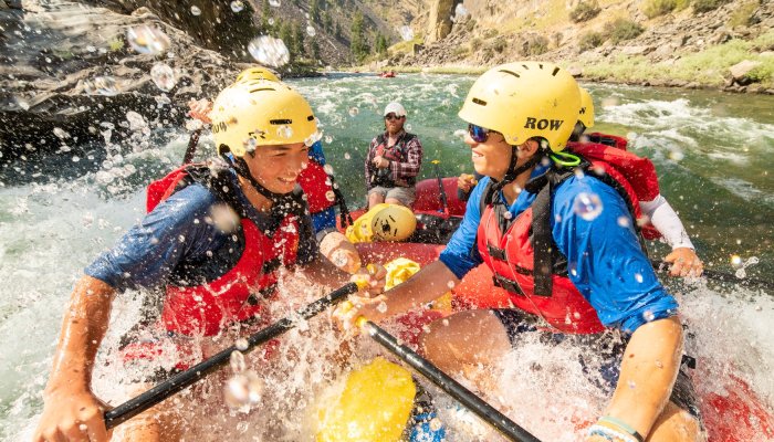
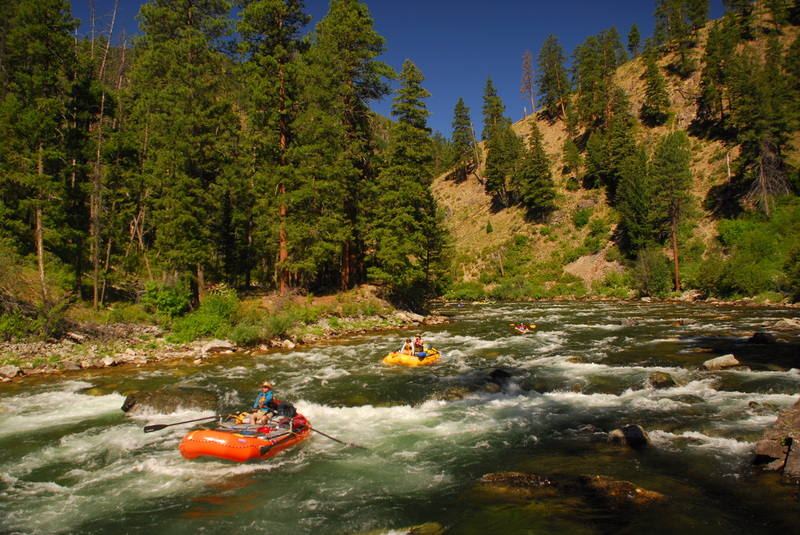
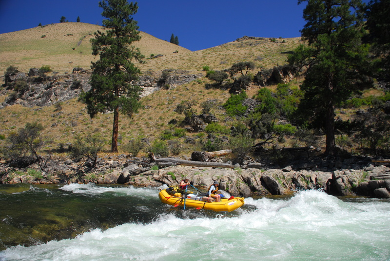
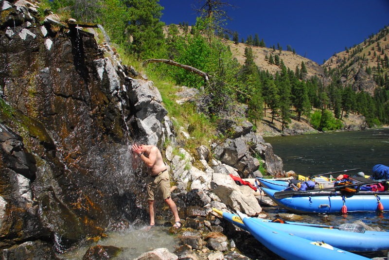
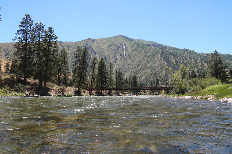
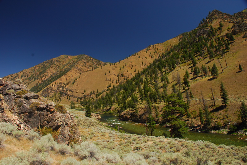
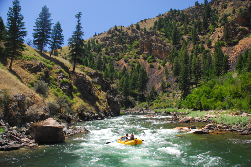
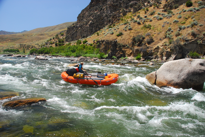
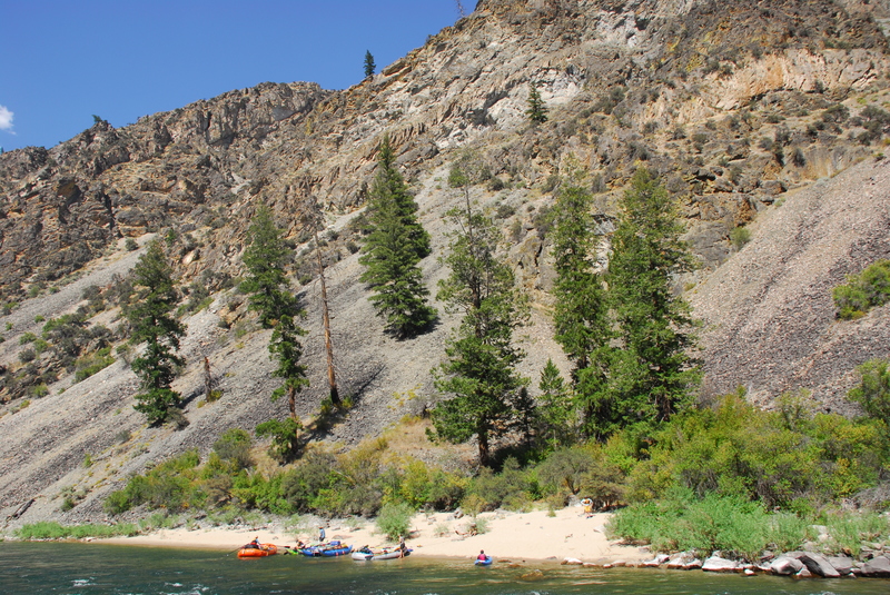
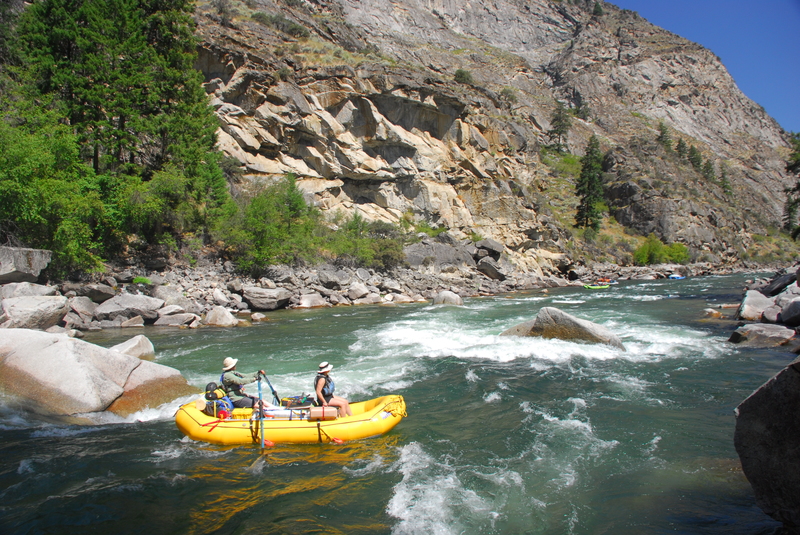
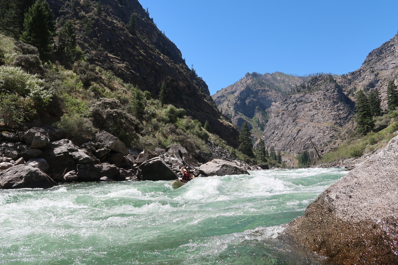
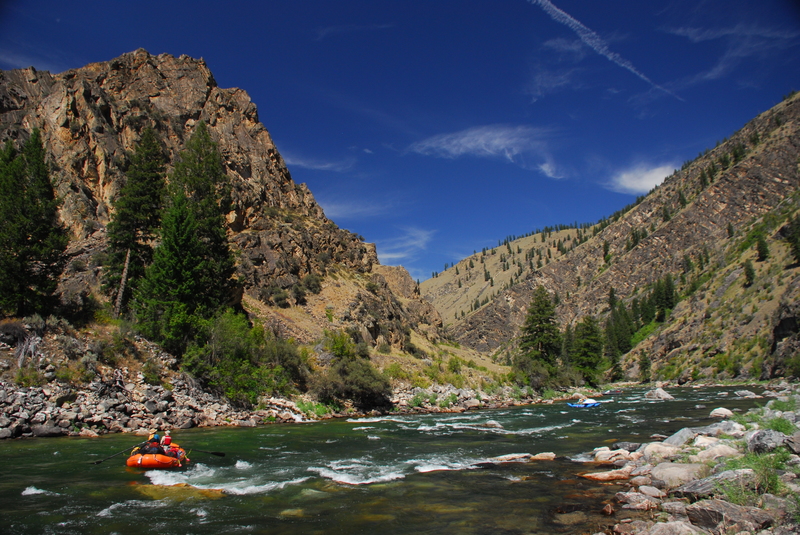
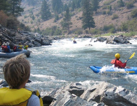
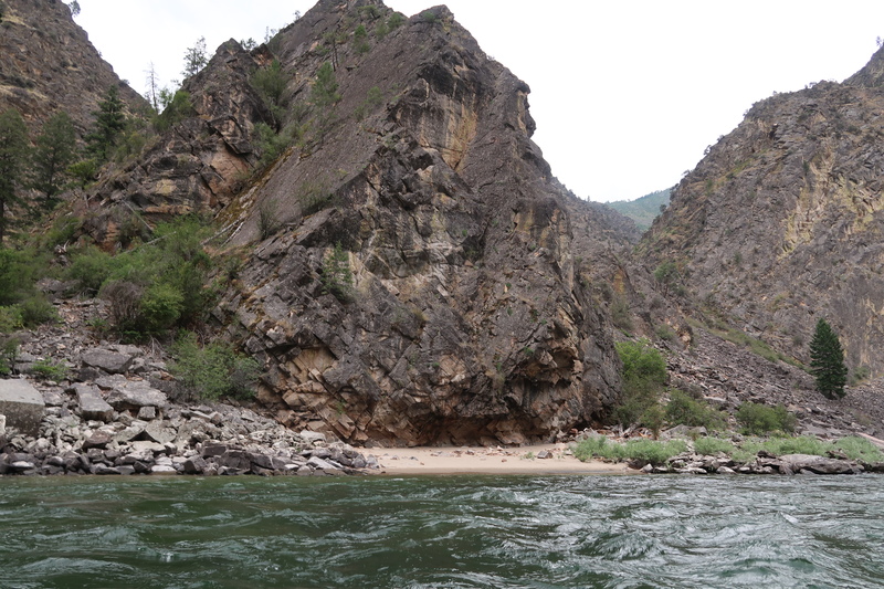
Idaho's Middle Fork of the Salmon is considered by many to be the country's premier multi-day whitewater trip. With unregulated flows, remarkable wilderness scenery, numerous hot springs, a native fishery, and great whitewater it's no wonder that anyone who secures a permit in the annual lottery has no trouble finding people who want to go. Most plan for a week-long trip on this federally designated Wild and Scenic River with full raft support, but kayakers have paddled it as a long--and intense--day trip during peak snow melt in the highest water years.
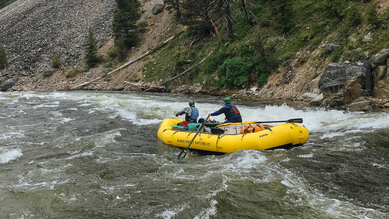
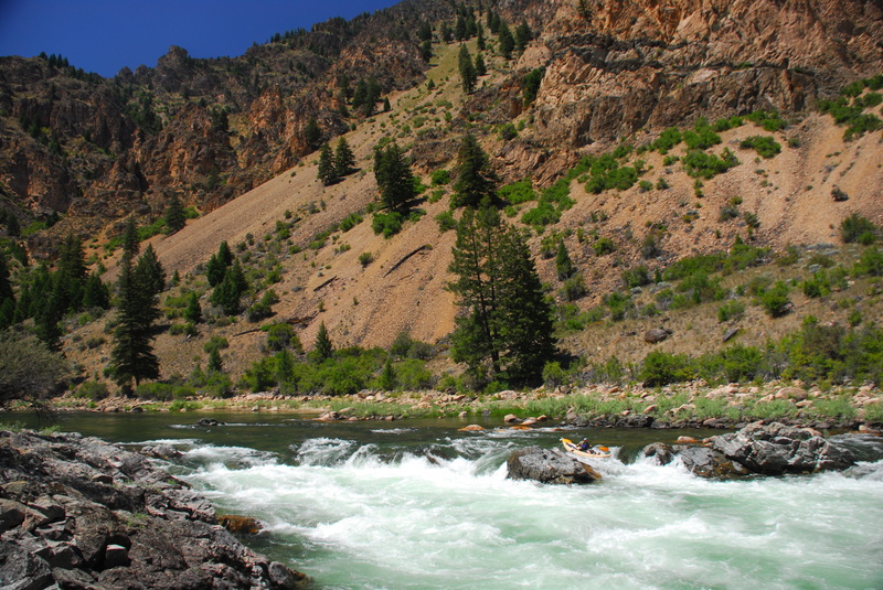
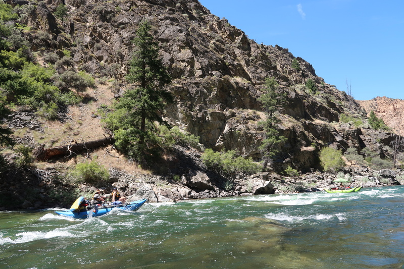
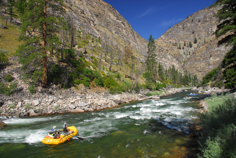
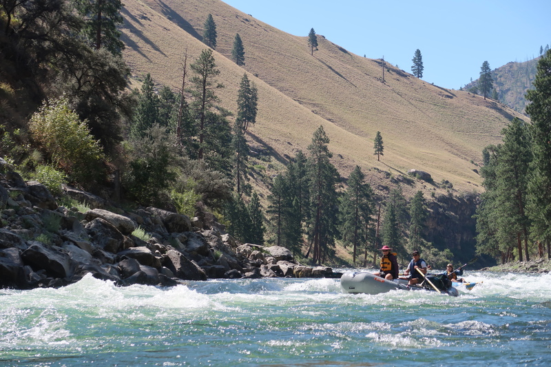
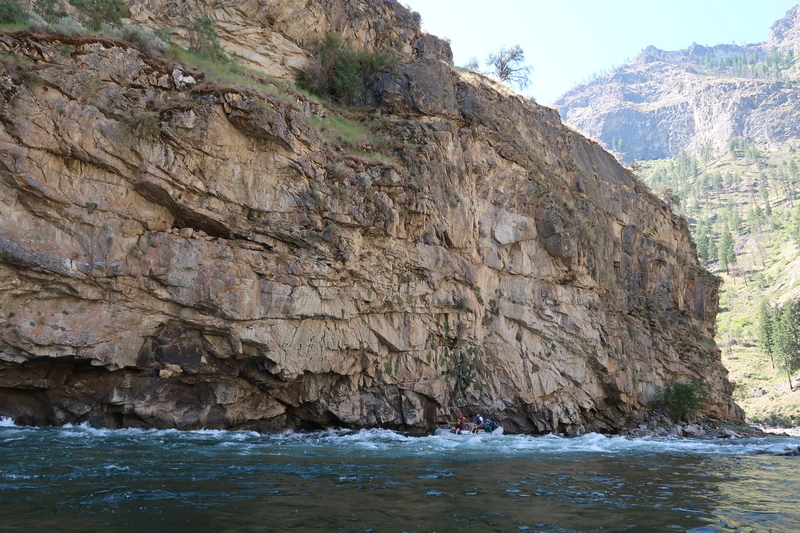
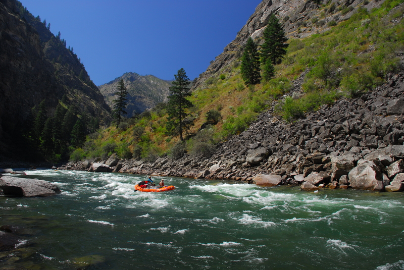
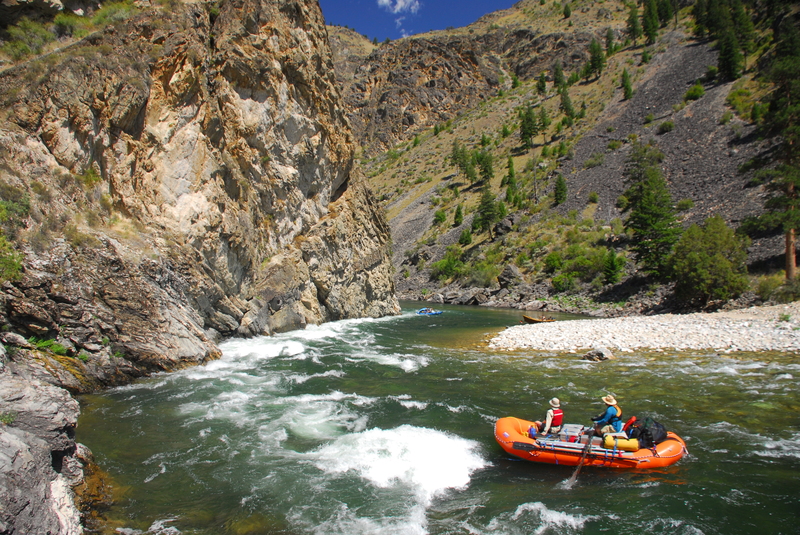
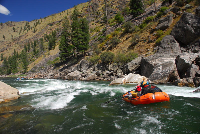
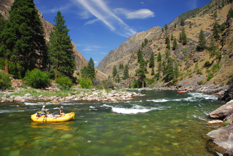
From Dagger Falls the river starts right off with some great continuous whitewater action (at 40' per mile). At moderate flows this section provides some of the best rapids of the trip, but at higher flows it can be a little too much action for inexperienced paddlers. Several groups, especially those with less experienced raft crews, have gotten into serious trouble right away when attempting this section at high water. At low flows this section can be a real pain with rafts. While kayaks can make their way through the shallow boulder gardens, those with rafts should consider flying in to the Indian Creek access downstream when flows begin to drop down to 1200 cfs. Even kayaks may want to use this alternate access at flows below 700 cfs. Velvet Falls, Powerhouse, and Pistol Creek are good rapids that come early in the trip. Once you pass Indian Creek the river eases up (23' per mile from here to the take-out), but you still have good whitewater. The Tappan Rapids and Haystack are highlights of this section. Most of the best whitewater, and some incredible surfing at higher flows, comes near the end in the Impassable Canyon--so named for the fact that there is no land route. The rapids Redside, Weber, and Rubber are all found in this stretch.
The run ends with a four-mile paddle on the Main Salmon to Cache Bar.
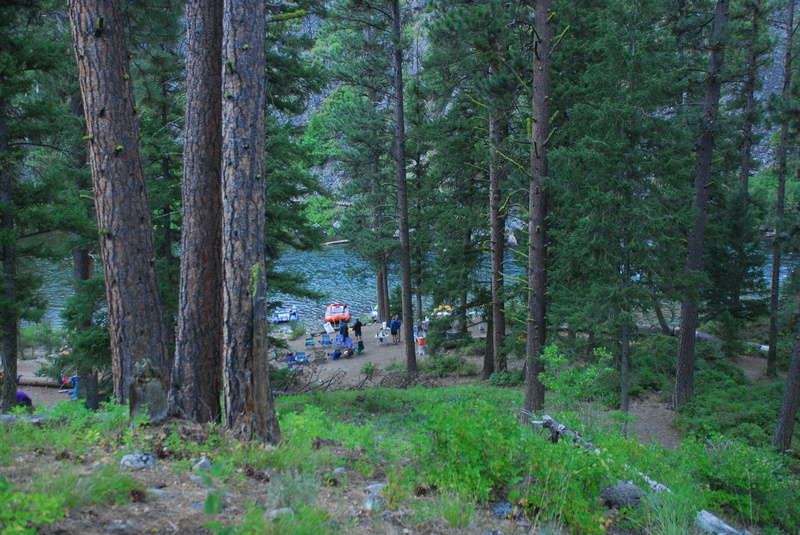
SEASON: As one of the few multi-day trips in the lower 48 with unregulated flows, it's always a challenge to plan your trip and decide what launch dates to request six months in advance. The road to the put-in is generally clear by early June. If it's not, kayakers can paddle in on Marsh Creek and rafts can fly in to a point further downstream. Weather for pre-season trips can be cold but you'll likely have your pick of hot springs as fewer people boat the river. During high snow pack years flows can be dangerously high in the early part of June--many trips have met with disaster in high water years. The greatest demand for permits is always towards the end of June. In low snow years you should still have plenty of water and in high snow years you'll be past the peak. Decent boating opportunities normally persist into July and by August the river is typically pretty low.
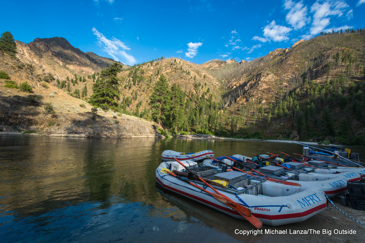
LOGISTICS: Trips start out at the Boundary Creek put-in (just downstream of Dagger Falls). From Highway 21 mile 109.4, take FR 579 (Bear Valley Road) 9.4 miles, and then bear right on FR 568 which goes another 11 miles to the launch ramp (be sure to stay left at the Y at 9.6 miles on this road). It's best to arrive the day before your launch to rig. For kayak self support trips early in the season you may have to put in on Marsh Creek. In high snow pack years the road to Boundary Creek may not be accessible until early June. Rafts use the Indian Creek airstrip as an alternate access point particularly later in the season when flows are too low for the upper section. The shuttle is 210 miles and takes a full day. Groups often hire someone locally to run the shuttle for them. The take-out is the Cache Bar boat ramp on the mainstem of the Salmon River.
More Resources
- Matt Leidecker's The Middle Fork of the Salmon River - A Comprehensie Guide is the mile by mile guide that most poeple use.
- High water (above 5 feet) considerations for the Middle Fork of the Salmon River
- Low water (below 2.2 feet) consieratons for the Middle Fork of the Salmon River
Rapids in this Run (161)
Rapid
II
First Bend Rapid
 Rapid
IV
Rapid
IV
Murph's Hole Rapid
Rapid
Teepee Hole Camp (RL)
Rapid
Cable Hole Camp (RL)
 Rapid
II
Rapid
II
Pinball Rapid
Rapid
Gardell's Hole Camp (RR)
Rapid
III
Sulphur Slide Rapid
 Rapid
III
Rapid
III
Ramshorn Rapid
Rapid
III
Hells Half Mile Rapid
Rapid
IV
Velvet Falls
Rapid
Boy Scout Camp (RR)
Rapid
Big Bend Camp (RR)
Rapid
Trail Flat Camp (RL)
Rapid
II
Avalanche Atoll Rapid (aka Upper Chutes)
Rapid
III+
The Chutes Rapid
Rapid
Elkhorn Bar Camp (RR)
Rapid
Saddle Camp (RL)
Rapid
Boot Camp (RR)
Rapid
IV
Powerhouse Rapid
Rapid
Joe Bump Camp (RL)
Rapid
Scout Camp (RL)
Rapid
Sheepeater Camp (RL)
Rapid
Lake Creek Camp (RR)
Rapid
Fire Island Camp (RL)
Rapid
John's Camp (RR)
Rapid
Greyhound Creek Camp (RR)
Rapid
Dome Hole Camp (RL)
Rapid
III
Artillery Rapids
Rapid
Rapid River Camp (RR)
Rapid
Dolly Lake Camp (RL)
Rapid
Big Snag Camp (RR)
Rapid
III
Cannon Creek Rapid
Rapid
III
Lake Creek Rapid
Rapid
Quick Stop Camp (RR)
Rapid
IV
Pistol Creek Rapid
Rapid
Pistol Creek Camp (RL)
Rapid
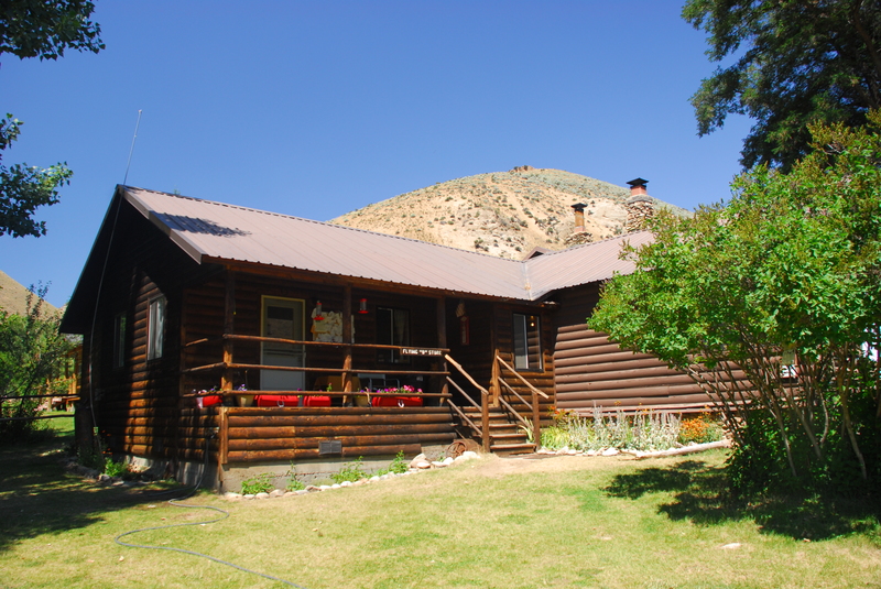
Pistol Creek Ranch (RL)
Rapid
Airplane Camp (RL)
Rapid
Indian Creek Launch and Guard Station (RL)
Rapid
Pack Bridge Camp (RL)
Rapid
Indian Creek Camp (RL)
 Rapid
Rapid
Pungo Creek Camp (RL)
 Rapid
II+
Rapid
II+
Orelano Rapid
Rapid
Little Soldier Camp (RR)
Rapid
Upper Marble Camp (RL)
Rapid
Marble Left Camp (RL)
 Rapid
III
Rapid
III
Marble Creek Rapid
Rapid
Marble Right Camp (RR)
 Rapid
Rapid
Sunflower Flat Camp and Hot Spring (RR)
Rapid
Lost Oak Camp (RL)
 Rapid
Rapid
Middle Fork Lodge
Rapid
State Land Left Camp (RL)
Rapid
State Land Right Camp (RR)
Rapid
Little Creek Camp (RR)
Rapid
Hood Ranch Camp (RL)
Rapid
III
Jackass Rapid
Rapid
Upper Jackass Flat Camp (RR)
Rapid
Lower Jackass Flat Camp (RR)
 Rapid
Rapid
Cameron Creek Day Use Site (RL)
Rapid
Cougar Creek Ranch (RR)
Rapid
Mahoney Camp (RR)
Rapid
Pine Creek Flat Camp (RR)
Rapid
Culver Creek Camp (RR)
Rapid
Whitie Cox Camp (RR)
Rapid
Rock Island Camp (RL)
Rapid
Pebble Beach Camp (RL)
Rapid
II
White Creek Rapid
Rapid
White Creek Camp (RR)
Rapid
Shelf Camp (RR)
Rapid
Big Loon Camp (RR)
Rapid
Cow Creek Camp (RR)
Rapid
Cave Camp (RR)
Rapid
Hospital Bar Camp (RL)
Rapid
Horsetail Camp (RR)
Rapid
Cub Creek Camp (RL)
Rapid
Upper Grouse Creek Camp (RR)
Rapid
Lower Grouse Creek Camp (RR)
Rapid
Tappan Creek Cabin (RR)
Rapid
Tappan Island Center Camp
 Rapid
III
Rapid
III
Tappan I Rapid
 Rapid
IV
Rapid
IV
Tappan Falls
Rapid
III
Tappan II Rapid
Rapid
III
Tappan III Rapid (aka Cove Creek Rapid)
 Rapid
II
Rapid
II
Tappan IV Rapid
Rapid
Camas Creek Camp (RR)
Rapid
Johnny Walker Camp (RL)
Rapid
Pool Camp (RR)
Rapid
Funston Camp (RL)
Rapid
Broken Oar Camp (RR)
 Rapid
Rapid
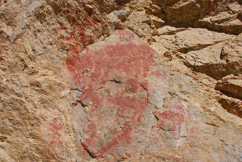
Shark Fin Pictographs (RL)
Rapid
III
Aparejo Point Rapids
Rapid
Trail Camp (RR)
Rapid
Normandy Beach Camp (RL)
Rapid
Sheep Creek Camp (RL)
 Rapid
Rapid
Flying B Ranch (RL)
Rapid
Flying B Camp (RR)
Rapid
Flying B Airport Camp (RR)
Rapid
III
Haystack Rapid
Rapid
III
Bernard Creek Rapid
Rapid
Bernard Camp (RL)
Rapid
Short Creek Camp (RR)
Rapid
Cold Spring Camp (RR)
Rapid
III
Earthquake Rock Rapid
 Rapid
III
Rapid
III
Jack Creek Rapid
Rapid
II
Little Pine Rapid
Rapid
Little Pine Camp (RL)
Rapid
II
Little Pine Boulders
Rapid
II
Driftwood Rapid
Rapid
Driftwood Camp (RR)
 Rapid
II
Rapid
II
Lower Driftwood Rapid
Rapid
Wilson Creek Camp (RR)
Rapid
Grassy Flat I Camp (RL)
Rapid
Grassy Flat II Camp (RL)
 Rapid
Rapid
Rattlesnake Cave (RR)
Rapid
Survey Creek Camp (RL)
Rapid
Woolard Creek Camp (RR)
 Rapid
Rapid
Fly Camp (RR)
Rapid
Fish Camp (RL)
 Rapid
Rapid
Waterfall Creek Rapid
Rapid
Big Creek Camp (RL)
Rapid
Last Chance Camp (RR)
Rapid
Pine Bluff Camp (RL)
 Rapid
III-
Rapid
III-
Cutthroat Cove Rapid
Rapid
Cutthroat Cove Camp (RL)
Rapid
Big Pine Camp (RR)
Rapid
Elk Bar Camp (RL)
Rapid
Love Bar Camp (RL)
Rapid
Veil Falls (RR)
 Rapid
III
Rapid
III
Wall Creek Rapid (aka Porcupine)
Rapid
Redside Camp (RL)
 Rapid
IV
Rapid
IV
Redside Rapid
 Rapid
IV
Rapid
IV
Weber Rapid
 Rapid
III-
Rapid
III-
Mist Falls Rapid
Rapid
Papoose Camp (RL)
Rapid
Ship Island Camp (RL)
Rapid
Lightning Strike Camp (RL)
Rapid
Parrot Placer Camp (RR)
Rapid
Parrot Cabin (RL)
 Rapid
III
Rapid
III
Upper Cliffside Rapid
Rapid
Cradle Creek Camp (RR)
Rapid
III
Lower Cliffside Rapid
Rapid
Tumble Creek Camp (RR)
Rapid
Ouzel Camp (RL)
Rapid
Cliffside Camp (RR)
 Rapid
II
Rapid
II
Ouzel Rapid
Rapid
Stoddard Camp (RL)
 Rapid
Rapid
Otter Bar Camp (RR)
 Rapid
IV
Rapid
IV
Rubber Rapid
 Rapid
IV
Rapid
IV
Hancock Rapid
Rapid
Solitude Camp (RL)
Rapid
II
Devil's Molar Rapid
Rapid
III
Devil's Tooth Rapid
Rapid
III+
House of Rocks Rapid
Rapid
II
Clamshell Rock
 Rapid
III
Rapid
III
Jump Off Rapid
Rapid
II
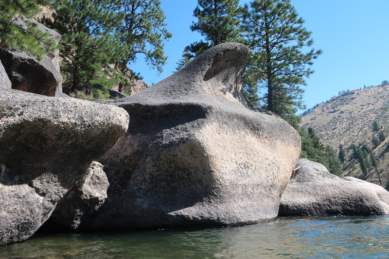
Best Rock on the Middle Fork (BROTMF)
 Rapid
II+
Rapid
II+
Upper Goat Creek Rapid
 Rapid
Rapid
Goat Creek Camp (RR)
Rapid
II
Lower Goat Creek Rapid
Rapid
Salmon River Confluence
Rapid
IV
Cramer Creek Rapid
Difficulty
Class III-IV
Length
95.0 mi
Gradient
28 ft/mi
max 40
Rapids
161
Access Points
Difficulty Classes
I Easy
II Novice
III Intermediate
IV Advanced
V Expert/Extreme
VI Unrunnable
Permit Required
A float permit is required year-round to be on the waters of the Middle Fork of the Salmon River between Dagger Falls and the river's confluence with the Main Salmon. The lottery control season extends from May 28 - September 3. Applications are due January 31. Seven launches are allowed per day. During the lottery control season, an average of four launches per day are allocated for outfitter-guide trips with three for the public. Outside of the control season, the seven launches are available to all on a first-come, first-served basis. Reservations open on October 1 for the following year.
Get Permit
Current Conditions
5-Day Forecast
Whitewater data from
American Whitewater
American Whitewater