2. Bremer to Ike Kinswa State Park (Lower)
Linked via: Nhdplus discovery 90% confidence Synced 6mo ago
Gauge Conditions
Runnable: 400.0 – 5,000.0 CFS
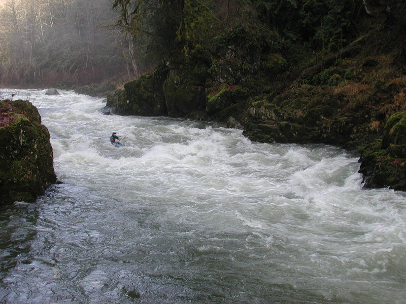
Although the paddle in will be pretty scratchy, once in the gorge, the major rapids channelize really well.
Data from American Whitewater & USGS
Run Map
Run Time Estimate
Select put-in and take-out to estimate time.
Unlock Advanced Trip Planning
See wind-adjusted speed maps, forecast planning, and detailed time estimates.
Sign in to generate an AI timing estimate for this run.
Whitewater timing varies with scouting, portages, and group pace. Use as a planning baseline.
Description
The Tilton River is a low elevation run highly dependent on winter rains that is often best after a good rain between late November and early April. The run featrures some good play spots, great scenery, and some beautiful rapids.
When many paddlers consider their first trip to the Tilton River, the class I/II paddle in and the flatwater paddle out on a reservoir, may cause some to have second thoughts. Once you've paddled the Tilton, however, you'll be back for more as the whitewater in the middle more than makes up for the lack of action at the beginning and end. You'll find some great drops and fun play spots, and the scenery in the gorge is outstanding. This run is remote and a hike out would be an epic adventure through the devil's club. Although the drops are relatively easy to scout and the pool-drop nature of the run provides good recovery stretches, some are very difficult if not impossible to portage due to the steep canyon walls. For the most part the run consists of a few class IV drops, particularly as flows increase, separated by intervening sections of class III whitewater. Use your judgement and consider a trip at the lower range of flows if you have limited class IV experience as once you are in the gorge you are committed to the run.
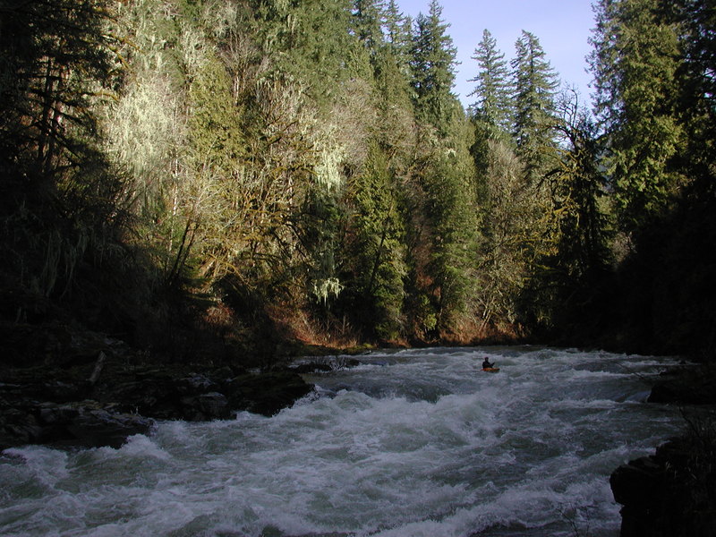
The run starts out with nearly two miles of paddling through swift water interrupted by a few easy class II rapids. It's not too bad though as there are some fun eddy lines and the current moves you along. Just as you're starting to wonder when the action will get started the bedrock canyon walls start to close in and you'll have a couple fun class III drops before reaching an an obvious horizon line at the start of the first gorge. You can get out to scout on the right, and the line winds down the center and then cuts to the left to avoid a big hole on the right about midway down. The next few rapids have some great playspots and are relatively easy to boat scout. There are some great waves along the right-hand side of an island. There are some eddies along the bedrock wall on river right and once you've worked this section you can continue down to the pool and catch eddy service for a nice playspot near a little beach area just downstream from the island.
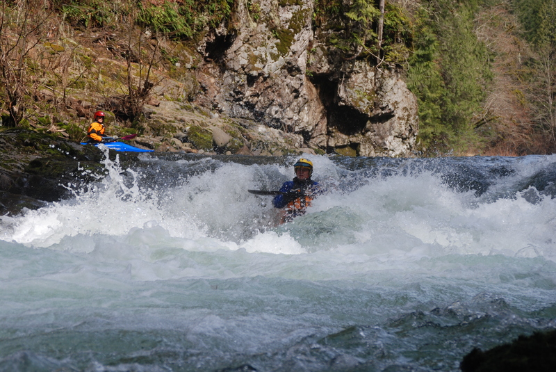
Some more great class III/IV rapids follow and the next next major drop is Leap of Faith. It's marked by a distinct horizon line, a mid-stream rock with chutes running down both sides, and a bedrock wall along river right. Grab an eddy on the left to get out and scout. There are routes along the right, left, or center depending on flows and your preference. As the river takes a slight bend to the right around the corner, a fairly significant hole forms that you will probably want to avoid. Hug the right side to avoid the hole or take the more challenging route down the left. After a short recovery pool, the stretch following Leap of Faith is fairly continuous with a runout through a narrow constrained canyon section.
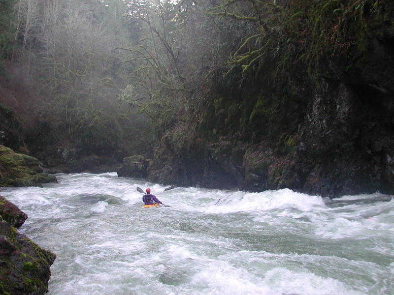
After several more fun rapids and some scenic waterfalls that cascade in from the sides, the river comes to another horizon line at a river-wide ledge. Scout from the outcrop on river right and choose from a boof move off the center ledge, a more technical line along the left that winds past a large outcrop, or punch the edge of a hole along the right (beware of the undercut cave on river right).
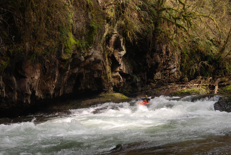
After a final short recovery stretch, the river pools up above the final drop. A huge eddy on the right is available for collecting the group, but the best place to scout is from river left and it's easiest if you work your way partway down the rapid. Here the river plunges into the longest and most continuous rapid of the run before settling out in the reservoir. You can run this final big drop down the center, weaving to avoid rocks and a couple of holes. At lower flows the rapid becomes technical and pin potential is higher. At higher flows the drop cleans up but you'll want to avoid the holes.
After one final little plunge, the flow gradually slows as you hit the reservoir. Depending on level you get a little bit of current and the paddle takes about 30 minutes. Take out in the park, with the grass lawn, on the left (it's before you reach the bridge).
When flows are high (> 2000 cfs) and you get an early start a longer trip starting on the North Fork Tilton is a possibility.
Access Logistics:
From I-5: Take exit #68 (U.S. 12 E, Morton, Yakima), and drive east on U.S. 12 for 14 miles. Turn north on SR 122 (Silver Creek Rd.) and drive 1.9 miles. At the Y-intersection, take SR 122 (Harmony Rd.) 1.6 miles east across the reservoir to Ike Kinswa State Park. Turn left into the park and drive to the parking area at the far end. To reach the put-in, drive back out to the Y-intersection and then take the other fork heading north (Cinebar Road). In approximately 4.5 miles the road comes to a T. Turn right and continue east on SR 508 for about 7 miles. You'll cross high over a tributary creek before you arrive at the bridge across the Tilton. Parking along the highway shoulder and easy river access is avaialble on the upstream river left side of the Tilton River bridge.
Additional Information:
- Bennett, J. and T. Bennett. 1997. A guide to the whitewater rivers of Washington, second edition. Swiftwater Publishing. Portland, OR.
Rapids in this Run (5)
Playspots (1)
Difficulty
Class III-IV
Length
8.9 mi
Rapids
5
Access Points
Difficulty Classes
I Easy
II Novice
III Intermediate
IV Advanced
V Expert/Extreme
VI Unrunnable
Current Conditions
5-Day Forecast
Whitewater data from
American Whitewater
American Whitewater