2. Chimneys Picnic Area to Campbell Overlook
Linked via: Nhdplus discovery 90% confidence Synced 6mo ago
Gauge Conditions
Runnable: 300.0 – 675.0 CFS
Jim JanneyWestern NC Creek Visuals 20m · West prong ran 3 days in a row so we got to experience both ends of the flow spectrum. New usgs gauge is fantastic. T
Data from American Whitewater & USGS
Run Map
Run Time Estimate
Select put-in and take-out to estimate time.
Unlock Advanced Trip Planning
See wind-adjusted speed maps, forecast planning, and detailed time estimates.
Sign in to generate an AI timing estimate for this run.
Whitewater timing varies with scouting, portages, and group pace. Use as a planning baseline.
Description
Picnic is no picnic.
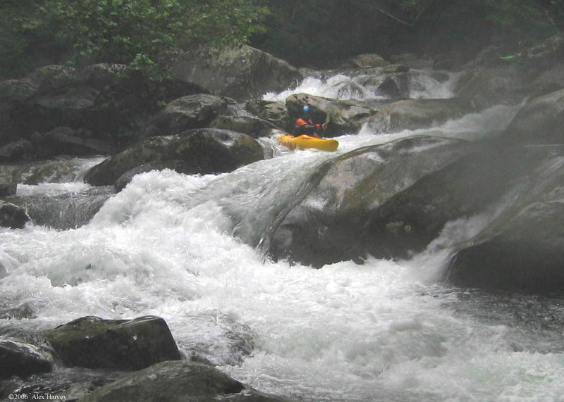
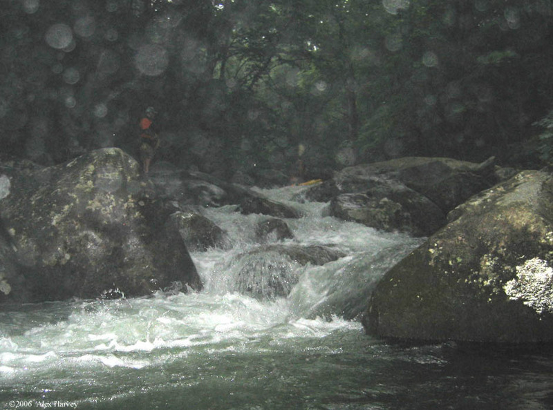
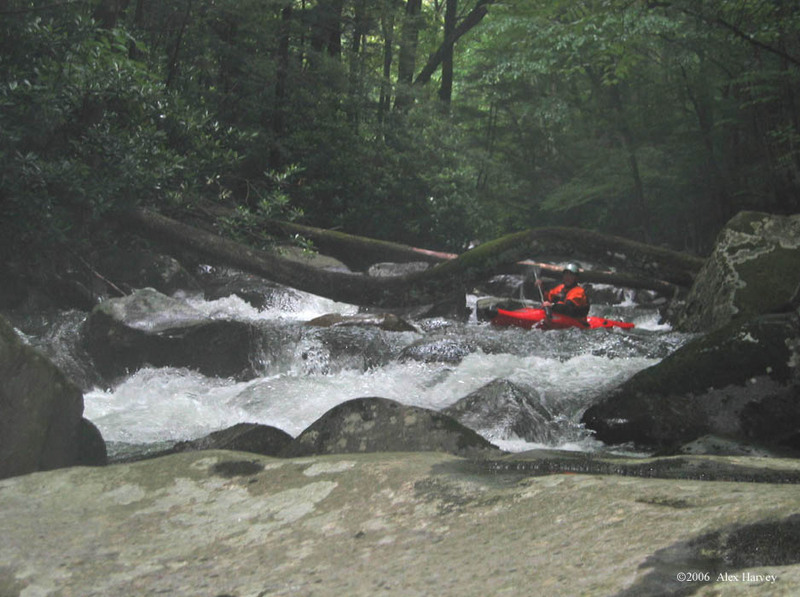
This section, although not as steep as "Trailhead", still packs a punch and gives you more river miles. The West Prong is "one big rapid" in a sense where you find the channel with the most water in it and go with the flow. There are a few named rapids and places in the river to note.
First Island: Stay left here. Not much rapid wise, but this is where most of the water goes and it is usually free of trees.
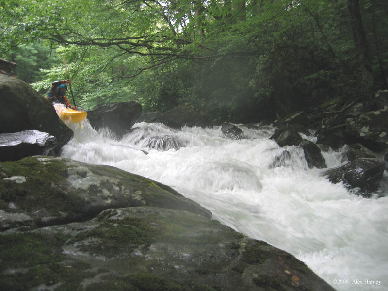
Second Island: Much more complicated than the first island. Here you go right. The entrance is somewhat of a boil, but managable. There are several drops back to back, the biggest one involving a hard boof right, followed almost immediately by a boof on the left.
Boof Right/Cave: This drop is in the center of the river. Ride the rock, but don't stall or boof too hard right. Get to river left after the slot to avoid the mini-cave on river right.
Skywalker: Entering slightly center left/left is the prefered line for the top drop here, followed immediately by a big ole rock in center of the river. Go left of this rock. At higher water this drop can also be run on far river left through smaller drops.
West Prong Falls: Shortly after Skywalker is WPF. Several lines exist. Some take a far river right line that ends in a vertical 8-10 foot slot boof. Another line is to run center where the falls have more of a ledge look to them. Beware that there is a large rock just under the surface on the left side of the center line. Far river left should be avoided entirely.
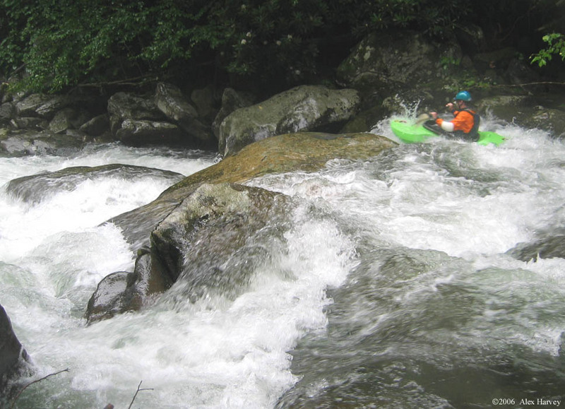
Amtrack: The entrance to this rapid is quite long and ends with an exciting boof. The best lines are seen when boofing center to slightly center right. The drop is close to 8 feet and is followed by a river wide hole and several strange undercuts to be avoided. Luckily there is a large pool to gather your belongings below.
Room Without a View: Just around the corner from Amtrack is Room Without a View, the grandfather and climax of the West Prong "Picnic" rapids, and a tough one to have towards the end of the run. Enter through a slot on river left and hold on. You'll soon find the river running into a large boulder in the center of the river. Do not go left or you'll end up in a pin fest. Instead, go with the flow, towards the right, punch several holes and you're done. It's one big challenging s-turn of beauty.
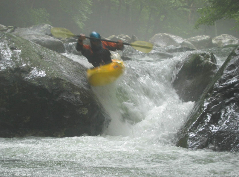
Blue Angel: Shortly after Room Without a View you'll come upon a third island. You want to go right here, for it is Blue Angel, an 8-10 foot launch off of a boulder in the center of the river.
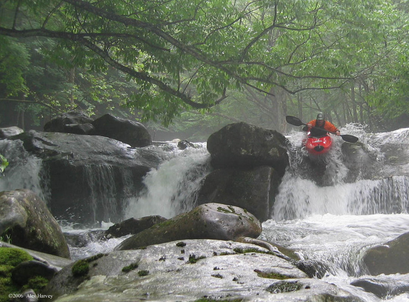
Bitch: As you turn the corner after Blue Angel you'll find yourself in a very long series of s-turns and slots. At the end of these is Bitch. The river-left side of the West Prong, just before the take out, goes into a sieve with many trees in it. Therefore, run the right side, also known as Bitch. It is probably the most dangerous rapid of the run because of it's high pinning possiblity.
The take out is just below this series of rapids, on river left that leads to a trail for Campbell Overlook.
However, you don't have to take out here if you're still up for a few more class IV's, solid class III and one BIG class V. The following rapid descriptions apply to what is being called section 3 of the West Prong, http://www.americanwhitewater.org/rivers/id/1761/.
However, the top part of this section 3 should be considered in the Picnic section, as, half of the time people don't take out at Campbell Overlook (especially with higher water levels), and two, there are big rapids yet to go that don't compair to the class II only from the Park Headquarters to Gatlinburg. With that being said...
Thors hammer: This rapid is not too far from the Campbell Overlook takeout. You'll find yourself hanging out on river left shortly before the drop, generally speaking, and when you begin to notice the river widening to the right, it's Thors Hammer. The river goes through many different slots with many different lines, all of them usually on the shallow side of life.
In a Hurry: This drop is as big as anything on the standard Picnic section. It's sort of like a longer Room Without a View but with In a Hurry mostly being straight on.
The take out, is close to a 1/2 mile below In a Hurry, the second walkway from the Vistors Center. You'll have gone through quite a bit of class II. The trail is easy to miss, so hike down from the takeout to make sure you know where to get out.
The West Prong, Trailhead and Picnic respectively, are very demanding runs and not to be taken lightly. It's best to go down with someone that knows the river. The rapids mentioned above are mostly class IV+ to V, meaning, there are no names for the scores of continuous class IV and III that you see. Trees are always an issue, so make sure you chat with local boaters before hand who know the latest hazards.
Rapids in this Run (9)


Hazards & Portages (1)
Caution: The following locations may require scouting or portaging. Always check current conditions.
Difficulty
Class V
Length
2.4 mi
Gradient
320 ft/mi
max 380
Rapids
9
1 Hazard
Access Points
Difficulty Classes
I Easy
II Novice
III Intermediate
IV Advanced
V Expert/Extreme
VI Unrunnable
Current Conditions
5-Day Forecast
Whitewater data from
American Whitewater
American Whitewater