2. FR 2918 Bridge to Klahowya Campground
Linked via: Proximity 88% confidence Synced 6mo ago
Gauge Conditions
Runnable: ? – ? CFS
Approximate reading: This gauge is 17.9 miles away on Sol Duc. Use as a general reference only.
Data from American Whitewater & USGS
Run Map
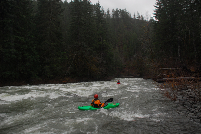
Description
The run passes through a mix of Forest Service land on river right and private timber lands on river left. Headwalls along both banks of the river create fun rapids that can be enjoyed during winter storms when area rivers are moderately high.
After a couple of miles a few cabins come into view before the river turns to the west and parallels Highway 101. The river is well buffered by forest between the river and highway and a number of boulder garden rapids make for fun class II+ boating.
As the river makes a hard bend to the right and under the Highway 101 Bridge, you will encounter the biggest rapid on the run, Bridge Drop, which pushes class III. You can see this rapid by looking downstream from the bridge at Highway 101 mile 212.6. After passing private land on river left, you will eventually come to the Forest Service Camgpround which makes a convenient take-out.
Access Logistics: To reach the put-in, turn south on FR 2918 at Highway 101 mile 216.4. Follow this road to mile 3.0 and the bridge across the Sol Duc. You can put-in here on the downstream river right side of the bridge or use an access downstream closer to Highway 101.
The take-out is at Klahowya Campground administered by the US Forest Service. The campground is located at Highway 101 mile 211.9 on the north side of the road. The campground is closed during the winter paddling season but it is suitable for hand-carry craft by walking into camp sites 6, 7, and 8 that have the best river access. Alternatively you can use the Highway 101 bridge downstream of the campground as an access point on the south side of Highway 101.
for additional information see
- Korb, G. 1997. A paddlers guide to the Olympic Peninsula. third edition.
- Pacific Ranger District, North - USFS Olympic National Forest web site
Rapids in this Run (1)
Difficulty
Class III
Length
9.8 mi
Gradient
28 ft/mi
Rapids
1
Access Points
Difficulty Classes
I Easy
II Novice
III Intermediate
IV Advanced
V Expert/Extreme
VI Unrunnable
Current Conditions
5-Day Forecast
Whitewater data from
American Whitewater
American Whitewater