2. Glines Canyon to Highway 101
Linked via: Proximity 86% confidence Synced 6mo ago
Gauge Conditions
Runnable: 500.0 – 2,000.0 CFS
Data from American Whitewater & USGS
Run Map
Run Time Estimate
Select put-in and take-out to estimate time.
Unlock Advanced Trip Planning
See wind-adjusted speed maps, forecast planning, and detailed time estimates.
Sign in to generate an AI timing estimate for this run.
Whitewater timing varies with scouting, portages, and group pace. Use as a planning baseline.
Description
This was known as a good intermediate run with easy access that was best after a winter rain and during snowmelt (November to June) and could be boated throughout the year. Severe damage to the road however now requires hiking in to access the run and wood is a persistent hazard as the river carves a new channel. It's a good option for packrafters who are prepared to deal with wood hazards.
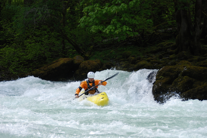
This run covers the whitewater from Glines Canyon to the Highway 101 bridge that was historically the segment between the two dams. If you use the upper put-in at the historic powerhouse site, the run starts with the last half of Glines Canyon with some fun III- rapids before arriving at a sequence of boulders and ledges creating a fun class IV rapid about 0.5 miles from the put-in (the portage is fairly easy). You can see some of this section from the road (look for a set of wooden steps leading down to the river about 250 yards up the road from the bridge--the rapid is just upstream of this). Shortly after this rapid you cross under the bridge at Altair and the old campground that serves as the alternate put-in.
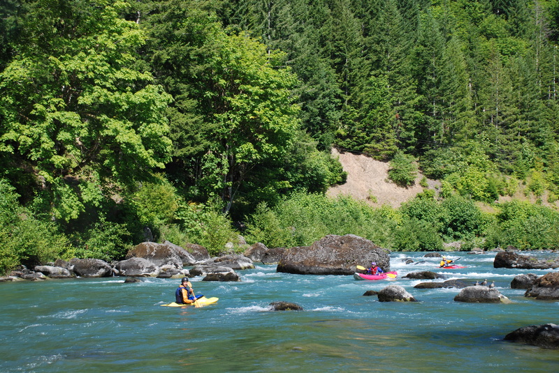
From Altair, the river opens up into a broader valley with plenty of class II whitewater and a couple of III- rapids. With Glines Canyon Dam no longer holding back wood and gravel the river channel has become much more dynamic with changes occurring year to year and associated wood hazards. You can get a good view of the character of this run on the shuttle run.
Access Logistics:
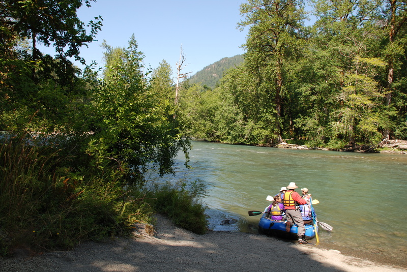
Put-in: At mile 239.5 on Highway 101 take Olympic Hotsprings Road south to the National Park entrance at Madison Falls Trailhead. From here you will need to hike up the road bed of the Olympic Hotsprings Road that is closed due to a major washout. Continue up the road and take the bypass trail where the road was washed away by the river until you reach the bridge at the old Altair Campground. Altair was the historic access point and had a raft launch at the downstream end of the campground until it was damaged by floods. You can put-in here or continue another 1.0 mile up the road to a drive that leads down to the old Glines Canyon Powerhouse site and a formal river access. A good class IV drop is between this access and Altair. You can also continue on up the road to the Glines Canyon Dam and look into Glines Canyon from the overlook on river left. A social trail leads down into the former reservoir where you can access the river upstream of Glines Canyon if you want to boat through it.
Take-Out: Access is avaiable on river right at the Highway 101 Elwha River Bridge at highway mile 239.5. Another option is a pull out 1.1 up Olympic Hotsprings Road. An old road bed here has decent river access with a short scramble up the bank.
for additional information see:
- Korb, G. 1997. A paddlers guide to the Olympic Peninsula. third edition.
- Bennett, J. and T. Bennett. 1997. A guide to the whitewater rivers of Washington, second edition. Swiftwater Publishing. Portland, OR.
- Olympic National Park website
Rapids in this Run (4)
Difficulty
Class II-III(IV)
Length
5.3 mi
Rapids
4
Access Points
Difficulty Classes
I Easy
II Novice
III Intermediate
IV Advanced
V Expert/Extreme
VI Unrunnable
Current Conditions
5-Day Forecast
Whitewater data from
American Whitewater
American Whitewater