2. Gold Creek to Three Pools
Linked via: Nhdplus discovery 90% confidence Synced 6mo ago
Gauge Conditions
Runnable: 600.0 – 4,000.0 CFS
Data from American Whitewater & USGS
Run Map
Description
Flows: This section has been run below 400 cfs and was reportedly still worth doing. It has also been run over 5,000 cfs and was reported (by strong class V boaters) to be mostly class IV+ still, with portages at Fluffy and Thor's.
Most boaters look for between 800-2,500 cfs for medium flows.
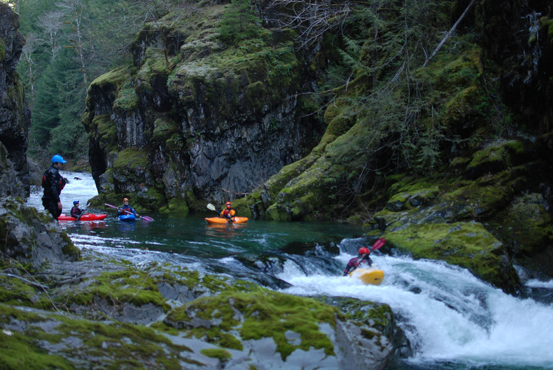
Stream: Boaters normally just refer to this upper reach of the Little North Fork Santiam as 'Opal Creek' and it is without question one of the most beautiful runs in the Cascades. Opal Creek properly is actually upstream of Jawbone Flats. Historically this river was known for small mining operations and you can see relics of that history at the put-in. Today the river is protected as the Opal Creek Wilderness and Scenic Recreation Area and benefits from the stewardship of Friends of Opal Creek who manage the Opal Creek Ancient Forest Center a couple miles up from the put-in.
The run itself features great advanced whitewater through a spectacular river canyon that passes through old-growth forest. Crystal clear water and beautiful pools between the drops round out what is one of the best boating adventures in the entire region.
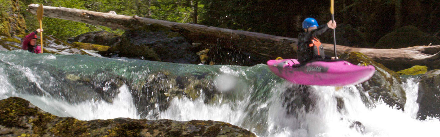
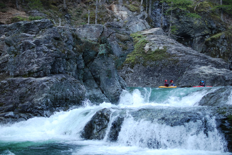
From the normal put-in, there is a short section of bubbly warm up before the confluence with Gold Creek. If flows are up, adventurous boaters sometimes put in on Gold Creek for another handful of class IV ledges and chutes. Below Gold Creek the action starts quickly with boulder gardens, ledge drops, and fun chutes interspersed with stunningly beautiful pools surrounded by overhanging moss-draped cliffs and an impressive canopy of old-growth forest. Many of the rapids can be boat scouted but a few have lines that are not immediately obvious from above. Use caution at the S turn drop where the river slams into a couple of big boulders with a sieve in between them.
Big Ugly is the first of the bigger drops. The small rapid above pushes boaters toward the right wall. The river then turn 90 degrees to the right and the next rapid is Big Fluffy. Scout/Portage right. Here the river flows through a narrow slot down river left along the wall or you can take the sneak on the far right depending on flows.
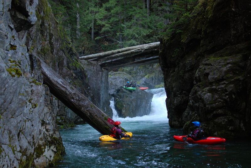
Below here is a narrow chute that is best run left, driving as far right as possible. The stream then spreads at a gravelly island, shortly downstream of where the water reconsolidates the bedrock is obvious as a small horizon presents itself. Scout on the right before this ledge as around the corner is Big Fluffy with no reasonable egress in between. If you would like to portage, there is a seal launch on the right or you can walk across the logs spanning the canyon and return downstream.
Below Big Fluffy the action tapers off but there are a few more fun rapids. The run ends with a finale at Thor's Playroom. This is a three-part rapid. You have a couple options at the start through one of several different entrance doors, a bouncy flume of holes and waves in the middle section, and then a big ledge at the end that drops you into the pool at the take-out and the short hike up to the parking lot.
For more information and photos see Classic Opal on Oregon Kayaking or Into the Outside.
Logistics: From Highway 22 mile 23.2 turn onto Little North Santiam Road (this turn is at a flashing light on the west side of the Highway 22 bridge across the North Santiam). Head up this road paralleling the river and at mile 16.9 where the road comes to a Y turn right onto Forest Road 2207. Follow this road down 0.7 mile to Three Pools which is the take-out. To reach the put-in head back up to the Y and this time take the left fork onto Forest Road 2209. Follow this road to the gate at mile 21.1. From here you will hike in a few minutes and cross the bridge at Gold Creek. After crossing this bridge continue a couple hundred yards and take the old road that heads off to the right down the hill to the put-in at the old mine shaft. It's a total of about 3/4 of a mile hike in.
Rapids in this Run (3)
Waterfalls (1)
Difficulty
Class III-IV(V)
Length
4.1 mi
Gradient
100 ft/mi
Rapids
3
Access Points
Difficulty Classes
I Easy
II Novice
III Intermediate
IV Advanced
V Expert/Extreme
VI Unrunnable
Current Conditions
5-Day Forecast
Whitewater data from
American Whitewater
American Whitewater