2. Hamma Hamma Campground to gorge (Lower)
Linked via: Proximity 95% confidence Synced 6mo ago
Gauge Conditions
Runnable: ? – ? CFS
Approximate reading: This gauge is 4.7 miles away on Hamma Hamma. Use as a general reference only.
Data from American Whitewater & USGS
Run Map
Run Time Estimate
Select put-in and take-out to estimate time.
Unlock Advanced Trip Planning
See wind-adjusted speed maps, forecast planning, and detailed time estimates.
Sign in to generate an AI timing estimate for this run.
Whitewater timing varies with scouting, portages, and group pace. Use as a planning baseline.
Description
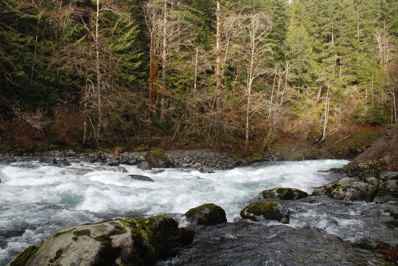
This run has some good whitewater but also some sections of braided channel. It typically comes in with fall rains and can flow through the winter and then into the spring with snowmelt.
The river starts off at the bridge just upstream of Hamma Hamma Campground with a fun rapid and after a couple bends the gradient starts to flatten out a bit. You will soon come to an area of active channel migration where you should be prepared to portage log jams that form in this reach.
The gradient starts to pick up again and the character noticeably changes as you pass Jefferson Creek where the additional flow and steeper gradient create some fun class III rapids. You soon come to point where the river drops away in a turbulent furry and disappears around the corner into U Turn. This rapid is difficult to scout but with some effort you can scramble along the rim and get a few views from high above. At medium flows the run starts with a couple of holes at the entrance and then a couple more as you turn the corner before tapering off into a good recovery pool at the end of the gorge. You can take-out here or go another 1/3 of a mile to pick up one more rapid before the river plunges into an unrunnable canyon.
ACCESS: At Highway 101 mile 317.9 Take FR 25 (Hamma Hamma Road) as it runs west into the National Forest. Head up this road past Hamma Hamma Campground and go left across the Cabin Creek bridge and then Hamma Hamma River bridge. This is the put-in. To reach the take-out continue a short distance past the bridge and take a hard left on to FR 2480 which heads downstream along river right (this road can be blocked by low elevation snow during winter and unfortunately paddling out to Highway 101 is not an option due to the presence of an unrunnable gorge between the take-out and Highway 101). Check road reports under Recereation, Current Conditions, Hood Canal South, on the USFS Olympic National Forest web site. Follow FR 2480 3.6 miles to a spur road that heads down to the river and the take-out (you will need to scout this out carefully because the spur road is largely overgrown and not marked on current USFS maps and the unrunnable gorge is just downstream). An alternative is to take-out just after U Turn and hike out straight to the road (in 2011 this was a clear cut with skid roads but trees have since grown in).
for additional information see:
- Korb, G. 1997. A paddlers guide to the Olympic Peninsula. third edition.
- Hood Canal Ranger District, South - USFS Olympic National Forest web site
Rapids in this Run (1)
Difficulty
Class III-IV
Length
4.6 mi
Gradient
40 ft/mi
Rapids
1
Access Points
Difficulty Classes
I Easy
II Novice
III Intermediate
IV Advanced
V Expert/Extreme
VI Unrunnable
Current Conditions
5-Day Forecast
Whitewater data from
American Whitewater
American Whitewater