2.) Lower
Linked via: Nhdplus discovery 90% confidence Synced 6mo ago
Gauge Conditions
Runnable: ? – ? CFS
Approximate reading: This gauge is 140.6 miles away on Rock. Use as a general reference only.
Data from American Whitewater & USGS
Run Map
Run Time Estimate
Select put-in and take-out to estimate time.
Unlock Advanced Trip Planning
See wind-adjusted speed maps, forecast planning, and detailed time estimates.
Sign in to generate an AI timing estimate for this run.
Whitewater timing varies with scouting, portages, and group pace. Use as a planning baseline.
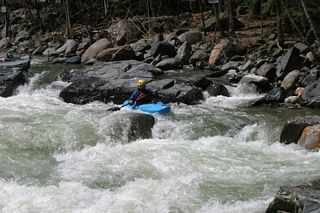
Description
Hurricane Irene Changes: This section of the Rock River changed because of the flooding of August, 2011. The flood was so violent in the section a half mile upstream that houses were washed away. This section is still runnable, but most rapids have changed. The river has changed course completely in the section between the dam and the cement bridge.
The river is still a class 3/4, but please scout it carefully, because the riverbanks have yet to stabilize as of 2016, and stariners are still developing. Also, all of the rapids differ somewhat from the old description, which is below.
Pre Hurricane Irene River Description:
The river starts out gently, with some surf spots and a few rapids. Watch out for strainers which often fall down the steep side hill on the right hand side. You'll reach the old dam (now broken), the first major rapid, about a half mile down river. This is described as a class 3 or 4 rapid, depending on whom you talk to and the water level. This rapid, like most on the Rock River, changes from time to time, depending on where the rocks have moved during the last storm. The rest of the section through Williamsville is straightforward fun, with some splashy waves and rocks to dodge, but no difficult rapids. At the bottom of this section, you'll reach the cement bridge and the beginning of the ledges.
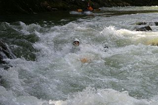
About 200 yards below the cement bridge, you'll reach Double Drop. The top drop plunges over a blind ledge, and then slides down to the second, smaller drop. There is a pool below the second drop if you miss, so hold on and you can roll at the bottom. Run the first ledge of Double Drop right middle or left middle, but avoid running it down the center. Also, avoid the far right. There is a hole at the bottom of the first drop that can hold you for a whilebut will usually spit you out, butitcould hold you at high water.
Down river is a neat ledge which you can barrel over on the left side or sneak around on the right side. Barreling over it is usually pain-free at most water levels – it's really a big chute.
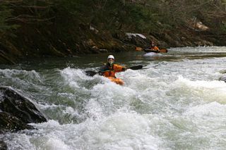
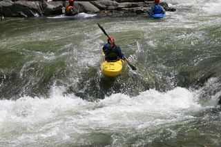
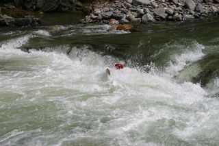
About .3 miles down river is Triple Drop, the hardest on the river. Triple Drop is Class 4 except at very low water levels. This rapid can easily be scouted on the left hand side, or walked on this side if you don't want to run it. The second drop of Triple Drop is the most difficult, as it can drop you into a hole that can hold you at low and medium water levels, and can really recirculate you and work you at higher levels. To run Triple Drop, run tight to the right of the two large rocks at the top of the first drop, and pull into the eddy below it. From there, you need to build up enough speed to cross the second ledge and pull you over the hole. If you run this ledge a little right of center, once you get past the hole, there is lots of green water to ride you right over the third, smaller drop. If you run it left-middle, you can usually poke your way through some more narrow and less powerful rocky drops to make it through to the bottom. Once again, there is a pool below the bottom rapid if you flip, so hang on until you reach the bottom if you can't roll above.
Below Triple Drop, the Rock continues another 1.5 miles through a beautiful gorge. This passage is much more straightforward class 2+ and class 3 rapids. The most difficult rapid in this section is a neat chute on river right, about a mile south of Triple Drop. There are many bouncy waves, sometimes steep, and many surf opportunities before you connect with the West River.
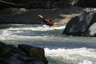
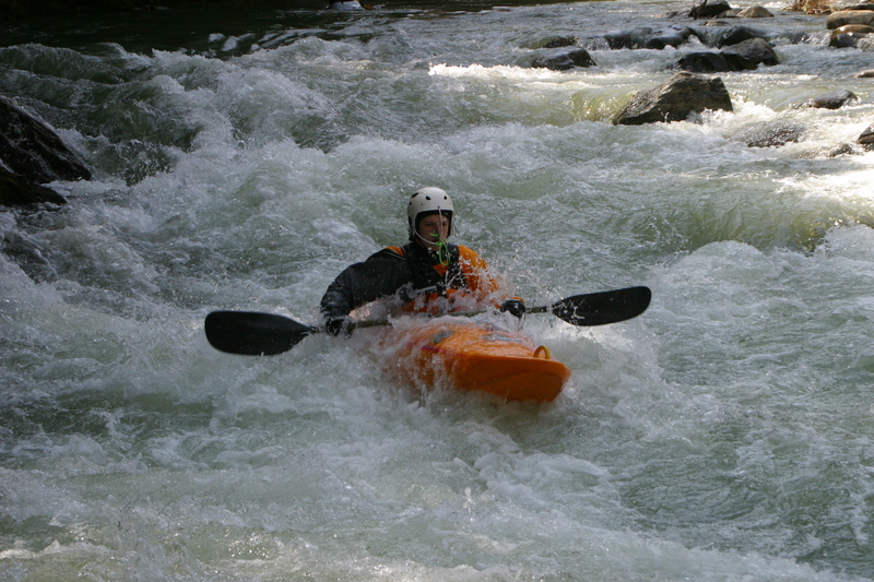
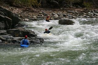
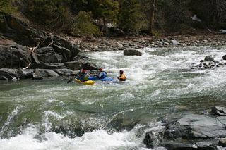
A note to all: watch out for strainers, particularly in the section past the cement bridge. This river is frequently run after a heavy rain, and the heavy rains frequently generate strainers in Double Drop, Triple Drop and the gorge below. The river is class 3 / 4, and difficulty varies significantly depending on the level. There is no gauge.
Carl Askegreen says, on the Northeast Paddlers' Message Board:
"Pretty flashy. I describe it as one world-class rodeo hole after another with class 3/4 rapids in between. Super fun.
"Runoff patterns are similar to West Branch, Green, South Branch of Ashuelot...yada yada.
"Way fun and way cool, should really check it out. Put in at the covered bridge then run down; strainers in the first rapid but easy to pass by. Nice rodeo hole. About .62 miles from bridge is a weird strainer on the river right, so I just kind of stay left there. Has this habit of grabbing boaters... got two in one day last year.
"Expect to find good technical play all the way down."
Posted by Eric Bishop
A warm sunny day. We put in about 2 miles upstream from S. Newfane and planned to paddle to the confluence with the West, about 6 miles. The water was fairly high. The run to S. Newfane was uninterrupted class II-III. A large tributary doubled the size of the river in S. Newfane. The broken dam in Williamsville sits at the start of a long section of III-IV past the village. We lined the dam, and Fred broke a paddle in the drop below. After a run down the creek without a paddle he bailed out and made shore. After recovering the boat, we decided to call it a trip as the water had risen noticeably. This is definitely a river to try again. -- Eric Bishop
Directions:
Take out: Take Route 30 from Brattleboro. The West River will be on your right. After approximately 6 miles, you'll pass a covered bridge on your right. Continue for another two miles. The take out is on the right hand side, just before you cross a bridge. There is a large parking area there (in summer, you could see fifty cars squeezed in there). The confluence of the Rock River and the West River is at that point. There is also a seasonal hot dog stand located there. You can walk across the bridge to get a view of the Rock.
Put in:
From Route 30, turn left on the road directly across from the put in. This is called both Depot Road and Williamsville Road by the locals. Follow this road for about two miles until you cross a cement bridge and reach a T. (Scouting Note: you can scout Triple Drop from Duke Road, a dirt road you'll pass on the right hand side, just before you reach the cement bridge). Turn left at the T and pass through the village of Williamsville (you'll see the Dam on the Rock River in the center of town). Pass through the covered bridge and park at one of two pullouts on the left hand side, just past the covered bridge.
Rapids in this Run (5)
Difficulty
Class III-IV
Length
4.5 mi
Gradient
63 ft/mi
Rapids
5
Access Points
Difficulty Classes
I Easy
II Novice
III Intermediate
IV Advanced
V Expert/Extreme
VI Unrunnable
Current Conditions
5-Day Forecast
Whitewater data from
American Whitewater
American Whitewater